Solid state LiDAR point cloud density varies more than expected
Publication Date
author
Solid state lidar point cloud density often shifts far more than spec sheets suggest, especially when lidar sunlight interference resistance, lidar field of view comparison, and mmwave radar angular resolution are evaluated in real deployment conditions. For engineers, buyers, and decision-makers, this gap matters: it affects perception reliability, system cost, and supplier selection across edge AI, machine vision, and industrial sensing ecosystems.
Why does solid state LiDAR point cloud density change so much in real environments?
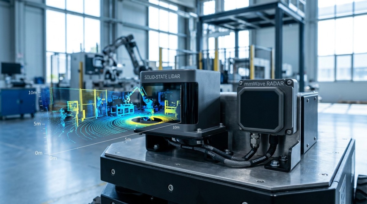
Many procurement teams assume point cloud density is a fixed specification. In practice, it is conditional. A solid state LiDAR may publish one density figure under controlled test conditions, yet deliver noticeably different output when target reflectivity, ambient illumination, range window, scanning pattern, and vehicle speed change together. This is why a lab-friendly value can become misleading in outdoor robotics, UAV mapping, perimeter monitoring, or industrial navigation.
For operators, the problem appears as unstable detection. For procurement managers, it appears as supplier confusion. For enterprise decision-makers, it becomes a budgeting risk because one sensor that looked sufficient on paper may require extra cameras, radar, compute modules, or software filtering after deployment. A 10% to 30% variation in usable point returns under changing scene conditions can alter downstream perception performance much more than expected.
TechStat Vanguard approaches this issue from an engineering-first perspective. Instead of treating point cloud density as a standalone sales number, TSV evaluates it as part of a sensing stack. That means looking at the interaction between scan architecture, anti-interference behavior, field of view design, synchronization timing, and real operating envelopes such as 5 m to 120 m detection zones, day-night transitions, and mixed-material targets.
In other words, the critical question is not simply “How dense is the point cloud?” The better question is “How much of that density remains usable under the conditions that matter to your system?” This distinction is essential in edge AI deployments where latency budgets may sit within 20 ms to 100 ms, and every unnecessary false point or missing return can affect classification, tracking, and control stability.
The main engineering drivers behind density variation
Several variables shape observed point cloud density. None should be reviewed in isolation if the goal is procurement accuracy rather than marketing interpretation.
- Target reflectivity: dark rubber, matte plastic, glass, painted metal, vegetation, and concrete return different signal strengths at the same distance.
- Ambient light: lidar sunlight interference resistance becomes decisive in bright noon conditions, especially for forward-facing outdoor perception.
- Field of view allocation: a wide FoV can reduce angular sampling concentration in the area that actually matters for obstacle detection.
- Range distribution: density near 10 m may look strong, while the same unit becomes sparse beyond 60 m or 80 m.
- Motion and integration effects: platform vibration, scan stitching, timestamp drift, and sensor fusion can all reduce usable effective density.
What should engineers compare beyond the headline density number?
A robust lidar field of view comparison should not stop at horizontal and vertical angles. Buyers need to ask how the field is distributed, where angular resolution is concentrated, and whether blind zones appear at installation angles common in vehicles, UAV payload bays, smart infrastructure poles, or factory mobile robots. A sensor with broader stated coverage is not automatically better if the relevant corridor receives fewer effective points.
This is also where mmwave radar angular resolution enters the discussion. LiDAR and mmWave radar are often compared incorrectly as substitutes. They are different perception tools. LiDAR delivers geometric richness and classification support; mmWave radar offers resilience in dust, rain, fog, and some glare-heavy conditions. However, if radar angular resolution is too coarse for the intended object spacing, it cannot compensate for sparse LiDAR returns in tightly packed scenes.
For B2B teams evaluating industrial sensing stacks, it is more useful to compare “perception sufficiency” than isolated sensor claims. That means checking whether the sensor combination can maintain stable obstacle separation, edge detection, and tracking confidence across 3 to 5 operating scenarios. Typical scenarios include indoor warehouse transit, mixed indoor-outdoor loading zones, reflective factory aisles, low-feature agricultural terrain, and urban curbside environments.
The table below organizes the most relevant dimensions for a practical comparison between solid state LiDAR behavior and supporting radar characteristics. It is intended for early-stage spec definition, supplier shortlisting, and cross-functional reviews between engineering and sourcing teams.
The key takeaway is simple: a supplier comparison should weigh density, field of view behavior, and environmental robustness together. A sensor with a cleaner, more stable output across four realistic conditions can be more valuable than one with a higher published peak density but poorer consistency during deployment.
Three practical comparison questions for sourcing teams
Before advancing a vendor into commercial review, ask three questions. First, what is the usable density at the target distance band, such as 20 m to 50 m or 50 m to 120 m? Second, how does density shift under direct sun, low-albedo targets, or partial occlusion? Third, what additional sensors are still required after integration? These questions reduce the risk of comparing incompatible data sheets.
Which deployment scenarios expose the largest gap between spec sheets and real point clouds?
The biggest performance gap usually appears in scenarios with mixed materials, dynamic lighting, and non-ideal mounting geometry. In a factory, glossy floor coatings and metal racks can create misleading reflections. In logistics yards, low-angle sunlight and moving forklifts stress lidar sunlight interference resistance. In UAV mapping, vibration and altitude changes shift point distribution. In roadside systems, rain residue, heat shimmer, and installation height all affect return quality.
Operators often notice this as inconsistent object edges or intermittent holes in the point cloud. Engineers see it in clustering instability and degraded tracking continuity. Procurement teams see a secondary effect: the “budget sensor” may trigger added spending on mechanical isolation, thermal control, shielding, or sensor fusion software. A lower upfront price can therefore lead to a higher total project cost over the first 6 to 12 months of operation.
The scenarios below are especially useful when writing acceptance criteria. They represent common environments across smart manufacturing, robotics, mobility, and edge AI deployments where real density behavior matters more than headline metrics.
These scenarios show why field testing matters. If your procurement document only requests a nominal point rate, suppliers may all appear equivalent. If you request performance across 4 defined scenarios, 3 target material groups, and 2 ambient light bands, differences become far easier to quantify and defend internally.
Where many teams underestimate installation effects
Mounting height, tilt angle, enclosure window quality, cable routing, and thermal management can all change effective point cloud density. Even a 5° to 10° change in installation angle may shift the high-value sampling region away from the operational path. This is why TSV recommends validating sensor geometry with actual vehicle or machine layouts before final purchase approval.
A practical pilot often takes 2 to 4 weeks. That period should include at least one daytime stress test, one low-light session, one reflective-surface pass, and one motion-rich scenario. Teams that skip this stage often spend much longer in troubleshooting after deployment.
How should procurement teams evaluate suppliers and avoid misleading claims?
The most reliable procurement process separates raw specification review from scenario-based acceptance review. First, collect baseline parameters: range bands, update rate, field of view, interface type, synchronization options, ingress protection, operating temperature, and integration requirements. Then move to performance validation using your own use cases rather than supplier demo scripts. This two-stage method protects both budget and schedule.
For multi-stakeholder B2B projects, a practical evaluation matrix usually includes 5 core dimensions: perception sufficiency, environmental robustness, integration complexity, delivery readiness, and lifecycle support. Each dimension should be scored against a defined threshold. For example, engineering may prioritize density retention and timestamp consistency, while procurement may prioritize lead time, replacement policy, and documentation completeness.
The checklist below is especially useful when comparing solid state LiDAR suppliers for robotics, machine vision, smart infrastructure, or UAV-adjacent sensing projects. It helps teams avoid overpaying for unused performance while also avoiding low-cost options that later require expensive mitigation work.
A 6-point procurement checklist
- Define the critical distance band first, such as 0 m to 20 m, 20 m to 50 m, or 50 m to 120 m. Density outside the main operating band may not justify added cost.
- Request test conditions behind the published point cloud density. Ask about target material, ambient light, object size, and mounting configuration.
- Run a lidar field of view comparison using your actual installation envelope. A wide FoV with poor placement can still leave blind regions.
- Check whether mmwave radar angular resolution is required for redundancy or weather resilience. Do not assume radar will automatically solve sparse LiDAR returns.
- Assess software and compute cost. Higher raw point volume can increase bandwidth, storage, and edge inference demands.
- Confirm delivery and validation timing. A realistic sourcing cycle may require 1 to 3 weeks for samples and another 2 to 6 weeks for integration testing.
Common red flags during supplier review
Be cautious when a supplier presents peak point counts without distance segmentation, omits sunlight conditions, or avoids discussing reflectivity sensitivity. Another warning sign is an impressive demo that does not match your installation angle, enclosure design, or target speed. In hard-tech procurement, incomplete context is often more risky than a lower raw metric.
TSV’s value in this process is practical: we help teams translate broad sensor claims into parameter-based decisions. That includes benchmark framing, spec-sheet interpretation, scenario selection, and cross-supplier comparison built around measurable engineering outcomes rather than adjectives.
FAQ: what do buyers and technical teams ask most often?
How should we interpret point cloud density when vendors use different test methods?
Treat density as a conditional metric, not a universal truth. Ask for the test distance, target reflectivity, illumination level, frame rate, and field of view region where the number was measured. If two vendors report density under different range windows or different object materials, the figures are not directly comparable. Normalize the comparison using one shared scene and one shared acceptance method.
Does better lidar sunlight interference resistance always reduce the need for radar?
Not always. Stronger sunlight interference resistance improves LiDAR reliability in bright outdoor conditions, but radar still provides value in rain, fog, airborne particles, and velocity estimation tasks. The right decision depends on risk tolerance, object types, weather exposure, and safety architecture. In many deployments, the question is not LiDAR or radar, but how much fusion is necessary for the operational design domain.
What is the biggest mistake in lidar field of view comparison?
The most common mistake is comparing total FoV without mapping it to the actual task zone. If your robot only needs precise forward obstacle separation in a 30° to 60° central corridor, a broader total FoV may add little value. Buyers should compare coverage concentration, blind spots, and installation geometry rather than headline angle numbers alone.
When does mmwave radar angular resolution become a critical factor?
It becomes critical when adjacent objects need to be separated reliably at distance, such as roadside detection, vehicle perception, or high-speed outdoor robotics. If radar angular resolution is too coarse, multiple nearby objects may merge into one target. In that case, radar remains useful for robustness, but it cannot fully substitute for geometric detail lost through sparse LiDAR point clouds.
Why work with TechStat Vanguard when sensor choices affect budget, risk, and delivery?
TechStat Vanguard was built for teams that need engineering truth, not vague product language. In solid state LiDAR evaluation, that means helping you move from generic claims to measurable decision criteria: usable point cloud density, lidar sunlight interference resistance, lidar field of view comparison, integration burden, and the role of mmwave radar angular resolution in the full perception stack. This is especially relevant when one procurement choice can influence R&D time, validation effort, and supplier qualification cycles across multiple regions.
We support information researchers, operators, sourcing managers, and enterprise leaders with structured benchmark thinking. Instead of asking you to accept a single “best” sensor narrative, we help define what is fit for your distance band, environment, and cost envelope. That may include reviewing acceptance criteria, comparing candidate configurations, identifying hidden integration costs, or refining a specification sheet before RFQ release.
If you are currently evaluating sensors for robotics, edge AI, industrial automation, UAV payloads, or smart infrastructure, contact TSV to discuss concrete decision inputs such as parameter confirmation, field test planning, sensor selection logic, delivery timing, fusion architecture questions, compliance-oriented documentation, sample evaluation priorities, and quotation comparison frameworks. A short technical review at the right stage can prevent weeks of avoidable rework later.
Bring your current spec sheet, target range band, installation constraints, and 3 to 4 real operating scenarios. TSV can help you turn those inputs into a clearer supplier shortlist and a more defensible procurement decision grounded in data, tolerances, and deployment reality.
Search News
Hot Articles
- Carbon Fiber StructuresHow to Specify Aerospace Carbon Fiber Assemblies for Lightweight, Load-Bearing PartsJul 11, 2026
- Machine VisionXiaomi, Alibaba DAMO Academy Drive Open-Source Robotics Model Ecosystem, Lowering Algorithm Development Barriers for Overseas SMEs Adopting Chinese Robotics SolutionsMar 30, 2026
- Cobots & ArmsShanxi 'AI+' Conference Showcases Embodied Intelligence with Multinational Buyer Engagement: Key Industry ImplicationsMar 30, 2026
Popular Tags
Recommended News
 Jul 11, 2026How to Specify Aerospace Carbon Fiber Assemblies for Lightweight, Load-Bearing PartsAerospace carbon fiber assemblies: learn how to specify laminate design, load data, joining methods, and inspection controls for lighter, reliable load-bearing aerospace parts.Elena Rostova (UAV Systems Researcher)
 Mar 30, 2026Xiaomi, Alibaba DAMO Academy Drive Open-Source Robotics Model Ecosystem, Lowering Algorithm Development Barriers for Overseas SMEs Adopting Chinese Robotics SolutionsXiaomi & Alibaba DAMO Academy's open-source robotics models lower algorithm barriers for global SMEs. Boost efficiency in manufacturing, logistics & smart retail with ROS 2 compatible solutions.TSV Data Lab
 Mar 30, 2026Shanxi 'AI+' Conference Showcases Embodied Intelligence with Multinational Buyer Engagement: Key Industry ImplicationsShanxi 'AI+' Conference highlights embodied intelligence with Tesla, Ubtech & Jiantao showcasing multimodal robotics. 40+ global buyers validated tech on-site, creating new B2B channels for industrial automation & AI solutions.Chen Wei (Automation Lead Engineer)
 Mar 30, 2026Zhongguancun Unveils 6G Integrated Sensing-Computing-Intelligence Platform to Empower Embodied Robots for Global Industrial ApplicationsZhongguancun's new 6G platform revolutionizes industrial robotics with <10ms latency, empowering global automotive, logistics & port automation. Discover how this tech boosts China's smart manufacturing exports.TSV Data Lab
 Mar 30, 2026Mech-Mind Tianjin Embodied Intelligence R&D and Production Base Goes Live, Cutting Delivery Time by 20%–30% for Global Customized AMR+Vision SolutionsMech-Mind's Tianjin AMR+Vision production base cuts delivery time by 20%-30% for欧美 & Latin American markets. Discover how this PLd-certified facility accelerates customized robotics solutions for smart manufacturing and logistics.Chen Wei (Automation Lead Engineer)
 Mar 30, 2026Boao Forum Reveals 'Co-evolution of Big and Small Brains' Trend in Humanoid Robots, China's Embodied Intelligence Accelerates Adaptation to Overseas Manufacturing Service ScenariosDiscover how China's humanoid robots, featuring 'Co-evolution of Big and Small Brains,' are revolutionizing global manufacturing. Learn about Embodied Tian Gong 3.0's ISO compliance and overseas deployment at Boao Forum 2026.Chen Wei (Automation Lead Engineer)
 Mar 30, 2026China Railway Industrial Secures Patent for Embodied Robotics in Material Handling, Boosting High-Precision Delivery Capabilities for Overseas Infrastructure and Manufacturing ProjectsChina Railway Industrial's new patent for embodied robotics in material handling boosts high-precision delivery for global infrastructure & manufacturing. Discover how this innovation enhances logistics accuracy in automotive, rail transit & EPC projects.Chen Wei (Automation Lead Engineer)
 Oct 21, 2026China’s Industrial Robot Exports Near RMB 10 Billion in First Nine Months of 2026China’s industrial robot exports neared RMB 10 billion in January–September 2026, with value rising faster than volume. Explore the data and what it could mean for suppliers.Chen Wei (Automation Lead Engineer)
 Oct 21, 2026Low-Latency Industrial Data Processing: Pricing and Key Cost DriversExplore industrial data latency price drivers, from edge hardware to integration and support. Learn how to compare quotes, verify performance, and avoid unnecessary costs.TSV Data Lab
 Oct 20, 2026KUKA Launches iiQKA.AI Vision to Simplify Industrial Image ProcessingKUKA iiQKA.AI Vision simplifies industrial image processing with controller-based 2D and 3D vision. Explore drag-and-drop setup for vision-guided automation.TSV Data Lab
 Oct 20, 2026Smart Industrial Edge Devices: Key Criteria for Legacy PLC IntegrationChoose smart industrial edge devices for legacy PLC integration. Discover key criteria for compatibility, data quality, security, and reliable collection without disrupting control.TSV Data Lab
 Oct 19, 2026Choosing a Radar Sensor by Application: Range, Resolution, and Field of ViewSimplify radar sensor application based product selection. Compare range, resolution, and field of view to avoid blind spots and choose with confidence. Explore the guide.TSV Data Lab
 Oct 18, 2026Comparing Material Options for Procurement: Specs, Costs, and Supply RisksExplore procurement oriented technical content on material options, specs, costs, and supply risks. Compare alternatives to cut hidden expenses and make confident sourcing decisions.Dr. Marcus Vance
 Oct 17, 20265-Axis CNC Positioning Accuracy: How to Interpret ISO 230-2 Test ResultsAssess 5 axis CNC machining positioning accuracy with ISO 230-2. Learn to interpret repeatability, reversal error, and test conditions to compare suppliers and make confident acceptance decisions.Dr. Marcus Vance
 Oct 16, 2026Choosing a Rugged Edge AI Box Supplier: Thermal Tests and Lifecycle SupportChoose a rugged edge AI box supplier with proven thermal performance and reliable lifecycle support. Discover the tests and commitments to verify before you buy.TSV Data Lab
 Oct 15, 2026R&D Cost Reduction Services: How to Evaluate Fees, Savings, and ROIEvaluate R&D cost reduction services with confidence. Compare fees, verify savings, and calculate ROI without compromising performance. Discover how to choose a provider that delivers real value.Chen Wei (Automation Lead Engineer)
 Oct 20, 2026How Do You Measure Industrial IoT Gateway Latency Under Load?Measure industrial IoT gateway latency under load with reliable timestamps, realistic traffic, and tail-latency analysis. Discover how to expose bottlenecks and choose the right gateway.TSV Data Lab
 Oct 19, 2026How Do You Verify That Precision Machined Parts Meet Tolerances?Master precision machining tolerance verification with the right tools, datum setups, and acceptance rules. Learn how to validate parts confidently and reduce costly inspection errors.Dr. Marcus Vance
 Oct 18, 2026What Should an AS9100 Machining Supplier Checklist Include?Build an AS9100 machining supplier checklist that verifies capability, traceability, inspection, and outsourced processes. Discover what to check before approving your next aerospace supplier.Dr. Marcus Vance
 Oct 17, 2026How Should You Interpret Industrial Robot Repeatability Specs?Decode industrial robot repeatability specifications, understand ISO 9283 test conditions, and avoid costly selection mistakes. Learn how to verify performance for your process.Chen Wei (Automation Lead Engineer)
 Oct 16, 2026How Can You Fairly Compare MTBF Across Industrial Servo Motors?Make a fair industrial servo motor MTBF comparison with matched operating profiles, failure criteria, and confidence bounds. Discover how to assess reliability beyond advertised numbers.Chen Wei (Automation Lead Engineer)
 Oct 15, 2026How Should You Compare TechStat Vanguard 5-Axis CNC Tolerances?TechStat Vanguard 5-axis CNC tolerance comparison: learn how to verify part accuracy, assess inspection evidence, and choose suppliers that reliably meet your drawing requirements.Dr. Marcus Vance
 Oct 14, 2026Drone Frame Composites: Carbon Fiber vs. Fiberglass for Weight and StiffnessExplore drone structural materials composites: compare carbon fiber and fiberglass for weight, stiffness, cost, and antenna compatibility. Find the right material for your drone frame.Elena Rostova (UAV Systems Researcher)
 Oct 13, 2026Smart Cameras vs. PC-Based Machine Vision: Which Fits High-Speed Inspection?This industrial product comparison for machine vision weighs smart cameras vs. PC-based systems on latency, throughput, and cost. Discover your best fit for high-speed inspection.TSV Data Lab