LiDAR sunlight interference resistance is not equal across sensors
Publication Date
author
LiDAR sunlight interference resistance is not equal across sensors, and that gap can reshape outcomes in autonomy, mapping, and industrial safety. For engineers, buyers, and decision-makers comparing lidar field of view comparison, solid state lidar point cloud density, mmwave radar angular resolution, and 77ghz radar detection range, surface-level claims are not enough. This article examines how real anti-interference performance should be benchmarked alongside edge AI, vision, and gateway metrics to support evidence-based sourcing and system design.
Why sunlight resistance becomes a procurement issue, not just a lab metric
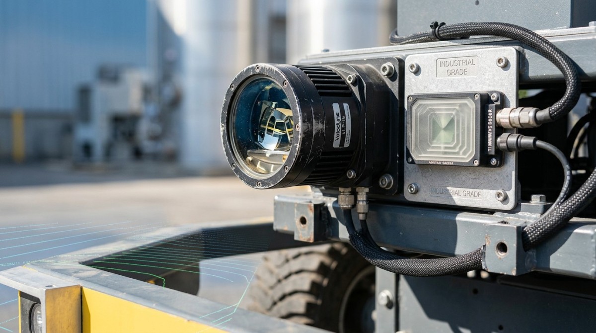
In outdoor autonomy and mixed-light industrial environments, sunlight interference is not a minor specification footnote. It directly affects perception stability, false point suppression, target continuity, and downstream control confidence. A sensor that performs well under indoor demo conditions may degrade sharply at noon, near reflective metal, or over concrete and water. For procurement teams, that means a specification sheet without anti-interference test context is incomplete.
The problem becomes more serious when teams compare LiDAR and radar using only headline numbers. A lidar field of view comparison may highlight horizontal and vertical coverage, yet fail to explain how much usable data remains when ambient illumination rises. A solid state lidar point cloud density value can look attractive, but if density collapses under high irradiance, the practical benefit narrows. In the same program, mmwave radar angular resolution and 77ghz radar detection range may remain more stable in sunlight, but radar introduces different tradeoffs in object contour detail.
For information researchers and system architects, the key is to separate nominal performance from robust field performance. In many B2B deployments, evaluation should cover at least 3 operating bands: indoor controlled light, overcast outdoor conditions, and high-glare outdoor conditions. Without this 3-stage benchmark, engineering teams often underestimate integration risk, while procurement teams overestimate cross-vendor comparability.
This is exactly where TechStat Vanguard focuses its value. TSV looks beyond marketing language and centers benchmark logic on engineering truth: usable returns, interference tolerance, latency stability, and system-level integration impact. For CTOs, senior buyers, and operators, the priority is not whether a sensor claims to resist sunlight, but how that claim is defined, measured, and reproduced across scenarios lasting 2–8 hours of continuous field operation.
What sunlight interference actually changes in real deployments
Sunlight interference affects more than visibility. It can reduce effective detection reliability, create noisy returns, disturb range precision, and increase compute burden because filtering must become more aggressive. In edge AI systems, that burden can push gateway latency upward by milliseconds, which matters in mobile robots, UAV obstacle avoidance, and roadside sensing where decisions are made in tight timing windows.
- Autonomous mobile platforms may see path planning confidence drop when point clouds become sparse or unstable under direct sun.
- Survey and mapping teams may face rework if point cloud consistency changes between morning, midday, and late afternoon capture windows.
- Industrial safety systems can suffer nuisance alarms or missed detections near reflective surfaces, glass, or polished machine guards.
- Procurement projects may incur hidden costs if a cheaper sensor requires extra shielding, recalibration cycles, or a second sensing modality.
These risks are rarely visible in headline brochures. They only become clear when teams benchmark under fixed distance bands, repeatable target materials, and multiple sun angles. That is why anti-interference should be treated as a sourcing dimension with measurable acceptance criteria, not as a vague promise.
How to benchmark sensors fairly: LiDAR, vision, radar, and edge gateway together
A fair comparison starts with a shared test framework. Teams should not compare one vendor’s ideal-condition point cloud against another vendor’s outdoor range claim. Instead, define 4 benchmark layers: sensing physics, environmental stress, compute transport, and task-level output. This avoids the common mistake of ranking sensors by isolated numbers that do not translate to deployment quality.
For LiDAR, useful metrics include point retention under high ambient light, false return behavior, range stability across low- and high-reflectivity targets, and degradation at the edge of the field of view. For radar, focus on mmwave radar angular resolution, velocity discrimination, clutter handling, and 77ghz radar detection range in the actual target class. For vision, include dynamic exposure behavior, lens flare resistance, and recognition confidence under backlight. For gateways, test throughput, buffering, and end-to-end latency under multi-sensor load.
The next table helps frame a practical benchmark model for mixed-modality perception procurement. It is especially relevant when comparing lidar field of view comparison results with radar and camera specifications that may look unrelated on paper but interact heavily in deployed systems.
The key takeaway is that sensor benchmarking must be system-aware. A LiDAR that holds its point cloud under sunlight but overwhelms a gateway at peak density can still become a weak choice. Likewise, radar with strong sunlight immunity may underperform in classification-heavy tasks if angular separation is insufficient for dense environments. Balanced evaluation prevents single-number bias.
Three benchmark mistakes that distort decisions
First, many teams compare maximum range without defining target reflectivity, target size, or angle. Second, they measure lidar field of view comparison as coverage only, not as coverage quality under interference. Third, they evaluate sensor output without checking whether the edge compute layer can sustain stable ingestion and inference over 4–6 parallel data streams.
A more reliable test sequence
- Define task targets clearly: obstacle detection, mapping, counting, safety zoning, or object classification.
- Run controlled baseline tests indoors, then repeat outdoors across at least 3 lighting bands.
- Measure sensor-plus-gateway latency, not sensor latency alone.
- Review degradation patterns, not just pass or fail status.
This sequence produces more procurement-grade evidence, especially when sourcing for robotics, aerial mapping, industrial automation, and roadside infrastructure where environmental variance is built into the use case.
Which applications are most sensitive to unequal sunlight resistance?
Not every use case is equally exposed. Indoor warehouse robots may only encounter strong glare at dock doors or skylight lanes, while outdoor UAVs and intelligent transport nodes can face long high-irradiance periods every day. Buyers should classify exposure severity before choosing between LiDAR-first, radar-first, or sensor-fusion designs. This reduces overengineering in low-risk sites and avoids under-specification in critical deployments.
In mapping and surveying, sunlight resistance affects consistency more than simple detection. A solid state lidar point cloud density figure may appear sufficient in vendor material, but the real concern is whether density remains stable enough for alignment, surface reconstruction, and repeat survey quality. When flight windows are limited to 2–3 hours, unstable data can turn one field mission into two.
In industrial safety, the issue is operational trust. Operators need predictable warnings near outdoor conveyors, ports, mining zones, and heavy equipment yards. If sunlight causes intermittent target loss or excessive clutter, the result is either missed hazards or too many nuisance alerts. Both outcomes carry cost: one in safety exposure, the other in operator fatigue and bypass behavior.
The following comparison table highlights where sunlight interference should carry higher weight in selection and how it intersects with lidar field of view comparison, mmwave radar angular resolution, and edge processing choices.
This table shows why equal weighting across all procurement projects is inefficient. In some environments, sunlight resistance is a gating factor. In others, it is one of several design checks. TSV’s engineering-led approach helps teams map environment severity to measurable sensor acceptance criteria rather than generic performance labels.
Practical scenario signals that a standard spec sheet is not enough
- Your site includes glass façades, polished steel, water, sand, or white concrete that amplify glare and reflections.
- Operations run through noon or late afternoon when sun angle changes create inconsistent returns.
- You need one sensor platform across indoor and outdoor zones with limited recalibration time.
- The project requires evidence for supplier qualification, not only a demo-day impression.
If two or more of these conditions apply, selection should move from catalog review to structured field validation before final sourcing or design freeze.
What should buyers and engineers check before committing to a sensor stack?
Procurement decisions fail most often when teams buy sensors in isolation. The more reliable method is to evaluate a perception stack: sensing, processing, data transport, installation geometry, and maintenance workflow. For buyers, the focus should be on 5 decision areas: application fit, benchmark evidence, integration burden, lifecycle cost, and qualification timeline. This structure supports both initial sourcing and later supplier comparison rounds.
Application fit starts with mission definition. Is the system expected to classify, localize, map, or enforce a safety boundary? For example, if the task is long-range coarse detection in harsh sunlight, 77ghz radar detection range and clutter stability may deserve more weight. If the task requires contour-rich mapping or precise obstacle geometry, then solid state lidar point cloud density under bright conditions becomes central. The right answer depends on output quality, not on sensor category preference.
Benchmark evidence should include repeatable test notes, not only screenshots or curated point cloud clips. At minimum, ask for environmental conditions, target assumptions, mounting position, and sustained run duration. A 15-minute demo can reveal peak performance, but a 1–8 hour run is more useful for operational confidence. This matters especially in edge AI systems where thermal load and data congestion can alter behavior over time.
Lifecycle cost is another overlooked factor. A lower-cost sensor can become more expensive if it forces extra shielding, denser maintenance intervals, or a second sensing modality to compensate for sunlight weakness. In some projects, choosing a more stable sensor reduces calibration effort, shortens supplier qualification by 2–4 weeks, and lowers software tuning cost across the first deployment phase.
A practical procurement checklist
- Define 3 critical operating environments, including the brightest likely field condition.
- Request a lidar field of view comparison that includes edge quality, not only nominal angles.
- Ask whether solid state lidar point cloud density is measured under controlled light or outdoor daylight.
- For radar options, review mmwave radar angular resolution together with 77ghz radar detection range on the target class you actually need.
- Confirm gateway throughput, interface compatibility, logging access, and update workflow before supplier shortlisting.
- Set acceptance criteria for sustained testing, not only one-time peak output.
Common misconceptions that create avoidable cost
One misconception is that wider field of view always means better safety or awareness. In reality, edge degradation, mounting height, and processing limits can make part of that field less useful. Another is that point cloud density alone predicts deployment quality. Density must remain interpretable and stable under sunlight, vibration, and temperature changes. A third misconception is that radar can replace LiDAR in all cases because of sunlight robustness. Radar is powerful, but its output characteristics differ and may not satisfy geometry-heavy tasks without fusion or application redesign.
These are not theoretical concerns. They are recurring sources of rework in robotics, industrial automation, and UAV integration. A benchmark-driven sourcing method reduces such rework by forcing each claim to connect with a measurable operating condition and a defined system task.
FAQ and next-step guidance for evidence-based sensor sourcing
Many teams searching for sunlight-resistant perception hardware are really trying to answer a broader question: how do we avoid buying on incomplete data? The right response is to align technical validation, procurement criteria, and deployment timing from the beginning. The FAQ below addresses the most common decision points.
How should we compare LiDAR sunlight resistance across vendors?
Use the same target set, the same mounting logic, and the same light windows. Compare point retention, false returns, edge FOV usability, and sustained stability over at least 3 environmental conditions. A single daytime demo is not enough. Ask whether the published solid state lidar point cloud density and lidar field of view comparison are measured under controlled or outdoor conditions.
When is radar a better choice than LiDAR in bright environments?
Radar often gains priority when long-range detection, weather resilience, and sunlight robustness are more important than contour detail. But the evaluation should not stop at range. Review mmwave radar angular resolution and 77ghz radar detection range together, because long reach with poor object separation may still underperform in dense traffic, yard automation, or multi-object scenes.
What is a reasonable validation timeline before purchase?
For many B2B projects, a structured validation cycle takes 2–4 weeks. That window usually covers baseline setup, multi-condition field tests, gateway logging review, and internal scoring. More complex UAV, roadside, or industrial safety programs may require a longer period if multiple mounting options or fusion strategies must be assessed.
What should operators ask for, not just engineers?
Operators should ask about cleaning intervals, recalibration triggers, nuisance alert behavior, diagnostic visibility, and maintenance workflow. A technically capable sensor that creates frequent field interventions can still become an operational burden. Practical usability must be scored alongside perception performance.
Why work with TSV when selecting sunlight-critical sensing systems?
TechStat Vanguard supports teams that need engineering-grade clarity rather than amplified marketing language. Our strength is not in promoting a single device category. It is in building a benchmark framework that helps R&D teams, procurement managers, and decision-makers compare LiDAR, radar, vision, and edge infrastructure on the basis of measurable operating truth. That approach shortens trial-and-error cycles and improves supplier qualification quality.
If your team is reviewing lidar field of view comparison results, questioning whether solid state lidar point cloud density remains usable in sunlight, or balancing mmwave radar angular resolution against 77ghz radar detection range, TSV can help structure the evaluation. We focus on parameter logic, test comparability, and practical deployment risk, especially in robotics, UAV, automation, and industrial sensing ecosystems.
You can contact TSV for specific support on parameter confirmation, sensor selection logic, benchmark design, supplier comparison, delivery planning, interface compatibility, edge gateway review, and compliance-oriented documentation needs. If you are preparing a spec sheet, validating a shortlist, or trying to reduce a 2–4 week qualification cycle, our engineering-centered analysis can help you move faster with better evidence.
The most reliable sourcing decisions begin when teams stop asking which sensor sounds stronger and start asking which sensor stack remains truthful under real conditions. That is where TSV works best: turning noise into measurable criteria, and turning claims into comparable engineering decisions.
Search News
Hot Articles
- Carbon Fiber StructuresHow to Specify Aerospace Carbon Fiber Assemblies for Lightweight, Load-Bearing PartsJul 11, 2026
- Machine VisionXiaomi, Alibaba DAMO Academy Drive Open-Source Robotics Model Ecosystem, Lowering Algorithm Development Barriers for Overseas SMEs Adopting Chinese Robotics SolutionsMar 30, 2026
- Cobots & ArmsShanxi 'AI+' Conference Showcases Embodied Intelligence with Multinational Buyer Engagement: Key Industry ImplicationsMar 30, 2026
Popular Tags
Recommended News
 Jul 11, 2026How to Specify Aerospace Carbon Fiber Assemblies for Lightweight, Load-Bearing PartsAerospace carbon fiber assemblies: learn how to specify laminate design, load data, joining methods, and inspection controls for lighter, reliable load-bearing aerospace parts.Elena Rostova (UAV Systems Researcher)
 Mar 30, 2026Xiaomi, Alibaba DAMO Academy Drive Open-Source Robotics Model Ecosystem, Lowering Algorithm Development Barriers for Overseas SMEs Adopting Chinese Robotics SolutionsXiaomi & Alibaba DAMO Academy's open-source robotics models lower algorithm barriers for global SMEs. Boost efficiency in manufacturing, logistics & smart retail with ROS 2 compatible solutions.TSV Data Lab
 Mar 30, 2026Shanxi 'AI+' Conference Showcases Embodied Intelligence with Multinational Buyer Engagement: Key Industry ImplicationsShanxi 'AI+' Conference highlights embodied intelligence with Tesla, Ubtech & Jiantao showcasing multimodal robotics. 40+ global buyers validated tech on-site, creating new B2B channels for industrial automation & AI solutions.Chen Wei (Automation Lead Engineer)
 Mar 30, 2026Zhongguancun Unveils 6G Integrated Sensing-Computing-Intelligence Platform to Empower Embodied Robots for Global Industrial ApplicationsZhongguancun's new 6G platform revolutionizes industrial robotics with <10ms latency, empowering global automotive, logistics & port automation. Discover how this tech boosts China's smart manufacturing exports.TSV Data Lab
 Mar 30, 2026Mech-Mind Tianjin Embodied Intelligence R&D and Production Base Goes Live, Cutting Delivery Time by 20%–30% for Global Customized AMR+Vision SolutionsMech-Mind's Tianjin AMR+Vision production base cuts delivery time by 20%-30% for欧美 & Latin American markets. Discover how this PLd-certified facility accelerates customized robotics solutions for smart manufacturing and logistics.Chen Wei (Automation Lead Engineer)
 Mar 30, 2026Boao Forum Reveals 'Co-evolution of Big and Small Brains' Trend in Humanoid Robots, China's Embodied Intelligence Accelerates Adaptation to Overseas Manufacturing Service ScenariosDiscover how China's humanoid robots, featuring 'Co-evolution of Big and Small Brains,' are revolutionizing global manufacturing. Learn about Embodied Tian Gong 3.0's ISO compliance and overseas deployment at Boao Forum 2026.Chen Wei (Automation Lead Engineer)
 Mar 30, 2026China Railway Industrial Secures Patent for Embodied Robotics in Material Handling, Boosting High-Precision Delivery Capabilities for Overseas Infrastructure and Manufacturing ProjectsChina Railway Industrial's new patent for embodied robotics in material handling boosts high-precision delivery for global infrastructure & manufacturing. Discover how this innovation enhances logistics accuracy in automotive, rail transit & EPC projects.Chen Wei (Automation Lead Engineer)
 Oct 21, 2026China’s Industrial Robot Exports Near RMB 10 Billion in First Nine Months of 2026China’s industrial robot exports neared RMB 10 billion in January–September 2026, with value rising faster than volume. Explore the data and what it could mean for suppliers.Chen Wei (Automation Lead Engineer)
 Oct 21, 2026Low-Latency Industrial Data Processing: Pricing and Key Cost DriversExplore industrial data latency price drivers, from edge hardware to integration and support. Learn how to compare quotes, verify performance, and avoid unnecessary costs.TSV Data Lab
 Oct 20, 2026KUKA Launches iiQKA.AI Vision to Simplify Industrial Image ProcessingKUKA iiQKA.AI Vision simplifies industrial image processing with controller-based 2D and 3D vision. Explore drag-and-drop setup for vision-guided automation.TSV Data Lab
 Oct 20, 2026Smart Industrial Edge Devices: Key Criteria for Legacy PLC IntegrationChoose smart industrial edge devices for legacy PLC integration. Discover key criteria for compatibility, data quality, security, and reliable collection without disrupting control.TSV Data Lab
 Oct 19, 2026Choosing a Radar Sensor by Application: Range, Resolution, and Field of ViewSimplify radar sensor application based product selection. Compare range, resolution, and field of view to avoid blind spots and choose with confidence. Explore the guide.TSV Data Lab
 Oct 18, 2026Comparing Material Options for Procurement: Specs, Costs, and Supply RisksExplore procurement oriented technical content on material options, specs, costs, and supply risks. Compare alternatives to cut hidden expenses and make confident sourcing decisions.Dr. Marcus Vance
 Oct 17, 20265-Axis CNC Positioning Accuracy: How to Interpret ISO 230-2 Test ResultsAssess 5 axis CNC machining positioning accuracy with ISO 230-2. Learn to interpret repeatability, reversal error, and test conditions to compare suppliers and make confident acceptance decisions.Dr. Marcus Vance
 Oct 16, 2026Choosing a Rugged Edge AI Box Supplier: Thermal Tests and Lifecycle SupportChoose a rugged edge AI box supplier with proven thermal performance and reliable lifecycle support. Discover the tests and commitments to verify before you buy.TSV Data Lab
 Oct 15, 2026R&D Cost Reduction Services: How to Evaluate Fees, Savings, and ROIEvaluate R&D cost reduction services with confidence. Compare fees, verify savings, and calculate ROI without compromising performance. Discover how to choose a provider that delivers real value.Chen Wei (Automation Lead Engineer)
 Oct 21, 2026How Should You Balance Cobot Payload Against Reach?Explore cobot payload versus reach to choose the right robot. Learn how tooling, load limits, workspace, and cycle time affect performance—and avoid costly selection mistakes.Chen Wei (Automation Lead Engineer)
 Oct 20, 2026How Do You Measure Industrial IoT Gateway Latency Under Load?Measure industrial IoT gateway latency under load with reliable timestamps, realistic traffic, and tail-latency analysis. Discover how to expose bottlenecks and choose the right gateway.TSV Data Lab
 Oct 19, 2026How Do You Verify That Precision Machined Parts Meet Tolerances?Master precision machining tolerance verification with the right tools, datum setups, and acceptance rules. Learn how to validate parts confidently and reduce costly inspection errors.Dr. Marcus Vance
 Oct 18, 2026What Should an AS9100 Machining Supplier Checklist Include?Build an AS9100 machining supplier checklist that verifies capability, traceability, inspection, and outsourced processes. Discover what to check before approving your next aerospace supplier.Dr. Marcus Vance
 Oct 17, 2026How Should You Interpret Industrial Robot Repeatability Specs?Decode industrial robot repeatability specifications, understand ISO 9283 test conditions, and avoid costly selection mistakes. Learn how to verify performance for your process.Chen Wei (Automation Lead Engineer)
 Oct 16, 2026How Can You Fairly Compare MTBF Across Industrial Servo Motors?Make a fair industrial servo motor MTBF comparison with matched operating profiles, failure criteria, and confidence bounds. Discover how to assess reliability beyond advertised numbers.Chen Wei (Automation Lead Engineer)
 Oct 15, 2026How Should You Compare TechStat Vanguard 5-Axis CNC Tolerances?TechStat Vanguard 5-axis CNC tolerance comparison: learn how to verify part accuracy, assess inspection evidence, and choose suppliers that reliably meet your drawing requirements.Dr. Marcus Vance
 Oct 14, 2026Drone Frame Composites: Carbon Fiber vs. Fiberglass for Weight and StiffnessExplore drone structural materials composites: compare carbon fiber and fiberglass for weight, stiffness, cost, and antenna compatibility. Find the right material for your drone frame.Elena Rostova (UAV Systems Researcher)