Why Some Mining Maps Look Precise but Fail in the Field
Publication Date
author
A mapping drone for mining industry can look flawless on paper yet fail once dust, magnetic noise, terrain shadowing, and payload stress enter the equation. From uav gps rtk accuracy millimeter claims to drone electromagnetic interference test gaps, field reality exposes what brochures hide. This article explains why precise-looking mining maps break down in practice—and which engineering benchmarks decision-makers should verify before procurement.
Why do mining maps appear precise in reports but break down on site?
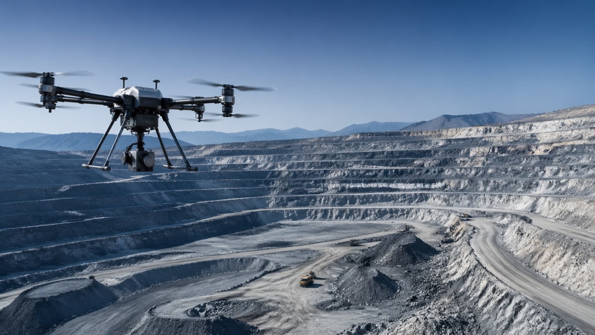
In mining operations, map precision is not defined by a clean orthomosaic alone. It is defined by whether survey outputs remain usable after slope variation, blasting residue, reflective surfaces, haul-road vibration, and GNSS instability affect the workflow. A drone may produce visually sharp data in a vendor demo, yet still generate weak field results once real mine conditions compress every tolerance at the same time.
This gap often starts with how specifications are presented. Vendors may highlight uav gps rtk accuracy in ideal conditions, but a mine rarely offers ideal conditions for 6–8 continuous flight hours across multiple sorties. Open-sky assumptions, short baseline references, and controlled temperature ranges do not fully represent pit walls, metallic machinery, radio congestion, and dust-loaded air.
For information researchers and procurement teams, the key question is not whether a mining map looks precise in a brochure. The question is whether the entire mapping chain remains stable across 3 layers: positioning integrity, sensor reliability, and processing consistency. If one layer drifts, the final output may still look neat while carrying hidden spatial error that disrupts stockpile estimates, cut-and-fill planning, or safety inspections.
TSV approaches this issue from an engineering truth perspective. Instead of accepting marketing adjectives, we focus on measurable thresholds, test context, and system interactions. In hard-tech procurement, especially for UAV mapping in mining, tolerances dictate success more than headline claims do.
Three reasons brochure-level precision often fails
- Single-condition testing: many published figures come from calm, low-interference environments rather than dust, vibration, and terrain-shadowed mine sites.
- System-level blind spots: camera, IMU, RTK, payload mount, and software are treated as separate strengths even though mapping quality depends on their combined behavior.
- Visual quality bias: operators and decision-makers may trust a clean image output without checking control-point residuals, overlap consistency, or repeat-flight variance.
A practical mining map must survive repeated missions over 2–4 weeks, not one controlled demonstration. If the same area produces materially different elevation values across separate flights, the map is not operationally reliable even if the first output looked impressive.
Which field variables most often distort a mining drone mapping result?
The mining environment creates compounded error. Unlike general land surveying, mining sites can combine steep geometry, metallic structures, moving assets, dust plumes, heat shimmer, and partially obstructed sky visibility within one operating window. This means a mapping drone for mining industry must be evaluated as a field system rather than a flying camera.
Dust is one of the most underestimated variables. Fine particulate matter affects lens clarity, thermal management, motor efficiency, and sensor stability over time. In short missions of 20–35 minutes, degradation may be limited. Over multiple flights in a full shift, however, airborne contamination can introduce drift, increase cooling stress, and reduce consistency between sorties.
Electromagnetic interference is another frequent failure point. Mine sites contain power systems, radios, heavy equipment, blasting systems, and metallic infrastructure that can disturb compass readings, degrade GNSS lock quality, or create unstable heading behavior. A drone electromagnetic interference test performed only in basic laboratory conditions may not predict what happens near crushers, conveyors, substations, or vehicle fleets.
Terrain itself also introduces error through shadowing and geometry loss. High walls, benches, ramps, and deep pits reduce signal geometry and image continuity. Even with claimed millimeter-level or centimeter-level positioning, terrain-induced signal degradation can increase residual error if flight planning, overlap settings, and control strategy are not adapted to the site.
Field variables procurement teams should ask about
Before supplier approval, teams should request not just nominal specifications but context-specific validation. The table below helps separate headline precision from operational reliability in mining map workflows.
For operators, these variables determine whether the map remains trustworthy after routine deployment. For enterprise decision-makers, they affect rework cost, survey delays, and downstream planning risk. A low initial purchase price can become expensive if 2–3 repeat flights are needed for one usable dataset.
A simple field rule
If a supplier cannot explain how performance changes across dust, EMI, terrain shadowing, and payload stress, then the published precision figure is incomplete. In mining, incomplete precision data is a procurement risk, not a minor documentation gap.
What engineering benchmarks matter more than a millimeter claim?
A single accuracy number rarely captures the true reliability of a mining mapping platform. Procurement teams should instead evaluate benchmark clusters. These include positioning robustness, vibration control, data continuity, sensor calibration stability, and repeat-flight variance. This is where TSV’s engineering benchmarking mindset becomes useful: parameters do not stand alone, and tolerances only matter inside realistic operating context.
For example, uav gps rtk accuracy may be advertised under short-baseline, unobstructed, low-interference conditions. Yet in mining, a more meaningful question is whether the aircraft holds stable results across 3 consecutive flights, under changing payload stress, with acceptable residual spread between checkpoints. Repeatability can be more valuable than a best-case headline figure.
Another overlooked benchmark is system endurance under full mission configuration. Endurance should not be reviewed only as a no-payload flight time. Mines often require sensor payloads, spare battery cycling, and mission repetition over 1 shift. What matters is usable flight time under actual mapping load, not only nominal airborne duration in a controlled spec sheet.
The same principle applies to software outputs. A processing platform that produces a rapid preview in 30–60 minutes may still fail if georeferencing confidence, overlap diagnostics, or quality flags are weak. Mapping quality is not just about speed. It is about traceable confidence in each stage of the dataset.
Benchmark categories worth validating
The table below summarizes the metrics that typically matter more than isolated marketing claims when selecting a mapping drone for mining industry projects.
For procurement teams, this framework shifts the conversation from brochure accuracy to operational confidence. That shift is critical because field failure in mining does not usually look dramatic. More often, it appears as subtle elevation mismatch, repeated reprocessing, disputed volume calculations, or delayed sign-off from technical teams.
A 5-point validation checklist
- Ask for test conditions, not only test results.
- Compare full-load endurance versus empty-airframe endurance.
- Review repeat-flight variance over at least 3 survey cycles.
- Check how EMI, dust, and terrain complexity were represented in validation.
- Confirm quality-control outputs inside the mapping software, not just final images.
These 5 checks often reveal more practical value than a longer spec sheet. They also help CTOs and procurement directors reduce supplier qualification cycles, because poor-fit vendors become easier to screen out early.
How should buyers compare mapping systems for mining procurement?
Mining procurement rarely fails because buyers forgot to compare price. It fails because teams compared visible features while overlooking lifecycle suitability. A lower-cost mapping platform may still create higher total operating burden if it needs more rework, more manual control points, more cleaning downtime, or more operator intervention in difficult terrain.
A stronger comparison model includes 4 dimensions: field reliability, data confidence, maintenance workload, and integration fit. These dimensions matter to different stakeholders. Operators care about ease of deployment and recovery. Procurement managers care about risk and supportability. Enterprise decision-makers care about output trust and predictable delivery cycles.
In practice, a realistic supplier review often takes 7–15 working days for document collection, technical clarification, and pilot criteria definition. For larger fleet or multi-site deployment, 2–4 weeks is common because teams must align survey, HSE, IT, and procurement requirements before approval.
The goal is not to find a platform that looks impressive in a generic UAV catalog. The goal is to find one that stays stable across your mine’s duty cycle, data workflow, and staffing model. That difference is where many expensive purchasing mistakes begin.
A practical selection matrix
Use the matrix below when comparing two or three vendors. It keeps the evaluation grounded in mining use, not presentation quality.
This selection logic also helps budget discussions. If one system costs less upfront but creates recurring operator overhead every week, it may not be the lower-cost option over a 12-month deployment horizon. In B2B mining procurement, total process friction matters almost as much as hardware price.
Common comparison mistake
Many teams compare sensor resolution first and field validation last. In mining, that order should be reversed. A sensor with slightly lower nominal output but better calibration retention and EMI resilience can deliver more reliable mapping results than a higher-resolution system that drifts under real operating stress.
What standards, workflow controls, and misconceptions should teams review?
No universal mining standard can remove all field risk, but teams can still use established engineering discipline to improve procurement quality. That includes traceable calibration records, documented maintenance intervals, site-specific risk assessment, controlled mission planning, and clear acceptance criteria for survey deliverables. The strongest suppliers usually explain these controls in practical detail rather than relying on generic assurance language.
For quality review, it is useful to define 3 acceptance layers before procurement: flight readiness, data capture integrity, and output verification. Flight readiness covers battery health, sensor status, firmware version, and environmental suitability. Data capture integrity covers overlap, control-point method, and interruption logs. Output verification covers residual review, anomaly checks, and consistency against prior site surveys.
Another important control is operator competence. Even a capable mapping drone for mining industry use can underperform if operators lack mine-specific planning habits. Bench height, safe launch location, route segmentation, and timing around traffic or blasting windows often matter as much as hardware choice. This is why implementation planning should be treated as part of procurement, not a separate afterthought.
TSV’s value in this area is not product hype. It is structured technical interpretation. By filtering marketing noise and emphasizing parameter context, testing scope, and engineering comparability, TSV helps research teams and decision-makers ask better questions before contracts are signed.
FAQ and common misconceptions
Is millimeter-level uav gps rtk accuracy enough to guarantee mining map quality?
No. It may describe positioning capability under specific conditions, but mining map quality also depends on calibration stability, terrain geometry, overlap consistency, payload vibration, and processing control. A strong procurement review looks at system repeatability over at least 3 flights, not only one nominal accuracy line.
How many checkpoints or validation steps should a buyer expect?
The exact number depends on project scale and site complexity, but buyers should expect a documented process with multiple validation nodes rather than a single final screenshot. In many mining workflows, 4 key stages are practical: pre-flight readiness, in-flight monitoring, post-flight data integrity review, and final output verification against known references.
Are dust and EMI only maintenance concerns?
No. They are also data-quality concerns. Dust can affect optics and thermal behavior, while EMI can influence heading and GNSS stability. If a drone electromagnetic interference test does not reflect realistic industrial conditions, mapping confidence may be overstated during vendor comparison.
What is the most overlooked procurement question?
A highly overlooked question is: how does the system perform after repeated transport, repeated flights, and repeated cleaning cycles over 2–4 weeks? Mines operate on continuity. A system that performs well on day 1 but drifts by week 3 can create hidden cost that is not visible in an initial quotation.
Why work with TSV when evaluating mining mapping systems?
TSV is built for technical buyers who need engineering truth, not promotional noise. For mining UAV evaluation, that means translating scattered specifications into decision-grade benchmarks: tolerances, repeatability, interference resilience, payload limits, and workflow fit. Our perspective is especially useful when teams must compare several suppliers with inconsistent data formats and uneven testing transparency.
We support information researchers, operators, procurement managers, and enterprise decision-makers by clarifying what to verify before purchase. That can include parameter confirmation, benchmark interpretation, selection logic, expected delivery preparation, and practical review of certification or compliance language used in supplier documents. The objective is to reduce trial-and-error cost and shorten qualification cycles.
If your team is assessing a mapping drone for mining industry deployment, contact TSV to discuss 6 concrete topics: uav gps rtk accuracy context, drone electromagnetic interference test scope, payload-margin endurance, calibration retention, field validation workflow, and supplier comparison structure. These are the areas where many purchasing decisions become either defensible or risky.
You can also consult us on pilot evaluation criteria, acceptance checklist design, integration questions, expected implementation timeline, and quotation comparison logic. In hard-tech procurement, better questions create better outcomes. TSV helps your team ask the right ones before field failure turns a precise-looking map into an operational liability.
Search News
Hot Articles
- Carbon Fiber StructuresHow to Specify Aerospace Carbon Fiber Assemblies for Lightweight, Load-Bearing PartsJul 11, 2026
- Machine VisionXiaomi, Alibaba DAMO Academy Drive Open-Source Robotics Model Ecosystem, Lowering Algorithm Development Barriers for Overseas SMEs Adopting Chinese Robotics SolutionsMar 30, 2026
- Cobots & ArmsShanxi 'AI+' Conference Showcases Embodied Intelligence with Multinational Buyer Engagement: Key Industry ImplicationsMar 30, 2026
Popular Tags
Recommended News
 Jul 11, 2026How to Specify Aerospace Carbon Fiber Assemblies for Lightweight, Load-Bearing PartsAerospace carbon fiber assemblies: learn how to specify laminate design, load data, joining methods, and inspection controls for lighter, reliable load-bearing aerospace parts.Elena Rostova (UAV Systems Researcher)
 Mar 30, 2026Xiaomi, Alibaba DAMO Academy Drive Open-Source Robotics Model Ecosystem, Lowering Algorithm Development Barriers for Overseas SMEs Adopting Chinese Robotics SolutionsXiaomi & Alibaba DAMO Academy's open-source robotics models lower algorithm barriers for global SMEs. Boost efficiency in manufacturing, logistics & smart retail with ROS 2 compatible solutions.TSV Data Lab
 Mar 30, 2026Shanxi 'AI+' Conference Showcases Embodied Intelligence with Multinational Buyer Engagement: Key Industry ImplicationsShanxi 'AI+' Conference highlights embodied intelligence with Tesla, Ubtech & Jiantao showcasing multimodal robotics. 40+ global buyers validated tech on-site, creating new B2B channels for industrial automation & AI solutions.Chen Wei (Automation Lead Engineer)
 Mar 30, 2026Zhongguancun Unveils 6G Integrated Sensing-Computing-Intelligence Platform to Empower Embodied Robots for Global Industrial ApplicationsZhongguancun's new 6G platform revolutionizes industrial robotics with <10ms latency, empowering global automotive, logistics & port automation. Discover how this tech boosts China's smart manufacturing exports.TSV Data Lab
 Mar 30, 2026Mech-Mind Tianjin Embodied Intelligence R&D and Production Base Goes Live, Cutting Delivery Time by 20%–30% for Global Customized AMR+Vision SolutionsMech-Mind's Tianjin AMR+Vision production base cuts delivery time by 20%-30% for欧美 & Latin American markets. Discover how this PLd-certified facility accelerates customized robotics solutions for smart manufacturing and logistics.Chen Wei (Automation Lead Engineer)
 Mar 30, 2026Boao Forum Reveals 'Co-evolution of Big and Small Brains' Trend in Humanoid Robots, China's Embodied Intelligence Accelerates Adaptation to Overseas Manufacturing Service ScenariosDiscover how China's humanoid robots, featuring 'Co-evolution of Big and Small Brains,' are revolutionizing global manufacturing. Learn about Embodied Tian Gong 3.0's ISO compliance and overseas deployment at Boao Forum 2026.Chen Wei (Automation Lead Engineer)
 Mar 30, 2026China Railway Industrial Secures Patent for Embodied Robotics in Material Handling, Boosting High-Precision Delivery Capabilities for Overseas Infrastructure and Manufacturing ProjectsChina Railway Industrial's new patent for embodied robotics in material handling boosts high-precision delivery for global infrastructure & manufacturing. Discover how this innovation enhances logistics accuracy in automotive, rail transit & EPC projects.Chen Wei (Automation Lead Engineer)
 Oct 23, 2026Choosing Industrial Sensing Systems for Global Plants: Protocol CompatibilityCompare industrial sensing systems international buyers can trust. Explore protocol compatibility, reduce integration risks, and select proven configurations for reliable global plant deployments.TSV Data Lab
 Oct 22, 2026KUKA Showcases Physical AI and iiQKA.AI Vision at NVIDIA GTC BerlinExplore KUKA’s Physical AI showcase at NVIDIA GTC Berlin and discover how iiQKA.AI Vision aims to simplify robotic vision integration and improve 2D and 3D scene recognition.TSV Data Lab
 Oct 22, 2026Robotic Machining of Advanced Composites: What Tolerances Are Achievable?Explore advanced materials machining robotics: discover what drives achievable composite tolerances and how to validate accuracy before investing in your next machining system.Dr. Marcus Vance
 Oct 21, 2026China’s Industrial Robot Exports Near RMB 10 Billion in First Nine Months of 2026China’s industrial robot exports neared RMB 10 billion in January–September 2026, with value rising faster than volume. Explore the data and what it could mean for suppliers.Chen Wei (Automation Lead Engineer)
 Oct 21, 2026Low-Latency Industrial Data Processing: Pricing and Key Cost DriversExplore industrial data latency price drivers, from edge hardware to integration and support. Learn how to compare quotes, verify performance, and avoid unnecessary costs.TSV Data Lab
 Oct 20, 2026KUKA Launches iiQKA.AI Vision to Simplify Industrial Image ProcessingKUKA iiQKA.AI Vision simplifies industrial image processing with controller-based 2D and 3D vision. Explore drag-and-drop setup for vision-guided automation.TSV Data Lab
 Oct 20, 2026Smart Industrial Edge Devices: Key Criteria for Legacy PLC IntegrationChoose smart industrial edge devices for legacy PLC integration. Discover key criteria for compatibility, data quality, security, and reliable collection without disrupting control.TSV Data Lab
 Oct 19, 2026Choosing a Radar Sensor by Application: Range, Resolution, and Field of ViewSimplify radar sensor application based product selection. Compare range, resolution, and field of view to avoid blind spots and choose with confidence. Explore the guide.TSV Data Lab
 Oct 18, 2026Comparing Material Options for Procurement: Specs, Costs, and Supply RisksExplore procurement oriented technical content on material options, specs, costs, and supply risks. Compare alternatives to cut hidden expenses and make confident sourcing decisions.Dr. Marcus Vance
 Oct 17, 20265-Axis CNC Positioning Accuracy: How to Interpret ISO 230-2 Test ResultsAssess 5 axis CNC machining positioning accuracy with ISO 230-2. Learn to interpret repeatability, reversal error, and test conditions to compare suppliers and make confident acceptance decisions.Dr. Marcus Vance
 Oct 16, 2026Choosing a Rugged Edge AI Box Supplier: Thermal Tests and Lifecycle SupportChoose a rugged edge AI box supplier with proven thermal performance and reliable lifecycle support. Discover the tests and commitments to verify before you buy.TSV Data Lab
 Oct 15, 2026R&D Cost Reduction Services: How to Evaluate Fees, Savings, and ROIEvaluate R&D cost reduction services with confidence. Compare fees, verify savings, and calculate ROI without compromising performance. Discover how to choose a provider that delivers real value.Chen Wei (Automation Lead Engineer)
 Oct 22, 2026How Do You Test AMR Navigation Accuracy in a Warehouse?Test AMR navigation accuracy in warehouses with practical methods for localization, path tracking, and docking. Learn to set tolerances and compare robots before deployment.Chen Wei (Automation Lead Engineer)
 Oct 21, 2026How Should You Balance Cobot Payload Against Reach?Explore cobot payload versus reach to choose the right robot. Learn how tooling, load limits, workspace, and cycle time affect performance—and avoid costly selection mistakes.Chen Wei (Automation Lead Engineer)
 Oct 20, 2026How Do You Measure Industrial IoT Gateway Latency Under Load?Measure industrial IoT gateway latency under load with reliable timestamps, realistic traffic, and tail-latency analysis. Discover how to expose bottlenecks and choose the right gateway.TSV Data Lab
 Oct 19, 2026How Do You Verify That Precision Machined Parts Meet Tolerances?Master precision machining tolerance verification with the right tools, datum setups, and acceptance rules. Learn how to validate parts confidently and reduce costly inspection errors.Dr. Marcus Vance
 Oct 18, 2026What Should an AS9100 Machining Supplier Checklist Include?Build an AS9100 machining supplier checklist that verifies capability, traceability, inspection, and outsourced processes. Discover what to check before approving your next aerospace supplier.Dr. Marcus Vance