Open Pit Surveying Problems a Mapping Drone Can Actually Fix
Publication Date
author
Open-pit operations demand faster, safer, and more repeatable site data than manual crews can deliver. This article explains how a mapping drone for mining industry workflows can solve common surveying bottlenecks—from unstable stockpile measurements to poor terrain visibility—while addressing what buyers should verify in uav gps rtk accuracy millimeter claims, lidar payload weight limit, and drone electromagnetic interference test results before deployment.
For survey managers, drone operators, procurement teams, and executives, the issue is no longer whether drones are useful. The real question is which open-pit surveying problems can be solved reliably, under what conditions, and with what technical limits. In mining, a 2 cm error can be acceptable in one task and unacceptable in another. A fast flight can improve coverage, but not if vibration, magnetic disturbance, or poor base-station setup degrades the final model.
That is why hard-tech buyers should evaluate mapping systems the same way they evaluate any critical industrial asset: by measurable performance, environmental tolerance, and workflow fit. A drone that produces attractive marketing visuals but weak geospatial repeatability will not reduce rework, shorten reconciliation cycles, or improve blast planning confidence. What follows is a practical, engineering-focused guide to where a mapping drone creates value in open-pit surveying and how to assess it before purchase.
Where Manual Open-Pit Surveying Breaks Down First
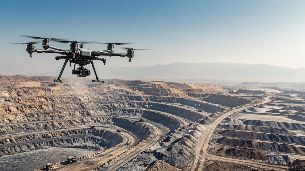
Open-pit mines change quickly. Benches are cut, haul roads deform, stockpiles shift, and drainage paths evolve after each weather event. In many sites, manual or rover-based surveying still handles critical checks, but coverage speed often becomes the first operational bottleneck. A crew may capture control points and selected breaklines in 4–8 hours, yet still leave blind zones on steep slopes, berm edges, and active loading areas.
Safety is the second bottleneck. Surveyors working near highwalls, moving haul trucks, and unstable pile faces accept unnecessary exposure when the task is simply to collect surface data. Even if access is permitted, the cost of traffic coordination, spotters, and delayed production windows can outweigh the apparent savings of manual fieldwork. A mapping drone for mining industry operations reduces that exposure by shifting data capture from the pit floor to planned aerial missions.
Repeatability is the third weakness. Manual methods can be highly accurate at specific points, but open-pit decisions increasingly depend on full-surface context, not isolated shots. If the same stockpile is measured by 2 crews using slightly different walk paths or edge assumptions, volume variation can appear even when the material has not changed significantly. This affects inventory reconciliation, contractor payment, and month-end reporting.
Terrain visibility also remains a practical problem. Dust, low-angle light, broken topography, and line-of-sight limitations make it hard to understand subtle elevation changes across a 20 ha, 50 ha, or 150 ha work area. Drone-derived orthomosaics, digital surface models, and point clouds help convert fragmented observations into a full site picture that engineering, operations, and management can review using the same reference data.
Typical failure points in conventional workflows
- Stockpile toe and crest boundaries are interpreted differently between shifts, causing volume inconsistency.
- Highwall and slope areas remain under-sampled because crews cannot safely occupy enough positions.
- Haul road rutting and drainage changes are noticed late because updates are collected weekly instead of daily.
- Data from total station, GNSS rover, and paper notes requires 1–2 extra processing steps before it becomes decision-ready.
The comparison below shows why mines increasingly use drone mapping for broad-surface capture while retaining ground survey for control, legal boundaries, or precision setout.
The key conclusion is not that drones replace every survey method. It is that they solve the highest-friction gap in open-pit operations: rapid, repeatable, full-area surface intelligence. That is where time savings, exposure reduction, and planning confidence start to compound.
What a Mapping Drone Can Actually Fix in Daily Mining Workflows
The most immediate value of a mapping drone for mining industry workflows is not abstract innovation. It is the ability to stabilize recurring survey outputs. When a mine measures stockpiles every 24 hours, every 72 hours, or at month end, the goal is not just a model. The goal is a repeatable method that minimizes variation caused by operator route choice, unsafe access, and incomplete surface capture.
In volumetric work, drones help by generating dense overlapping imagery or LiDAR scans over the whole stockpile, including shoulders and irregular edges that are often approximated manually. This matters when loose material, crusher feed, overburden, or blended products are reconciled across multiple locations. Even a 1%–3% improvement in volume consistency can meaningfully improve internal reporting when the site handles large tonnage.
For topographic updates, drones reduce cycle time. A survey that previously required a crew for most of a shift may be captured in a flight window of 20–45 minutes, depending on area size, overlap settings, and altitude. Processing still takes time, but the field bottleneck is reduced. This allows more frequent updates for pit progression, berm maintenance, and pre-drill planning.
Another fix is cross-team visibility. A drone dataset supports survey, geology, planning, HSE, and operations at the same time. The same mission can produce a current orthomosaic for traffic review, a terrain model for drainage analysis, and a surface reference for contractor discussions. In practice, one data capture event can serve 3–5 downstream decisions instead of only one survey deliverable.
High-value mine use cases
1. Stockpile measurement and reconciliation
This is often the fastest path to ROI. Piles change shape rapidly, and manual spot measurements can under-represent side slopes. Drone mapping provides fuller geometry and clearer historical comparison over weekly, monthly, and quarterly cycles.
2. Bench progression and cut-fill monitoring
Frequent aerial mapping supports better understanding of advance rates, crest lines, and compliance with design intent. Where the mine revisits the same zone every 2–7 days, repeatable drone flights can reveal changes that are difficult to track through isolated ground observations.
3. Haul road and drainage visibility
Open-pit haul roads deteriorate under heavy traffic and weather. Drone mapping helps identify rutting, ponding, shoulder erosion, and crossfall issues before they become larger maintenance or safety events.
- Plan a standard flight pattern over recurring areas.
- Use the same control strategy and processing settings each cycle.
- Compare surfaces at fixed intervals such as daily, weekly, or month end.
- Feed outputs into planning, inventory, and maintenance review.
The operational takeaway is straightforward: drone mapping is strongest where repeat surveys over changing terrain create manual inconsistency, safety exposure, or slow decision cycles. That is why mining teams should assess fit by workflow pain, not by marketing claims alone.
How to Verify RTK Accuracy, LiDAR Payload Limits, and EMI Performance
Mining buyers often see attractive claims around uav gps rtk accuracy millimeter performance, but procurement decisions should separate positioning language from delivered survey quality. RTK improves geotag precision and can reduce the number of required ground control points in some workflows, yet “millimeter” language is frequently misunderstood. In real site conditions, final absolute accuracy depends on flight altitude, camera calibration, control strategy, satellite visibility, processing quality, and terrain texture.
A more practical evaluation asks three questions. First, what is the repeatable horizontal and vertical accuracy under a documented workflow? Second, how does performance change if the site has pit walls, conveyors, crushers, or metallic structures that degrade GNSS conditions? Third, what ground validation method was used: checkpoints, control points, or only onboard logs? Without those details, a millimeter headline tells a procurement team very little.
LiDAR payload weight limit is equally important. Open-pit buyers often assume that if a drone can physically lift a LiDAR unit, the configuration is acceptable. In practice, payload mass affects flight time, stability, vibration margin, and thermal load. A platform flying 35–45 minutes with a camera may only achieve 18–28 minutes with a heavier LiDAR configuration, especially at higher elevations or in wind above 7–10 m/s.
Drone electromagnetic interference test results deserve the same scrutiny. Mines contain radios, high-current equipment, blasting systems, substations, and metallic infrastructure that can affect compasses, GNSS reception, or payload data quality. EMI resilience should not be treated as a vague quality statement. Buyers should request test conditions, pass criteria, and operational restrictions, including minimum safe distance from strong emitters and any known effect on heading stability or positioning continuity.
What procurement teams should request from vendors
The table highlights a core principle: mine-ready performance is a system characteristic, not a brochure headline. Accuracy, endurance, and stability must be interpreted together. If one parameter degrades under payload, EMI, or terrain shielding, the whole survey workflow is affected.
A practical acceptance checklist
- Request a validation mission over a 10–30 ha area with independent checkpoints.
- Compare flight time at zero payload versus operational payload, not advertised maximum only.
- Confirm whether EMI testing included active industrial environments or only laboratory conditions.
- Verify data output compatibility with your GIS, mine planning, or stockpile software.
- Ask how many operators are required for routine deployment and whether field setup stays under 20 minutes.
For technical buyers aligned with TSV’s engineering-first mindset, the standard is simple: require evidence that connects sensor, aircraft, workflow, and validation. Parameters only matter when they remain credible in the field.
Choosing the Right Drone Configuration for Open-Pit Conditions
Not every mine needs the same drone stack. Some sites mainly need photogrammetry for stockpiles and topographic updates. Others need LiDAR because surfaces are low-texture, lighting is inconsistent, or vegetation and complex geometry interfere with image matching. The best configuration depends on task frequency, site size, acceptable error, and environmental load such as dust, temperature, and wind.
Photogrammetry is often the lower-cost entry point and works well for many open-pit applications where lighting is manageable and the surface has enough texture. It is effective for orthomosaics, surface models, and routine volume calculations. LiDAR becomes more attractive when the mine demands stronger geometric capture over irregular terrain, low-contrast surfaces, or areas where visual reconstruction may be less stable.
Airframe selection also matters. Multirotor platforms are easier to deploy in constrained areas and can hover for targeted inspection, but fixed-wing systems may provide higher area coverage per flight over larger concessions. However, larger coverage is not automatically better if launch and recovery requirements complicate operations or if the mine needs frequent short missions instead of occasional long ones.
Procurement teams should also factor serviceability. Battery logistics, spare propellers, sensor calibration cycles, firmware management, and operator training can decide whether a drone is actually used 3 times per week or sits idle after initial enthusiasm. For many industrial buyers, lifecycle usability is more important than peak specification.
Configuration trade-off overview
A well-matched platform should fit the mine’s survey rhythm. If your team needs 15-minute setup, fast repeat missions, and simple logistics, a compact multirotor may outperform a theoretically more efficient system that is slower to prepare and harder to maintain. If your requirement is 100 ha to 300 ha mapping windows, area productivity may outweigh hover capability.
Selection criteria that matter most
- Define target deliverables first: volume, orthomosaic, terrain model, inspection imagery, or all four.
- Set acceptable accuracy and update frequency by workflow, not by generic survey language.
- Match payload and endurance to site elevation, wind profile, and daily sortie count.
- Confirm operator skill requirements, training time, and maintenance burden.
- Review total ownership costs over 12–24 months, including batteries, software, and spares.
This type of structured evaluation helps buyers avoid the common mistake of choosing the highest advertised specification instead of the most stable operational fit.
Deployment, Risk Control, and Buyer Questions Before Purchase
Successful deployment depends as much on process as on hardware. A mine can buy a capable drone and still fail to improve surveying if the mission workflow is undefined. Before rollout, teams should assign flight ownership, checkpoint procedures, file naming rules, processing settings, and approval responsibility. Standardization is what turns a drone from a pilot project into a production survey tool.
A useful implementation model has 4 stages: site assessment, validation mission, workflow integration, and scaled routine operation. Stage 1 usually takes 1–2 weeks and defines operating zones, communication protocols, and safety restrictions. Stage 2 confirms accuracy against checkpoints and tests 1–3 representative use cases. Stage 3 integrates outputs into mine planning or inventory workflows. Stage 4 formalizes recurring missions and operator competency.
Risk control should focus on realistic failure modes. Wind gusts, dust contamination, poor battery handling, GNSS shadowing near pit walls, and rushed control setup create more problems than headline hardware defects. The strongest deployments are built around preflight discipline, environmental go/no-go criteria, and data acceptance checks after every mission.
For procurement teams, vendor support deserves close review. Ask whether onboarding includes mission template setup, data processing guidance, maintenance intervals, and spare parts availability. A low purchase price can become expensive if battery replacement lead times are 6–8 weeks or if sensor recalibration requires long service interruptions.
Common buyer mistakes to avoid
- Buying for maximum payload without checking flight time at the mine’s actual elevation and temperature.
- Assuming RTK removes the need for validation checkpoints in all workflows.
- Ignoring electromagnetic interference risk near industrial infrastructure.
- Focusing on sensor specification while underestimating software and operator workflow.
- Skipping recurring maintenance and battery management planning.
FAQ: questions mining teams ask most often
How often should an open-pit site be mapped?
That depends on how quickly the surface changes and which decisions depend on the data. Active stockpiles may justify daily or every-2-day flights. Pit progression and haul roads are often updated weekly. Month-end reconciliation usually needs a standardized survey window with unchanged processing settings.
Is LiDAR always better than photogrammetry for mining?
No. LiDAR can be stronger for complex geometry and challenging surfaces, but photogrammetry remains effective for many mine tasks at lower system cost. The better choice depends on surface conditions, required detail, update rate, and budget across 12–24 months.
What is a reasonable proof-of-performance approach before purchase?
Run a controlled validation over a representative area, ideally 10–30 ha, with known checkpoints and one real mine use case such as stockpile volume or bench mapping. Evaluate not just the model but also setup time, battery turnover, data processing effort, and operator workload.
Open-pit surveying is moving toward faster cycles, broader surface coverage, and tighter integration between field capture and operational decisions. A mapping drone for mining industry workflows can fix several persistent problems: inconsistent stockpile measurement, unsafe surface access, poor terrain visibility, and slow update intervals. But the real value appears only when the platform is selected and validated against mine conditions, not generic brochure claims.
For information researchers, operators, procurement specialists, and decision-makers, the path forward is clear: verify uav gps rtk accuracy millimeter claims through checkpoint-based testing, assess lidar payload weight limit in relation to endurance and altitude, and demand clear drone electromagnetic interference test results before deployment. If you are comparing solutions for open-pit mapping, now is the time to request a tailored evaluation workflow, review technical evidence, and get a deployment plan that fits your mine’s real survey cadence. Contact us to discuss configuration options, validation criteria, and a data-driven mapping strategy for your site.
Search News
Hot Articles
- Carbon Fiber StructuresHow to Specify Aerospace Carbon Fiber Assemblies for Lightweight, Load-Bearing PartsJul 11, 2026
- Machine VisionXiaomi, Alibaba DAMO Academy Drive Open-Source Robotics Model Ecosystem, Lowering Algorithm Development Barriers for Overseas SMEs Adopting Chinese Robotics SolutionsMar 30, 2026
- Cobots & ArmsShanxi 'AI+' Conference Showcases Embodied Intelligence with Multinational Buyer Engagement: Key Industry ImplicationsMar 30, 2026
Popular Tags
Recommended News
 Jul 11, 2026How to Specify Aerospace Carbon Fiber Assemblies for Lightweight, Load-Bearing PartsAerospace carbon fiber assemblies: learn how to specify laminate design, load data, joining methods, and inspection controls for lighter, reliable load-bearing aerospace parts.Elena Rostova (UAV Systems Researcher)
 Mar 30, 2026Xiaomi, Alibaba DAMO Academy Drive Open-Source Robotics Model Ecosystem, Lowering Algorithm Development Barriers for Overseas SMEs Adopting Chinese Robotics SolutionsXiaomi & Alibaba DAMO Academy's open-source robotics models lower algorithm barriers for global SMEs. Boost efficiency in manufacturing, logistics & smart retail with ROS 2 compatible solutions.TSV Data Lab
 Mar 30, 2026Shanxi 'AI+' Conference Showcases Embodied Intelligence with Multinational Buyer Engagement: Key Industry ImplicationsShanxi 'AI+' Conference highlights embodied intelligence with Tesla, Ubtech & Jiantao showcasing multimodal robotics. 40+ global buyers validated tech on-site, creating new B2B channels for industrial automation & AI solutions.Chen Wei (Automation Lead Engineer)
 Mar 30, 2026Zhongguancun Unveils 6G Integrated Sensing-Computing-Intelligence Platform to Empower Embodied Robots for Global Industrial ApplicationsZhongguancun's new 6G platform revolutionizes industrial robotics with <10ms latency, empowering global automotive, logistics & port automation. Discover how this tech boosts China's smart manufacturing exports.TSV Data Lab
 Mar 30, 2026Mech-Mind Tianjin Embodied Intelligence R&D and Production Base Goes Live, Cutting Delivery Time by 20%–30% for Global Customized AMR+Vision SolutionsMech-Mind's Tianjin AMR+Vision production base cuts delivery time by 20%-30% for欧美 & Latin American markets. Discover how this PLd-certified facility accelerates customized robotics solutions for smart manufacturing and logistics.Chen Wei (Automation Lead Engineer)
 Mar 30, 2026Boao Forum Reveals 'Co-evolution of Big and Small Brains' Trend in Humanoid Robots, China's Embodied Intelligence Accelerates Adaptation to Overseas Manufacturing Service ScenariosDiscover how China's humanoid robots, featuring 'Co-evolution of Big and Small Brains,' are revolutionizing global manufacturing. Learn about Embodied Tian Gong 3.0's ISO compliance and overseas deployment at Boao Forum 2026.Chen Wei (Automation Lead Engineer)
 Mar 30, 2026China Railway Industrial Secures Patent for Embodied Robotics in Material Handling, Boosting High-Precision Delivery Capabilities for Overseas Infrastructure and Manufacturing ProjectsChina Railway Industrial's new patent for embodied robotics in material handling boosts high-precision delivery for global infrastructure & manufacturing. Discover how this innovation enhances logistics accuracy in automotive, rail transit & EPC projects.Chen Wei (Automation Lead Engineer)
 Oct 22, 2026KUKA Showcases Physical AI and iiQKA.AI Vision at NVIDIA GTC BerlinExplore KUKA’s Physical AI showcase at NVIDIA GTC Berlin and discover how iiQKA.AI Vision aims to simplify robotic vision integration and improve 2D and 3D scene recognition.TSV Data Lab
 Oct 22, 2026Robotic Machining of Advanced Composites: What Tolerances Are Achievable?Explore advanced materials machining robotics: discover what drives achievable composite tolerances and how to validate accuracy before investing in your next machining system.Dr. Marcus Vance
 Oct 21, 2026China’s Industrial Robot Exports Near RMB 10 Billion in First Nine Months of 2026China’s industrial robot exports neared RMB 10 billion in January–September 2026, with value rising faster than volume. Explore the data and what it could mean for suppliers.Chen Wei (Automation Lead Engineer)
 Oct 21, 2026Low-Latency Industrial Data Processing: Pricing and Key Cost DriversExplore industrial data latency price drivers, from edge hardware to integration and support. Learn how to compare quotes, verify performance, and avoid unnecessary costs.TSV Data Lab
 Oct 20, 2026KUKA Launches iiQKA.AI Vision to Simplify Industrial Image ProcessingKUKA iiQKA.AI Vision simplifies industrial image processing with controller-based 2D and 3D vision. Explore drag-and-drop setup for vision-guided automation.TSV Data Lab
 Oct 20, 2026Smart Industrial Edge Devices: Key Criteria for Legacy PLC IntegrationChoose smart industrial edge devices for legacy PLC integration. Discover key criteria for compatibility, data quality, security, and reliable collection without disrupting control.TSV Data Lab
 Oct 19, 2026Choosing a Radar Sensor by Application: Range, Resolution, and Field of ViewSimplify radar sensor application based product selection. Compare range, resolution, and field of view to avoid blind spots and choose with confidence. Explore the guide.TSV Data Lab
 Oct 18, 2026Comparing Material Options for Procurement: Specs, Costs, and Supply RisksExplore procurement oriented technical content on material options, specs, costs, and supply risks. Compare alternatives to cut hidden expenses and make confident sourcing decisions.Dr. Marcus Vance
 Oct 17, 20265-Axis CNC Positioning Accuracy: How to Interpret ISO 230-2 Test ResultsAssess 5 axis CNC machining positioning accuracy with ISO 230-2. Learn to interpret repeatability, reversal error, and test conditions to compare suppliers and make confident acceptance decisions.Dr. Marcus Vance
 Oct 16, 2026Choosing a Rugged Edge AI Box Supplier: Thermal Tests and Lifecycle SupportChoose a rugged edge AI box supplier with proven thermal performance and reliable lifecycle support. Discover the tests and commitments to verify before you buy.TSV Data Lab
 Oct 15, 2026R&D Cost Reduction Services: How to Evaluate Fees, Savings, and ROIEvaluate R&D cost reduction services with confidence. Compare fees, verify savings, and calculate ROI without compromising performance. Discover how to choose a provider that delivers real value.Chen Wei (Automation Lead Engineer)
 Oct 22, 2026How Do You Test AMR Navigation Accuracy in a Warehouse?Test AMR navigation accuracy in warehouses with practical methods for localization, path tracking, and docking. Learn to set tolerances and compare robots before deployment.Chen Wei (Automation Lead Engineer)
 Oct 21, 2026How Should You Balance Cobot Payload Against Reach?Explore cobot payload versus reach to choose the right robot. Learn how tooling, load limits, workspace, and cycle time affect performance—and avoid costly selection mistakes.Chen Wei (Automation Lead Engineer)
 Oct 20, 2026How Do You Measure Industrial IoT Gateway Latency Under Load?Measure industrial IoT gateway latency under load with reliable timestamps, realistic traffic, and tail-latency analysis. Discover how to expose bottlenecks and choose the right gateway.TSV Data Lab
 Oct 19, 2026How Do You Verify That Precision Machined Parts Meet Tolerances?Master precision machining tolerance verification with the right tools, datum setups, and acceptance rules. Learn how to validate parts confidently and reduce costly inspection errors.Dr. Marcus Vance
 Oct 18, 2026What Should an AS9100 Machining Supplier Checklist Include?Build an AS9100 machining supplier checklist that verifies capability, traceability, inspection, and outsourced processes. Discover what to check before approving your next aerospace supplier.Dr. Marcus Vance
 Oct 17, 2026How Should You Interpret Industrial Robot Repeatability Specs?Decode industrial robot repeatability specifications, understand ISO 9283 test conditions, and avoid costly selection mistakes. Learn how to verify performance for your process.Chen Wei (Automation Lead Engineer)