Sunlight interference resistance in LiDAR gets tested the wrong way
Publication Date
author
Sunlight performance in LiDAR is often overstated because many tests ignore real optical, thermal, and angle-of-incidence variables. This article re-examines lidar sunlight interference resistance through an engineering-first lens, connecting it with lidar field of view comparison, solid state lidar point cloud density, and mmwave radar angular resolution to help researchers, operators, buyers, and decision-makers judge sensor claims with data instead of marketing.
Why sunlight interference resistance in LiDAR is often misunderstood
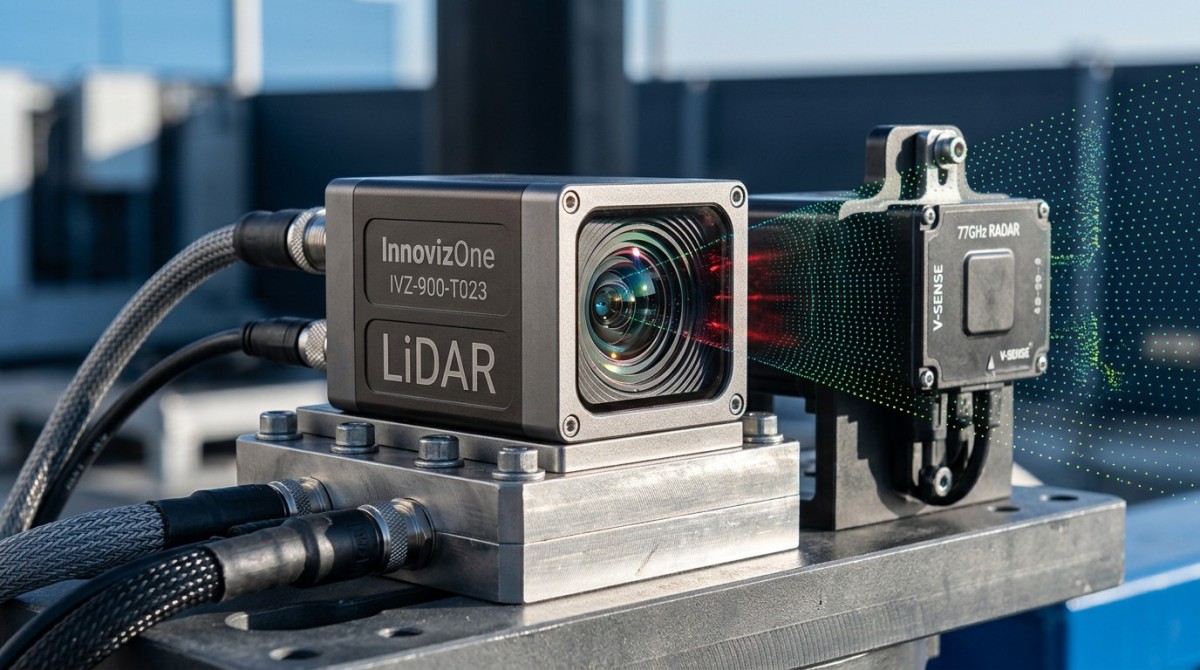
In many procurement decks and product pages, sunlight interference resistance is reduced to a simple claim: “works in bright outdoor conditions.” That phrase is not enough for engineering teams. Real LiDAR performance under sun exposure depends on at least 4 interacting variables: wavelength susceptibility, receiver filtering, optical design, and thermal stability over time. If any one of these is isolated from the others, the test result becomes less useful for field decisions.
A common mistake is testing a sensor under static illumination but not under dynamic angle changes. In actual deployment, a UAV, AMR, roadside unit, or industrial vehicle rarely faces the sun at one fixed orientation for 30 minutes. It operates through changing azimuth, pitch, surface reflectance, and target distance. A lab result collected at one angle of incidence may say very little about performance during a 2–4 hour outdoor shift.
Another weakness is treating sunlight interference as only a detection issue. In practice, engineering teams should evaluate 3 layers together: detection continuity, point cloud integrity, and downstream perception stability. A LiDAR can still “see” an object but generate sparse or noisy returns, which then degrades obstacle classification, localization, or mapping. For operators, that difference matters more than a marketing statement about anti-sun capability.
This is exactly where TSV’s engineering-first position matters. Instead of repeating generic supplier language, buyers need benchmark logic that asks the harder questions: At what lux range was the test run? What target reflectivity was used? Was the reported performance tied to full field of view, partial field of view, or only the center zone? Was the sensor thermally stabilized before measurement, and for how long?
What a realistic sunlight test should include
A credible evaluation method should simulate field complexity instead of single-variable convenience. This matters for information researchers comparing whitepapers, operators validating deployment risk, procurement teams screening vendors, and executives approving sensor platform choices for 12–36 month roadmaps.
- Multiple illumination conditions, such as overcast daylight, direct noon sunlight, and low-angle sunrise or sunset, because low-angle glare often stresses the receiver differently than overhead light.
- At least 3 target reflectivity bands, for example dark matte surfaces, mid-tone industrial materials, and high-reflectance panels, since sunlight interference interacts with object reflectance and not just ambient brightness.
- Thermal soak and continuous runtime checks, such as a 30–60 minute preconditioning window followed by repeated measurements, because receiver behavior can drift as the housing and internal optics heat up.
- Full-angle measurement across the advertised field of view rather than center-only reporting, especially for applications that rely on edge coverage for navigation or safety.
Which parameters matter more than a simple anti-sunlight claim?
When teams compare sensors, the conversation should move beyond whether a LiDAR “resists sunlight” and toward which measurable outputs remain stable under sunlight stress. In most B2B projects, 5 core indicators are more decision-relevant than one broad claim: detection stability, false return behavior, point cloud density retention, field-of-view consistency, and thermal repeatability across operating cycles.
Detection stability asks a basic but essential question: does the sensor keep reporting the target across repeated scans under bright conditions, or does it intermittently drop returns? For mobile robots and UAV payloads, intermittent loss over even a few scan cycles can create downstream risk. In edge AI pipelines, instability often causes worse operational outcomes than a modest reduction in maximum range.
Point cloud density retention is equally important. A solid state lidar point cloud density figure quoted in ideal lighting may collapse under direct glare, especially near the periphery of the field. If a supplier only presents total point count without stating the test angle, scene geometry, or target reflectivity, a buyer still does not know whether the sensor is suitable for pallet detection, curb recognition, or corridor mapping.
Field-of-view behavior should also be read carefully. A lidar field of view comparison is not only about nominal horizontal and vertical degrees. It is about usable field of view under environmental stress. Some systems maintain strong center performance but degrade at the edges in high illumination, which can be unacceptable for wide-angle perception on autonomous platforms.
Parameter interpretation table for engineering and procurement teams
The table below summarizes which sunlight-related indicators deserve closer review during technical benchmarking, pilot planning, or vendor comparison. It is designed as a practical screening tool rather than a generic glossary.
For procurement teams, this table helps convert vague claims into technical questions. For R&D teams, it clarifies whether the supplier’s data supports a validation plan. For decision-makers, it reduces the chance of approving a sensor based on one headline metric while hidden performance losses remain untested.
Three practical thresholds to review during evaluation
Not every project needs the same acceptance level, but most teams should define threshold windows before the pilot starts. A useful structure is to classify requirements into 3 tiers: minimum acceptable operation, preferred engineering margin, and mission-critical margin. That avoids disputes later between operations, engineering, and purchasing.
- Minimum acceptable operation: the sensor continues target reporting with tolerable sparsity and no unsafe blind spots during the intended duty cycle.
- Preferred engineering margin: the point cloud remains sufficiently dense for perception tasks after moderate sunlight variation and normal temperature rise.
- Mission-critical margin: the sensor maintains stable output across wide incidence angles, reflective targets, and continuous outdoor operation where failure cost is high.
LiDAR vs mmWave radar: where sunlight matters, and where it does not
A growing number of buyers compare LiDAR with radar after disappointing outdoor trials. That comparison is useful, but only if done correctly. Sunlight interference directly affects optical sensing in ways that do not map one-to-one onto radar behavior. mmWave radar angular resolution has its own constraints, but ambient visible light is not usually the primary limiting factor in the same way it is for LiDAR.
This means radar is not a universal replacement. It means sensor roles must be aligned with physics. LiDAR usually provides richer spatial geometry and finer scene structure, especially where solid state lidar point cloud density is high enough to support classification or mapping. Radar, on the other hand, often offers stronger environmental robustness in glare, dust, fog, or precipitation, but may provide coarser shape detail depending on configuration and processing.
In procurement practice, the question should not be “which is better?” but “which sensing stack handles the failure modes of the mission?” For low-speed industrial navigation, a LiDAR-only architecture may be workable if sunlight exposure is controlled. For outdoor robotics, perimeter monitoring, or UAV operations, a layered design with optical and radar redundancy may reduce risk over a 6–18 month deployment horizon.
TSV’s benchmarking philosophy is especially relevant here because supplier comparisons often blur categories. Some vendors promote radar resilience as if it guarantees optical-level spatial detail. Others promote LiDAR resolution as if it remains unchanged in full sunlight. Neither shortcut helps a buyer building a reliable specification sheet.
Comparison table for sensor planning in outdoor deployments
The following comparison table is intended for mixed-sensor decision-making in robotics, edge AI, industrial vehicles, and aerial systems. It focuses on operational trade-offs rather than vendor slogans.
The practical takeaway is simple. If the mission requires precise geometry, LiDAR remains highly valuable. If the mission must tolerate difficult outdoor conditions over long duty cycles, radar often adds resilience. The strongest engineering choice is frequently not substitution, but disciplined sensor fusion backed by realistic test design.
Where lidar field of view comparison changes the buying decision
Two LiDAR units with similar advertised range can behave very differently if one preserves edge performance under bright sunlight and the other does not. That is why a lidar field of view comparison should separate nominal coverage from effective coverage. In warehouse yards, road shoulders, and UAV side-looking configurations, edge-zone reliability can determine whether the entire platform is safe to deploy.
For buyers, this means test plans should map coverage into at least 3 zones: center, mid-angle, and edge. If the vendor only reports a single averaged outcome, hidden weak zones may remain invisible until field failures appear. That discovery is expensive because it often emerges after integration work, not before purchase approval.
How to build a procurement-grade sunlight test and selection workflow
A procurement-grade process should connect engineering validation with commercial screening. Too often, companies do one of two things: they buy on brochure claims, or they run a pilot with no acceptance framework. Both approaches waste time. A better method uses 4 stages: requirement definition, controlled comparison, field pilot, and supplier clarification. This can shorten the qualification loop and reduce redesign risk.
Stage one is requirement definition. Teams should document target range bands, mounting position, operating temperature window, likely sun angles, and acceptable degradation limits. Even a simple 1-page specification sheet helps. It forces alignment between operators who know the real environment and procurement teams who need objective screening criteria.
Stage two is controlled comparison. Here, buyers test 2–4 candidate sensors under repeatable conditions before any full pilot begins. The purpose is not to replicate every outdoor variable, but to remove weak options early. If a unit already loses point cloud integrity or shows unstable target continuity in basic bright-light tests, it is unlikely to improve after system integration.
Stage three is field validation. This should cover representative duty cycles such as 1 shift, 1 route block, or several repeat missions, depending on the application. Stage four is supplier clarification. At this point, the buyer should request missing details on optical filtering, firmware behavior, usable field of view, thermal control, and any recommended mounting constraints. That is where many hidden risks finally surface.
A practical checklist for buyers and engineering leads
The checklist below helps turn sunlight resistance from a vague topic into a sourcing framework that supports both technical and commercial decisions.
- Define 3 usage conditions: controlled daylight, direct sun exposure, and low-angle glare conditions relevant to the deployment site.
- Request raw and processed output examples so the team can distinguish true sensing performance from aggressive post-filtering.
- Compare solid state lidar point cloud density across center and edge zones of the field of view, not just total advertised points.
- Ask whether thermal preconditioning was used and whether repeated runs were performed after 30–60 minutes of operation.
- If the application is mission-critical, evaluate complementary sensing such as mmWave radar angular resolution requirements for redundancy planning.
Common selection mistakes that inflate project risk
Several mistakes appear repeatedly in B2B sensor procurement. The first is accepting a single sunlight statement with no test context. The second is focusing on maximum range when the actual application is sensitive to density, continuity, or edge coverage. The third is ignoring operator feedback about mounting angle, contamination, and real-world path geometry. The fourth is separating engineering review from commercial negotiations until it is too late.
These errors are expensive because they delay qualification by weeks or months. In some programs, the cost is not the sensor itself but the integration cycle, software tuning, and re-validation effort. That is why TSV emphasizes engineering truth through data: better questions early usually cost less than corrections later.
FAQ and next-step guidance for teams evaluating outdoor sensors
For search-driven readers and project teams under time pressure, the questions below summarize the most actionable issues. They are especially relevant for researchers comparing options, operators preparing trials, buyers validating claims, and decision-makers approving budgets.
How should sunlight interference resistance be verified before purchase?
Use a 3-step review: check the vendor’s published test context, run a controlled comparison with at least 2–4 candidate units, and validate in the real operating environment. Do not rely on one lux value or one indoor simulation. Ask for angle conditions, target reflectivity assumptions, thermal state, and whether performance was measured across the full advertised field of view.
Is high point cloud density enough to prove good outdoor LiDAR performance?
No. High solid state lidar point cloud density in a controlled setting does not guarantee useful output in direct sunlight. Teams should examine density retention, not only density headline figures. If dense output collapses at edge angles or after thermal buildup, the sensor may still underperform in real deployment even though the brochure numbers look strong.
When should mmWave radar be added to a LiDAR-based system?
Add radar when the application faces recurring visual stress, such as glare, fog, dust, or long outdoor duty cycles where single-sensor failure is unacceptable. The decision should depend on hazard tolerance, geometry needs, and environmental variability. Radar does not replace LiDAR in every task, but it often improves resilience when LiDAR sunlight interference resistance alone is not sufficient for the mission profile.
What does a buyer need from a supplier besides a datasheet?
At minimum, ask for application notes, test conditions, usable field-of-view evidence, recommended mounting guidance, thermal operating considerations, and integration constraints. For serious projects, request support on parameter confirmation, sample evaluation, delivery expectations, and any compliance or environmental requirements that affect deployment planning.
Why work with TSV when evaluating LiDAR claims and supplier data
TechStat Vanguard is built for teams that need engineering clarity, not promotional noise. Our value is not generic commentary. It is structured benchmarking logic for hard-tech procurement and validation. When sunlight interference resistance, lidar field of view comparison, solid state lidar point cloud density, and mmWave radar angular resolution all shape the same sourcing decision, fragmented marketing material is not enough.
We help engineering teams and procurement leaders translate sensor claims into verifiable evaluation frameworks. That includes parameter review, test-plan structuring, comparison criteria, and supplier-question design. For organizations trying to reduce trial-and-error cost, shorten qualification cycles, and build stronger spec sheets, this approach is more useful than broad “best product” language.
If your team is screening outdoor sensing options, you can contact TSV to discuss concrete issues such as sunlight test methodology, field-of-view interpretation, point cloud stability review, sensor fusion decision logic, delivery planning, sample evaluation scope, and supplier comparison criteria. These are the details that move a project forward.
If you need support on parameter confirmation, product selection, pilot planning, compliance context, or quotation-stage technical review, reach out with your application scenario, target environment, and current shortlist. TSV can help turn scattered claims into a decision-ready engineering brief that procurement, operations, and leadership can all use.
Search News
Hot Articles
- Carbon Fiber StructuresHow to Specify Aerospace Carbon Fiber Assemblies for Lightweight, Load-Bearing PartsJul 11, 2026
- Machine VisionXiaomi, Alibaba DAMO Academy Drive Open-Source Robotics Model Ecosystem, Lowering Algorithm Development Barriers for Overseas SMEs Adopting Chinese Robotics SolutionsMar 30, 2026
- Cobots & ArmsShanxi 'AI+' Conference Showcases Embodied Intelligence with Multinational Buyer Engagement: Key Industry ImplicationsMar 30, 2026
Popular Tags
Recommended News
 Jul 11, 2026How to Specify Aerospace Carbon Fiber Assemblies for Lightweight, Load-Bearing PartsAerospace carbon fiber assemblies: learn how to specify laminate design, load data, joining methods, and inspection controls for lighter, reliable load-bearing aerospace parts.Elena Rostova (UAV Systems Researcher)
 Mar 30, 2026Xiaomi, Alibaba DAMO Academy Drive Open-Source Robotics Model Ecosystem, Lowering Algorithm Development Barriers for Overseas SMEs Adopting Chinese Robotics SolutionsXiaomi & Alibaba DAMO Academy's open-source robotics models lower algorithm barriers for global SMEs. Boost efficiency in manufacturing, logistics & smart retail with ROS 2 compatible solutions.TSV Data Lab
 Mar 30, 2026Shanxi 'AI+' Conference Showcases Embodied Intelligence with Multinational Buyer Engagement: Key Industry ImplicationsShanxi 'AI+' Conference highlights embodied intelligence with Tesla, Ubtech & Jiantao showcasing multimodal robotics. 40+ global buyers validated tech on-site, creating new B2B channels for industrial automation & AI solutions.Chen Wei (Automation Lead Engineer)
 Mar 30, 2026Zhongguancun Unveils 6G Integrated Sensing-Computing-Intelligence Platform to Empower Embodied Robots for Global Industrial ApplicationsZhongguancun's new 6G platform revolutionizes industrial robotics with <10ms latency, empowering global automotive, logistics & port automation. Discover how this tech boosts China's smart manufacturing exports.TSV Data Lab
 Mar 30, 2026Mech-Mind Tianjin Embodied Intelligence R&D and Production Base Goes Live, Cutting Delivery Time by 20%–30% for Global Customized AMR+Vision SolutionsMech-Mind's Tianjin AMR+Vision production base cuts delivery time by 20%-30% for欧美 & Latin American markets. Discover how this PLd-certified facility accelerates customized robotics solutions for smart manufacturing and logistics.Chen Wei (Automation Lead Engineer)
 Mar 30, 2026Boao Forum Reveals 'Co-evolution of Big and Small Brains' Trend in Humanoid Robots, China's Embodied Intelligence Accelerates Adaptation to Overseas Manufacturing Service ScenariosDiscover how China's humanoid robots, featuring 'Co-evolution of Big and Small Brains,' are revolutionizing global manufacturing. Learn about Embodied Tian Gong 3.0's ISO compliance and overseas deployment at Boao Forum 2026.Chen Wei (Automation Lead Engineer)
 Mar 30, 2026China Railway Industrial Secures Patent for Embodied Robotics in Material Handling, Boosting High-Precision Delivery Capabilities for Overseas Infrastructure and Manufacturing ProjectsChina Railway Industrial's new patent for embodied robotics in material handling boosts high-precision delivery for global infrastructure & manufacturing. Discover how this innovation enhances logistics accuracy in automotive, rail transit & EPC projects.Chen Wei (Automation Lead Engineer)
 Oct 21, 2026China’s Industrial Robot Exports Near RMB 10 Billion in First Nine Months of 2026China’s industrial robot exports neared RMB 10 billion in January–September 2026, with value rising faster than volume. Explore the data and what it could mean for suppliers.Chen Wei (Automation Lead Engineer)
 Oct 21, 2026Low-Latency Industrial Data Processing: Pricing and Key Cost DriversExplore industrial data latency price drivers, from edge hardware to integration and support. Learn how to compare quotes, verify performance, and avoid unnecessary costs.TSV Data Lab
 Oct 20, 2026KUKA Launches iiQKA.AI Vision to Simplify Industrial Image ProcessingKUKA iiQKA.AI Vision simplifies industrial image processing with controller-based 2D and 3D vision. Explore drag-and-drop setup for vision-guided automation.TSV Data Lab
 Oct 20, 2026Smart Industrial Edge Devices: Key Criteria for Legacy PLC IntegrationChoose smart industrial edge devices for legacy PLC integration. Discover key criteria for compatibility, data quality, security, and reliable collection without disrupting control.TSV Data Lab
 Oct 19, 2026Choosing a Radar Sensor by Application: Range, Resolution, and Field of ViewSimplify radar sensor application based product selection. Compare range, resolution, and field of view to avoid blind spots and choose with confidence. Explore the guide.TSV Data Lab
 Oct 18, 2026Comparing Material Options for Procurement: Specs, Costs, and Supply RisksExplore procurement oriented technical content on material options, specs, costs, and supply risks. Compare alternatives to cut hidden expenses and make confident sourcing decisions.Dr. Marcus Vance
 Oct 17, 20265-Axis CNC Positioning Accuracy: How to Interpret ISO 230-2 Test ResultsAssess 5 axis CNC machining positioning accuracy with ISO 230-2. Learn to interpret repeatability, reversal error, and test conditions to compare suppliers and make confident acceptance decisions.Dr. Marcus Vance
 Oct 16, 2026Choosing a Rugged Edge AI Box Supplier: Thermal Tests and Lifecycle SupportChoose a rugged edge AI box supplier with proven thermal performance and reliable lifecycle support. Discover the tests and commitments to verify before you buy.TSV Data Lab
 Oct 15, 2026R&D Cost Reduction Services: How to Evaluate Fees, Savings, and ROIEvaluate R&D cost reduction services with confidence. Compare fees, verify savings, and calculate ROI without compromising performance. Discover how to choose a provider that delivers real value.Chen Wei (Automation Lead Engineer)
 Oct 21, 2026How Should You Balance Cobot Payload Against Reach?Explore cobot payload versus reach to choose the right robot. Learn how tooling, load limits, workspace, and cycle time affect performance—and avoid costly selection mistakes.Chen Wei (Automation Lead Engineer)
 Oct 20, 2026How Do You Measure Industrial IoT Gateway Latency Under Load?Measure industrial IoT gateway latency under load with reliable timestamps, realistic traffic, and tail-latency analysis. Discover how to expose bottlenecks and choose the right gateway.TSV Data Lab
 Oct 19, 2026How Do You Verify That Precision Machined Parts Meet Tolerances?Master precision machining tolerance verification with the right tools, datum setups, and acceptance rules. Learn how to validate parts confidently and reduce costly inspection errors.Dr. Marcus Vance
 Oct 18, 2026What Should an AS9100 Machining Supplier Checklist Include?Build an AS9100 machining supplier checklist that verifies capability, traceability, inspection, and outsourced processes. Discover what to check before approving your next aerospace supplier.Dr. Marcus Vance
 Oct 17, 2026How Should You Interpret Industrial Robot Repeatability Specs?Decode industrial robot repeatability specifications, understand ISO 9283 test conditions, and avoid costly selection mistakes. Learn how to verify performance for your process.Chen Wei (Automation Lead Engineer)
 Oct 16, 2026How Can You Fairly Compare MTBF Across Industrial Servo Motors?Make a fair industrial servo motor MTBF comparison with matched operating profiles, failure criteria, and confidence bounds. Discover how to assess reliability beyond advertised numbers.Chen Wei (Automation Lead Engineer)
 Oct 15, 2026How Should You Compare TechStat Vanguard 5-Axis CNC Tolerances?TechStat Vanguard 5-axis CNC tolerance comparison: learn how to verify part accuracy, assess inspection evidence, and choose suppliers that reliably meet your drawing requirements.Dr. Marcus Vance
 Oct 14, 2026Drone Frame Composites: Carbon Fiber vs. Fiberglass for Weight and StiffnessExplore drone structural materials composites: compare carbon fiber and fiberglass for weight, stiffness, cost, and antenna compatibility. Find the right material for your drone frame.Elena Rostova (UAV Systems Researcher)