LiDAR Payload Weight Limit: The Spec Sheet Trap on Small UAVs
Publication Date
author
A small UAV may list an impressive payload, but LiDAR payload weight limit is rarely just a number on a spec sheet. For teams comparing drone payload capacity vs flight time, uav center of gravity calculation, and carbon fiber frame vibration dampening, the real risk lies in hidden trade-offs that affect stability, accuracy, and mission reliability. This article breaks down what procurement teams, operators, and engineers must verify before trusting published payload claims.
In commercial mapping, corridor inspection, site surveying, and industrial asset monitoring, a payload figure shown as 1.5 kg, 2 kg, or even 3 kg can create false confidence. A LiDAR unit is never just a mass value. It is a moving load with dimensions, power draw, thermal output, mounting constraints, and vibration sensitivity. Once batteries, wiring, dampers, GNSS modules, onboard storage, and gimbal or fixed-mount hardware are included, the real integration burden can rise by 15% to 40% above the headline sensor weight.
For procurement leaders and UAV operators, the key question is not whether a drone can lift a LiDAR payload for a short demonstration. The practical question is whether it can do so for repeatable 20- to 35-minute missions, under crosswinds, at safe motor loading, while preserving point cloud quality and legal operating margin. That distinction determines whether a platform delivers usable engineering data or recurring field failure.
Why Published Payload Numbers Often Mislead LiDAR Buyers
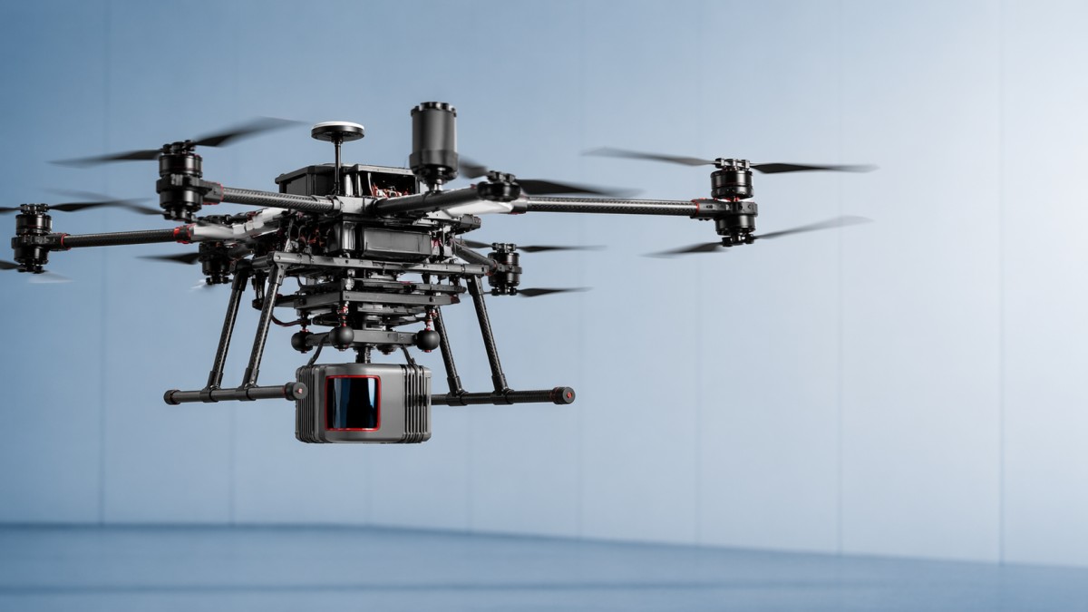
Many small UAV spec sheets present payload as a single maximum value measured under ideal conditions: low altitude, fresh batteries, minimal wind, and short hover time. That number can be technically accurate and still commercially misleading. A drone that can briefly lift 2.0 kg may not be suitable for a 1.6 kg LiDAR mapping package once endurance, control reserve, and vibration isolation are considered together.
LiDAR payload weight limit should be interpreted as an operational envelope, not a static threshold. In most field deployments, engineering teams need to leave margin for at least 4 variables: battery aging, wind load, thermal derating, and maneuver authority. A practical rule used by many integrators is to keep routine mission payload at roughly 70% to 85% of the aircraft’s realistic, tested lift capacity rather than the absolute advertised maximum.
The problem becomes more severe on small UAVs because every additional 100 g affects more than lift. It changes current draw, rotor response, brake distance in autonomous flight, and the accuracy of uav center of gravity calculation. A LiDAR platform that looks acceptable on paper can start oscillating, drifting in waypoint transitions, or reducing overlap quality on real corridors once those dynamics accumulate.
For TSV-style engineering review, the payload claim must always be broken into component-level reality. Decision-makers should ask whether the payload figure includes only net payload, whether battery is counted separately, and whether mounting hardware, shock absorbers, and auxiliary positioning modules are excluded. Those details often determine the difference between a successful procurement and a costly integration cycle.
What the spec sheet usually does not tell you
- Whether maximum payload was tested in hover only or in forward flight over a full mission profile.
- Whether endurance was measured at sea level or at higher density altitude where thrust margin drops noticeably.
- Whether the published figure assumes a centered payload or ignores offset mounting that changes pitch and roll stability.
- Whether point cloud quality was validated under vibration, not just flight survivability.
Headline payload vs usable LiDAR payload
The table below shows why drone payload capacity vs flight time must be reviewed as a trade-off rather than a marketing headline. The values are typical engineering ranges for small commercial multirotor assessment, not brand-specific promises.
The core conclusion is simple: a small UAV should be bought on usable payload under mission conditions, not on theoretical lift. For procurement teams comparing multiple platforms, the more reliable vendor is usually the one willing to provide loaded endurance curves, not the one with the highest single payload figure.
The Engineering Factors Behind a Real LiDAR Payload Weight Limit
A LiDAR mission system behaves as a combined mechanical and electrical package. Total mass matters, but location of that mass matters almost as much. On small UAVs, even a 20 mm to 40 mm shift away from the designed centerline can increase flight controller correction workload. That leads to more oscillation, higher power draw, and degraded point cloud consistency during acceleration and deceleration.
This is why uav center of gravity calculation should be treated as a pre-purchase issue rather than a workshop detail. Operators often assume a front-mounted LiDAR that keeps the field of view clear is acceptable by default. In reality, offset loading can create persistent pitch bias and motor asymmetry. Over a 25-minute route, that imbalance can reduce battery reserve enough to cut a planned corridor by 10% to 20%.
Frame behavior is another hidden variable. Carbon fiber frame vibration dampening is often marketed as a feature, but its real effectiveness depends on layup stiffness, arm resonance, motor-prop balancing, and isolator tuning. A frame that is extremely rigid may resist deformation well, yet still transmit high-frequency vibration into the LiDAR and IMU stack. Conversely, too much damping can produce low-frequency motion that affects trajectory estimation.
Power architecture also sets practical payload limit. A LiDAR package may draw 15 W, 25 W, or 40 W continuously, while onboard computing and GNSS add another 10 W to 30 W. On compact aircraft, that additional electrical load increases thermal stress inside the fuselage and can reduce battery efficiency. The result is that a platform with enough thrust may still fail endurance targets because it lacks power-system margin.
Four variables engineers must validate
- Mass distribution: confirm fore-aft and lateral balance after final mounting, not just after sensor attachment.
- Vibration transmission: review whether vibration spectra were checked at motor RPM bands relevant to cruise and climb.
- Power and heat: verify total payload draw, battery reserve target, and heat dissipation at ambient temperatures such as 25°C to 40°C.
- Aerodynamic drag: check whether payload shape, exposed wiring, or brackets reduce forward efficiency in mapping runs.
Typical integration mass expansion
A sensor advertised at 900 g may become a 1.15 kg to 1.35 kg airborne package after mounting. The expansion often comes from small items that procurement files overlook: 80 g to 150 g of brackets, 50 g to 120 g of damping hardware, 60 g to 200 g of auxiliary GNSS or timing modules, and power-conditioning or wiring additions. That is why experienced buyers request a complete airborne bill of mass, not just a sensor datasheet.
When the complete payload package exceeds expectations by 200 g to 400 g, the project risk is not limited to reduced flight time. It can trigger redesign of landing gear clearance, force propeller changes, or require stronger arms and larger batteries. Those changes increase lead time and can cascade into recertification of operating procedures.
How to Evaluate Drone Payload Capacity vs Flight Time Without Guesswork
For field teams, endurance is the commercial metric that turns payload theory into project cost. A LiDAR mission that drops from 32 minutes to 19 minutes can multiply takeoff cycles, battery swaps, and crew downtime. On linear infrastructure work such as roads, pipelines, or transmission lines, a loss of 10 minutes can materially reduce daily coverage and increase mobilization cost per kilometer.
The right way to assess drone payload capacity vs flight time is to request a loaded endurance matrix. This should show flight time at several payload bands, for example 0.5 kg, 1.0 kg, 1.5 kg, and 2.0 kg, under at least two conditions: hover and mapping cruise. A single unloaded endurance claim is insufficient for any serious procurement decision involving LiDAR.
Battery reserve policy matters just as much as the endurance figure itself. Conservative operators often land with 20% to 30% reserve to protect pack life and account for return-to-home requirements. If a supplier quotes 26 minutes to zero, the usable mission time may only be 18 to 21 minutes. Buyers should compare aircraft on usable route time after reserve, not maximum time before forced landing.
Environmental derating must also be priced into planning. High temperature, altitude, and wind can all reduce mission duration. At moderate density altitude or in 6 m/s to 8 m/s crosswinds, the same LiDAR setup can lose several minutes of endurance. In small-UAV economics, those minutes are often the difference between one-pass completion and a second sortie.
A practical endurance review table
The table below can be used as a procurement checklist when suppliers present payload and flight-time claims for LiDAR-equipped multirotors.
A disciplined review like this exposes weak offers quickly. If a vendor cannot provide loaded endurance data or declines to state reserve assumptions, the risk usually moves downstream to the buyer in the form of rework, operational limitations, or reduced mission output.
Procurement Criteria: What Buyers Should Request Before Approving a Small UAV LiDAR Platform
A procurement package for LiDAR-equipped small UAVs should be built around engineering evidence rather than brochure claims. For most organizations, the approval file should include at least 6 checkpoints: airborne system mass, center-of-gravity map, loaded endurance, vibration test summary, power budget, and mission envelope limits. These documents reduce ambiguity between vendor sales language and actual operating capability.
This is especially important when procurement teams are not the final users. A platform that appears cost-effective in unit price may create higher lifecycle cost if it requires more batteries, more site sorties, or additional data cleaning because vibration degrades the point cloud. For enterprise decision-makers, the better purchase is often the aircraft with a lower published payload but higher documented mission consistency.
Contract language should also define test conditions. Buyers should avoid generic clauses such as “supports LiDAR payloads up to X kg” without specifying ambient temperature, wind condition, mission type, and required flight reserve. A measurable acceptance standard protects both sides and shortens supplier qualification cycles.
At a minimum, procurement review should distinguish between survey-grade expectations and basic situational awareness. If the project requires dense, stable point clouds for engineering design, then vibration control, timing synchronization, and mounting repeatability become commercial requirements, not optional technical refinements.
Recommended buyer checklist
- Request a complete airborne mass breakdown in grams, including mounts, cables, antennas, and power modules.
- Ask for uav center of gravity calculation results for the exact LiDAR configuration being quoted.
- Require loaded endurance data with stated reserve policy and battery cycle condition.
- Confirm whether carbon fiber frame vibration dampening was validated with sensor data or only described qualitatively.
- Define acceptance criteria such as minimum 20-minute usable route time and stable operation in 5 m/s wind.
Commercial red flags
Buyers should be cautious when payload claims are presented without mission context, when endurance is quoted only with no sensor load, or when the vendor cannot identify whether the LiDAR integration has been flown as a complete package. Another warning sign is reliance on generic phrases such as “supports multiple sensors” with no mention of electrical power budget, mounting interface, or vibration testing method.
A credible supplier typically responds with specific thresholds, such as recommended payload range, maximum tested wind speed, or typical time loss per additional 100 g. That level of detail aligns with disciplined engineering procurement and reduces trial-and-error cost after delivery.
Common Integration Mistakes and How Operators Can Prevent Them
Operators often encounter LiDAR performance problems that are blamed on the sensor, while the root cause is aircraft integration. One frequent mistake is treating payload mounting as a mechanical attachment task instead of a systems engineering task. If mounting stiffness, isolation tuning, and cable routing are not considered together, the aircraft may fly safely while still producing degraded data.
Another mistake is using a payload combination that fits within nominal mass limits but exceeds practical moment limits. A compact drone may carry a 1.2 kg package directly beneath the center frame with acceptable behavior, yet perform poorly with the same 1.2 kg mounted forward to clear the LiDAR field of view. The mass did not change, but the dynamic effect did.
Field teams should also avoid assuming carbon fiber frame vibration dampening solves all quality issues. Propeller imbalance, motor bearing wear, loose fasteners, and cable slap can all inject noise into the sensor path. These are maintenance variables, not just design variables. Even a well-selected UAV can lose data quality after 50 to 100 flight hours if inspection routines are weak.
Operational discipline matters. Before every project, crews should verify payload fastening torque, connector security, battery health, and calibration status. For recurring industrial work, a short 5- to 10-minute validation flight before the main mission can prevent a full day of unusable point cloud collection.
Field prevention steps
- Weigh the complete airborne payload before deployment and compare it with approved configuration records.
- Check center-of-gravity balance after any bracket, battery, or sensor replacement.
- Inspect vibration-sensitive components every 25 to 50 flight hours, depending on mission intensity.
- Track actual route time in logbooks to identify endurance drift caused by battery aging or mounting changes.
FAQ for buyers and operators
How much safety margin should be kept below the published payload? For many small UAV LiDAR applications, keeping routine payload within roughly 70% to 85% of proven operational capacity is a practical starting point, especially if flights involve wind, heat, or repeated autonomous turns.
Is a lighter LiDAR always the better choice? Not necessarily. A lighter unit may still require extra GNSS hardware, more complex mounting, or higher computing load. Total airborne package mass and integration behavior matter more than sensor core weight alone.
What is the most overlooked procurement document? In many cases, it is the loaded endurance matrix tied to a clear reserve policy. Without it, teams cannot realistically estimate coverage, battery demand, or sortie count.
When should a larger UAV be considered? If the target configuration consistently drives mission time below about 20 minutes, requires tight balancing workarounds, or leaves little control reserve in routine 5-8 m/s wind, moving up one aircraft class is often more economical than forcing a small platform to operate at its edge.
For teams that evaluate UAV and aerospace systems through measurable engineering criteria, the lesson is clear: LiDAR payload weight limit is not a brochure line item but a system-level boundary shaped by mass, balance, vibration, power, and endurance. The platforms that perform best in real projects are rarely those with the most aggressive headline payload. They are the ones with documented loaded flight behavior, stable center-of-gravity management, and repeatable point cloud quality under practical field conditions.
TechStat Vanguard advocates this data-first approach because it shortens qualification cycles and reduces expensive field trial-and-error. If your team is comparing small UAV platforms, validating LiDAR integration risk, or drafting procurement specifications for mapping and inspection work, now is the right time to move beyond marketing language and request evidence that reflects actual mission performance. Contact us to discuss a tailored evaluation framework, request a structured procurement checklist, or explore more hard-tech benchmarking solutions.
Search News
Hot Articles
- Carbon Fiber StructuresHow to Specify Aerospace Carbon Fiber Assemblies for Lightweight, Load-Bearing PartsJul 11, 2026
- Machine VisionXiaomi, Alibaba DAMO Academy Drive Open-Source Robotics Model Ecosystem, Lowering Algorithm Development Barriers for Overseas SMEs Adopting Chinese Robotics SolutionsMar 30, 2026
- Cobots & ArmsShanxi 'AI+' Conference Showcases Embodied Intelligence with Multinational Buyer Engagement: Key Industry ImplicationsMar 30, 2026
Popular Tags
Recommended News
 Jul 11, 2026How to Specify Aerospace Carbon Fiber Assemblies for Lightweight, Load-Bearing PartsAerospace carbon fiber assemblies: learn how to specify laminate design, load data, joining methods, and inspection controls for lighter, reliable load-bearing aerospace parts.Elena Rostova (UAV Systems Researcher)
 Mar 30, 2026Xiaomi, Alibaba DAMO Academy Drive Open-Source Robotics Model Ecosystem, Lowering Algorithm Development Barriers for Overseas SMEs Adopting Chinese Robotics SolutionsXiaomi & Alibaba DAMO Academy's open-source robotics models lower algorithm barriers for global SMEs. Boost efficiency in manufacturing, logistics & smart retail with ROS 2 compatible solutions.TSV Data Lab
 Mar 30, 2026Shanxi 'AI+' Conference Showcases Embodied Intelligence with Multinational Buyer Engagement: Key Industry ImplicationsShanxi 'AI+' Conference highlights embodied intelligence with Tesla, Ubtech & Jiantao showcasing multimodal robotics. 40+ global buyers validated tech on-site, creating new B2B channels for industrial automation & AI solutions.Chen Wei (Automation Lead Engineer)
 Mar 30, 2026Zhongguancun Unveils 6G Integrated Sensing-Computing-Intelligence Platform to Empower Embodied Robots for Global Industrial ApplicationsZhongguancun's new 6G platform revolutionizes industrial robotics with <10ms latency, empowering global automotive, logistics & port automation. Discover how this tech boosts China's smart manufacturing exports.TSV Data Lab
 Mar 30, 2026Mech-Mind Tianjin Embodied Intelligence R&D and Production Base Goes Live, Cutting Delivery Time by 20%–30% for Global Customized AMR+Vision SolutionsMech-Mind's Tianjin AMR+Vision production base cuts delivery time by 20%-30% for欧美 & Latin American markets. Discover how this PLd-certified facility accelerates customized robotics solutions for smart manufacturing and logistics.Chen Wei (Automation Lead Engineer)
 Mar 30, 2026Boao Forum Reveals 'Co-evolution of Big and Small Brains' Trend in Humanoid Robots, China's Embodied Intelligence Accelerates Adaptation to Overseas Manufacturing Service ScenariosDiscover how China's humanoid robots, featuring 'Co-evolution of Big and Small Brains,' are revolutionizing global manufacturing. Learn about Embodied Tian Gong 3.0's ISO compliance and overseas deployment at Boao Forum 2026.Chen Wei (Automation Lead Engineer)
 Mar 30, 2026China Railway Industrial Secures Patent for Embodied Robotics in Material Handling, Boosting High-Precision Delivery Capabilities for Overseas Infrastructure and Manufacturing ProjectsChina Railway Industrial's new patent for embodied robotics in material handling boosts high-precision delivery for global infrastructure & manufacturing. Discover how this innovation enhances logistics accuracy in automotive, rail transit & EPC projects.Chen Wei (Automation Lead Engineer)
 Oct 22, 2026KUKA Showcases Physical AI and iiQKA.AI Vision at NVIDIA GTC BerlinExplore KUKA’s Physical AI showcase at NVIDIA GTC Berlin and discover how iiQKA.AI Vision aims to simplify robotic vision integration and improve 2D and 3D scene recognition.TSV Data Lab
 Oct 22, 2026Robotic Machining of Advanced Composites: What Tolerances Are Achievable?Explore advanced materials machining robotics: discover what drives achievable composite tolerances and how to validate accuracy before investing in your next machining system.Dr. Marcus Vance
 Oct 21, 2026China’s Industrial Robot Exports Near RMB 10 Billion in First Nine Months of 2026China’s industrial robot exports neared RMB 10 billion in January–September 2026, with value rising faster than volume. Explore the data and what it could mean for suppliers.Chen Wei (Automation Lead Engineer)
 Oct 21, 2026Low-Latency Industrial Data Processing: Pricing and Key Cost DriversExplore industrial data latency price drivers, from edge hardware to integration and support. Learn how to compare quotes, verify performance, and avoid unnecessary costs.TSV Data Lab
 Oct 20, 2026KUKA Launches iiQKA.AI Vision to Simplify Industrial Image ProcessingKUKA iiQKA.AI Vision simplifies industrial image processing with controller-based 2D and 3D vision. Explore drag-and-drop setup for vision-guided automation.TSV Data Lab
 Oct 20, 2026Smart Industrial Edge Devices: Key Criteria for Legacy PLC IntegrationChoose smart industrial edge devices for legacy PLC integration. Discover key criteria for compatibility, data quality, security, and reliable collection without disrupting control.TSV Data Lab
 Oct 19, 2026Choosing a Radar Sensor by Application: Range, Resolution, and Field of ViewSimplify radar sensor application based product selection. Compare range, resolution, and field of view to avoid blind spots and choose with confidence. Explore the guide.TSV Data Lab
 Oct 18, 2026Comparing Material Options for Procurement: Specs, Costs, and Supply RisksExplore procurement oriented technical content on material options, specs, costs, and supply risks. Compare alternatives to cut hidden expenses and make confident sourcing decisions.Dr. Marcus Vance
 Oct 17, 20265-Axis CNC Positioning Accuracy: How to Interpret ISO 230-2 Test ResultsAssess 5 axis CNC machining positioning accuracy with ISO 230-2. Learn to interpret repeatability, reversal error, and test conditions to compare suppliers and make confident acceptance decisions.Dr. Marcus Vance
 Oct 16, 2026Choosing a Rugged Edge AI Box Supplier: Thermal Tests and Lifecycle SupportChoose a rugged edge AI box supplier with proven thermal performance and reliable lifecycle support. Discover the tests and commitments to verify before you buy.TSV Data Lab
 Oct 15, 2026R&D Cost Reduction Services: How to Evaluate Fees, Savings, and ROIEvaluate R&D cost reduction services with confidence. Compare fees, verify savings, and calculate ROI without compromising performance. Discover how to choose a provider that delivers real value.Chen Wei (Automation Lead Engineer)
 Oct 22, 2026How Do You Test AMR Navigation Accuracy in a Warehouse?Test AMR navigation accuracy in warehouses with practical methods for localization, path tracking, and docking. Learn to set tolerances and compare robots before deployment.Chen Wei (Automation Lead Engineer)
 Oct 21, 2026How Should You Balance Cobot Payload Against Reach?Explore cobot payload versus reach to choose the right robot. Learn how tooling, load limits, workspace, and cycle time affect performance—and avoid costly selection mistakes.Chen Wei (Automation Lead Engineer)
 Oct 20, 2026How Do You Measure Industrial IoT Gateway Latency Under Load?Measure industrial IoT gateway latency under load with reliable timestamps, realistic traffic, and tail-latency analysis. Discover how to expose bottlenecks and choose the right gateway.TSV Data Lab
 Oct 19, 2026How Do You Verify That Precision Machined Parts Meet Tolerances?Master precision machining tolerance verification with the right tools, datum setups, and acceptance rules. Learn how to validate parts confidently and reduce costly inspection errors.Dr. Marcus Vance
 Oct 18, 2026What Should an AS9100 Machining Supplier Checklist Include?Build an AS9100 machining supplier checklist that verifies capability, traceability, inspection, and outsourced processes. Discover what to check before approving your next aerospace supplier.Dr. Marcus Vance
 Oct 17, 2026How Should You Interpret Industrial Robot Repeatability Specs?Decode industrial robot repeatability specifications, understand ISO 9283 test conditions, and avoid costly selection mistakes. Learn how to verify performance for your process.Chen Wei (Automation Lead Engineer)