How LiDAR Payload Weight Changes More Than Just Flight Time
Publication Date
author
LiDAR payload weight affects far more than drone payload capacity versus flight time. In practice, added sensor mass changes center of gravity, vibration behavior, propeller efficiency, controller workload, and data integrity. For teams evaluating a mapping drone for mining, corridor inspection, surveying, or a heavy lift UAV for construction, the key question is not simply “Can it fly?” but “Can it fly stably, safely, and deliver reliable point cloud quality under real mission conditions?” That is where payload weight becomes a procurement, operations, and risk-management issue—not just an endurance metric.
Why LiDAR payload weight changes the whole UAV system, not just endurance
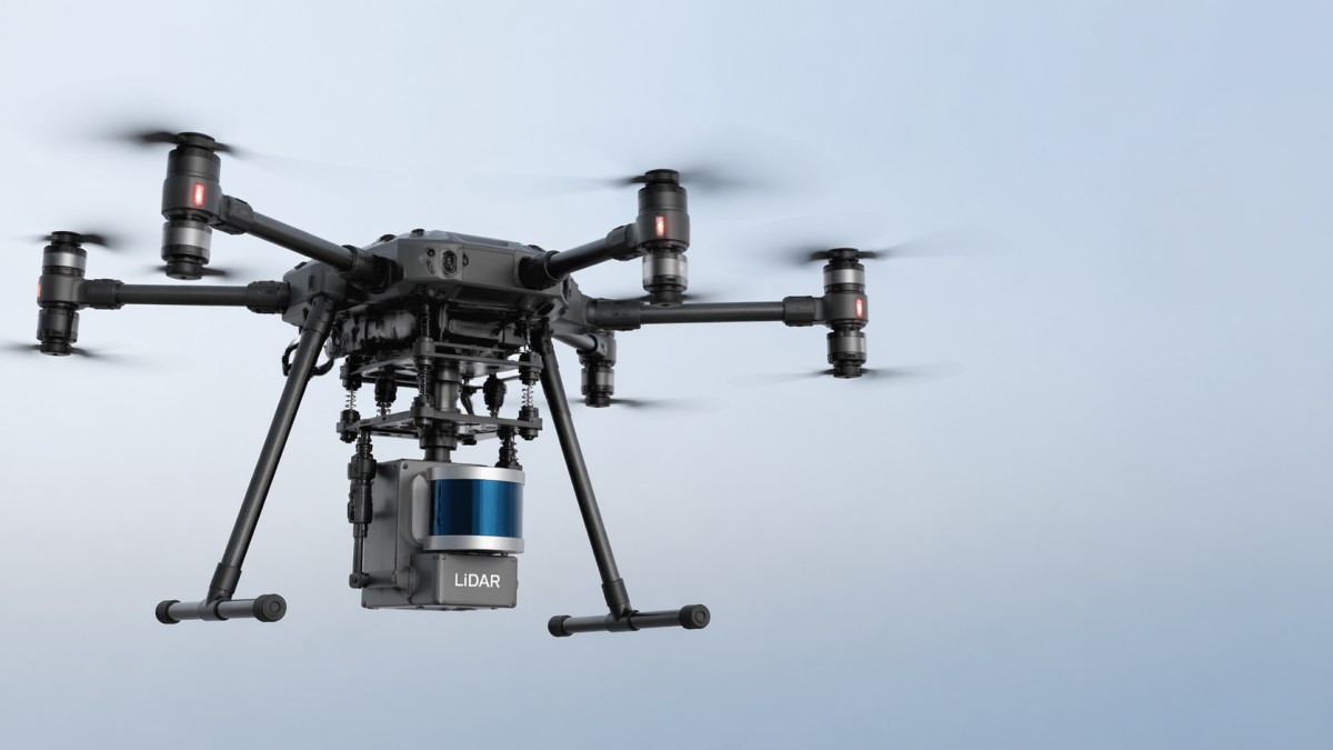
Many buyers and operators begin with a simple assumption: heavier LiDAR means shorter flight time. That is true, but incomplete. A UAV does not experience payload weight as an isolated number. It experiences it as a systems-level change that affects thrust demand, dynamic balance, power draw, thermal load, maneuverability, and sensor stability.
When LiDAR payload weight increases, the aircraft usually needs higher sustained thrust just to maintain hover. That means motors run at a higher percentage of available output, leaving less control margin for wind correction, route changes, or emergency recovery. In field operations, this reduced reserve matters more than brochure-level endurance figures.
Heavier payloads also alter the UAV center of gravity calculation. Even a technically “within-limit” payload can degrade flight behavior if its mass sits too far forward, too low, or too high relative to the airframe’s designed balance point. The result may include slower pitch response, more aggressive controller corrections, and unstable heading during scan passes. For LiDAR missions, that directly affects trajectory smoothness and therefore data consistency.
In short, payload weight changes:
- effective flight time under mission load, not empty-airframe test conditions
- available thrust margin in wind or at altitude
- center of gravity and rotational inertia
- vibration transfer into the sensor and mount
- battery discharge rate and thermal stress
- flight controller compensation workload and latency sensitivity
- risk exposure during takeoff, landing, and contingency maneuvers
That is why the real LiDAR payload weight limit should be judged as an operational threshold, not merely a published maximum payload number.
What buyers, operators, and technical evaluators should actually check
For most target readers—researchers, operators, procurement teams, and decision-makers—the practical issue is not understanding payload in theory. It is knowing how to evaluate whether a drone-LiDAR combination will perform reliably in a specific use case.
The most useful evaluation questions are these:
1. Is the published payload capacity measured for takeoff, or for mission-grade stability?
Some UAVs can lift a certain weight briefly, but that does not mean they can perform a 25-minute mapping mission with stable velocity, controlled vibration, and safe battery reserve. Ask whether the payload figure reflects:
- maximum lift capability
- recommended continuous mission payload
- payload at sea level only or also at operational altitude
- payload under no-wind test conditions versus realistic environments
2. How does the payload affect point cloud quality?
Heavier systems often require stronger mounts, larger batteries, or different gimbal arrangements. These changes can introduce micro-vibration, resonance, or slight trajectory instability. The result may be reduced point cloud sharpness, lower edge definition, strip misalignment, or more correction work during post-processing.
For a mapping drone for mining industry applications, this matters because terrain models, stockpile calculations, slope monitoring, and haul-road analysis depend on repeatable positional accuracy. In construction, unstable payload integration can compromise progress verification and volumetric measurement reliability.
3. What happens to thrust efficiency and maneuver margin?
Drone propeller thrust efficiency drops in practical terms when aircraft weight rises close to system limits. The motors may still generate enough lift, but at reduced efficiency and with less responsiveness. This becomes especially important in:
- high-altitude mines
- hot weather environments
- crosswind survey corridors
- vertical takeoff from confined construction zones
Procurement teams should ask for performance curves, not just payload labels. A drone operating at 80–85% throttle during routine flight has a very different risk profile from one operating at 55–60%.
4. Does the payload create hidden integration issues?
LiDAR weight often comes with associated mass: dampers, brackets, cables, GNSS/INS modules, onboard storage, thermal shielding, or auxiliary power systems. The true flight payload may be significantly higher than the sensor core alone. This is where many under-scoped projects fail.
A realistic integration review should include:
- sensor body weight
- mounting hardware
- power converter or separate battery
- IMU/GNSS hardware
- protective housing
- cable routing and connector strain
How extra LiDAR weight affects stability, data quality, and control behavior
This is where payload decisions become technical rather than purely logistical. Heavier payloads influence the feedback loop between the airframe, propulsion system, and flight controller.
Center of gravity shifts
A poor center of gravity position forces the controller to make constant compensation adjustments. Even if the aircraft appears flyable, that persistent correction can create oscillation, uneven motor loading, and heading inconsistency. For strip-based LiDAR mapping, even small attitude instability can reduce data uniformity across passes.
Vibration and structural resonance
As payload mass increases, natural frequencies of the mounting structure may shift. A frame that behaved well with a lighter camera may transmit more vibration with a heavier LiDAR package. This can influence scan clarity, IMU confidence, and trajectory smoothing results. The consequence is not always visible in flight, but it shows up later in registration quality and error correction workload.
Flight controller workload and latency sensitivity
Heavier payloads increase aircraft inertia. That means the UAV takes longer to respond to control inputs and disturbance corrections. In a benchmarking context, this can affect flight controller latency benchmark outcomes because the control system must process and compensate larger dynamic deviations. The latency issue is not only electronic; it is also mechanical and aerodynamic.
For operators, the practical meaning is simple: a heavier payload may make the aircraft feel less precise, especially during route transitions, hover corrections, and terrain-following tasks.
Electromagnetic and power-system side effects
Larger LiDAR systems may demand more power, require different cable layouts, or sit closer to other onboard electronics. This can influence drone electromagnetic interference test stability, especially in tightly integrated airframes where GNSS, telemetry, RTK, ESCs, and sensor lines compete for limited space. A payload upgrade can therefore create unexpected effects in navigation confidence or data synchronization.
This is one reason high-quality UAV platforms are evaluated as complete system architectures—not just as flying frames with interchangeable accessories.
How to estimate the real LiDAR payload weight limit for your mission
The most useful way to think about payload limit is not “What is the maximum the drone can lift?” but “What is the maximum weight the drone can carry while preserving safety margin, data quality, and operational efficiency in my environment?”
A practical decision framework includes the following five checks:
1. Start with all-up mission weight, not sensor brochure weight
Add the complete payload stack, including mount, cables, power accessories, and protective components. Then account for the battery configuration required to support that load.
2. Apply environmental derating
Payload performance should be reduced for:
- high altitude
- high temperature
- gusty wind
- frequent start-stop route profiles
- takeoff from uneven or dusty sites
For mining and infrastructure projects, these factors are often non-negotiable.
3. Preserve thrust reserve
A commercial survey drone should retain enough thrust margin for disturbance recovery and controlled landing with battery reserve. If the aircraft must work near its upper thrust range throughout the mission, the setup may be technically possible but operationally weak.
4. Validate center of gravity physically, not just on paper
CAD and mounting plans help, but field validation is essential. Measure actual balance, hover behavior, motor temperature distribution, and correction intensity during test flights.
5. Define acceptance criteria by output quality
The mission is successful only if the data is usable. Set thresholds for:
- point cloud density consistency
- strip alignment quality
- trajectory smoothness
- battery reserve at landing
- motor and ESC thermal conditions
- repeatability across multiple sorties
If one payload configuration produces longer processing time, more rejected passes, or more field rework, its nominal payload compatibility has little business value.
What this means for procurement: better buying decisions, lower risk, and stronger ROI
For procurement teams and enterprise decision-makers, payload analysis should influence platform selection, supplier qualification, and total cost of ownership. A cheaper drone that can “technically” carry a LiDAR unit may create higher downstream costs through shorter service life, more mission failures, inconsistent data, or greater operator workload.
When comparing vendors, ask for evidence in these areas:
- payload-specific flight time under real mission profiles
- center of gravity guidance and approved mounting geometry
- vibration isolation validation
- propulsion efficiency under payload load
- controller tuning for heavy payload configurations
- EMI compatibility and integration test records
- data quality results from similar industries and environments
For a heavy lift UAV for construction, the selection standard should include more than lift capacity. It should include how well the aircraft maintains stable flight near structures, in dust, in stop-and-go workflows, and during repeated daily sorties. For mining applications, altitude derating and route stability often matter more than top-line payload claims.
In many cases, the best procurement decision is not the platform with the highest payload rating, but the one with the most efficient performance envelope for your actual LiDAR package and mission profile.
Bottom line: payload weight is a data-quality and risk variable, not just a flight-time variable
LiDAR payload weight changes more than just endurance because UAV performance is a tightly coupled system. Added weight affects thrust reserve, balance, vibration, control responsiveness, EMI behavior, and ultimately mapping output quality. That means the real question is not whether a drone can lift a LiDAR unit, but whether it can do so with stable flight behavior, clean sensor performance, and enough margin to operate safely in real-world conditions.
For operators, this understanding helps prevent unstable missions and poor-quality datasets. For procurement teams, it reduces the risk of buying a platform that looks compatible on paper but underperforms in practice. For decision-makers, it supports better ROI by linking payload integration directly to mission success, fewer retakes, and more reliable surveying outcomes.
If you are evaluating LiDAR-ready UAV platforms, treat LiDAR payload weight as a full-system engineering parameter. That is the only reliable way to judge actual platform suitability, operational resilience, and long-term value.
Search News
Hot Articles
- Carbon Fiber StructuresHow to Specify Aerospace Carbon Fiber Assemblies for Lightweight, Load-Bearing PartsJul 11, 2026
- Machine VisionXiaomi, Alibaba DAMO Academy Drive Open-Source Robotics Model Ecosystem, Lowering Algorithm Development Barriers for Overseas SMEs Adopting Chinese Robotics SolutionsMar 30, 2026
- Cobots & ArmsShanxi 'AI+' Conference Showcases Embodied Intelligence with Multinational Buyer Engagement: Key Industry ImplicationsMar 30, 2026
Popular Tags
Recommended News
 Jul 11, 2026How to Specify Aerospace Carbon Fiber Assemblies for Lightweight, Load-Bearing PartsAerospace carbon fiber assemblies: learn how to specify laminate design, load data, joining methods, and inspection controls for lighter, reliable load-bearing aerospace parts.Elena Rostova (UAV Systems Researcher)
 Mar 30, 2026Xiaomi, Alibaba DAMO Academy Drive Open-Source Robotics Model Ecosystem, Lowering Algorithm Development Barriers for Overseas SMEs Adopting Chinese Robotics SolutionsXiaomi & Alibaba DAMO Academy's open-source robotics models lower algorithm barriers for global SMEs. Boost efficiency in manufacturing, logistics & smart retail with ROS 2 compatible solutions.TSV Data Lab
 Mar 30, 2026Shanxi 'AI+' Conference Showcases Embodied Intelligence with Multinational Buyer Engagement: Key Industry ImplicationsShanxi 'AI+' Conference highlights embodied intelligence with Tesla, Ubtech & Jiantao showcasing multimodal robotics. 40+ global buyers validated tech on-site, creating new B2B channels for industrial automation & AI solutions.Chen Wei (Automation Lead Engineer)
 Mar 30, 2026Zhongguancun Unveils 6G Integrated Sensing-Computing-Intelligence Platform to Empower Embodied Robots for Global Industrial ApplicationsZhongguancun's new 6G platform revolutionizes industrial robotics with <10ms latency, empowering global automotive, logistics & port automation. Discover how this tech boosts China's smart manufacturing exports.TSV Data Lab
 Mar 30, 2026Mech-Mind Tianjin Embodied Intelligence R&D and Production Base Goes Live, Cutting Delivery Time by 20%–30% for Global Customized AMR+Vision SolutionsMech-Mind's Tianjin AMR+Vision production base cuts delivery time by 20%-30% for欧美 & Latin American markets. Discover how this PLd-certified facility accelerates customized robotics solutions for smart manufacturing and logistics.Chen Wei (Automation Lead Engineer)
 Mar 30, 2026Boao Forum Reveals 'Co-evolution of Big and Small Brains' Trend in Humanoid Robots, China's Embodied Intelligence Accelerates Adaptation to Overseas Manufacturing Service ScenariosDiscover how China's humanoid robots, featuring 'Co-evolution of Big and Small Brains,' are revolutionizing global manufacturing. Learn about Embodied Tian Gong 3.0's ISO compliance and overseas deployment at Boao Forum 2026.Chen Wei (Automation Lead Engineer)
 Mar 30, 2026China Railway Industrial Secures Patent for Embodied Robotics in Material Handling, Boosting High-Precision Delivery Capabilities for Overseas Infrastructure and Manufacturing ProjectsChina Railway Industrial's new patent for embodied robotics in material handling boosts high-precision delivery for global infrastructure & manufacturing. Discover how this innovation enhances logistics accuracy in automotive, rail transit & EPC projects.Chen Wei (Automation Lead Engineer)
 Oct 22, 2026KUKA Showcases Physical AI and iiQKA.AI Vision at NVIDIA GTC BerlinExplore KUKA’s Physical AI showcase at NVIDIA GTC Berlin and discover how iiQKA.AI Vision aims to simplify robotic vision integration and improve 2D and 3D scene recognition.TSV Data Lab
 Oct 22, 2026Robotic Machining of Advanced Composites: What Tolerances Are Achievable?Explore advanced materials machining robotics: discover what drives achievable composite tolerances and how to validate accuracy before investing in your next machining system.Dr. Marcus Vance
 Oct 21, 2026China’s Industrial Robot Exports Near RMB 10 Billion in First Nine Months of 2026China’s industrial robot exports neared RMB 10 billion in January–September 2026, with value rising faster than volume. Explore the data and what it could mean for suppliers.Chen Wei (Automation Lead Engineer)
 Oct 21, 2026Low-Latency Industrial Data Processing: Pricing and Key Cost DriversExplore industrial data latency price drivers, from edge hardware to integration and support. Learn how to compare quotes, verify performance, and avoid unnecessary costs.TSV Data Lab
 Oct 20, 2026KUKA Launches iiQKA.AI Vision to Simplify Industrial Image ProcessingKUKA iiQKA.AI Vision simplifies industrial image processing with controller-based 2D and 3D vision. Explore drag-and-drop setup for vision-guided automation.TSV Data Lab
 Oct 20, 2026Smart Industrial Edge Devices: Key Criteria for Legacy PLC IntegrationChoose smart industrial edge devices for legacy PLC integration. Discover key criteria for compatibility, data quality, security, and reliable collection without disrupting control.TSV Data Lab
 Oct 19, 2026Choosing a Radar Sensor by Application: Range, Resolution, and Field of ViewSimplify radar sensor application based product selection. Compare range, resolution, and field of view to avoid blind spots and choose with confidence. Explore the guide.TSV Data Lab
 Oct 18, 2026Comparing Material Options for Procurement: Specs, Costs, and Supply RisksExplore procurement oriented technical content on material options, specs, costs, and supply risks. Compare alternatives to cut hidden expenses and make confident sourcing decisions.Dr. Marcus Vance
 Oct 17, 20265-Axis CNC Positioning Accuracy: How to Interpret ISO 230-2 Test ResultsAssess 5 axis CNC machining positioning accuracy with ISO 230-2. Learn to interpret repeatability, reversal error, and test conditions to compare suppliers and make confident acceptance decisions.Dr. Marcus Vance
 Oct 16, 2026Choosing a Rugged Edge AI Box Supplier: Thermal Tests and Lifecycle SupportChoose a rugged edge AI box supplier with proven thermal performance and reliable lifecycle support. Discover the tests and commitments to verify before you buy.TSV Data Lab
 Oct 15, 2026R&D Cost Reduction Services: How to Evaluate Fees, Savings, and ROIEvaluate R&D cost reduction services with confidence. Compare fees, verify savings, and calculate ROI without compromising performance. Discover how to choose a provider that delivers real value.Chen Wei (Automation Lead Engineer)
 Oct 22, 2026How Do You Test AMR Navigation Accuracy in a Warehouse?Test AMR navigation accuracy in warehouses with practical methods for localization, path tracking, and docking. Learn to set tolerances and compare robots before deployment.Chen Wei (Automation Lead Engineer)
 Oct 21, 2026How Should You Balance Cobot Payload Against Reach?Explore cobot payload versus reach to choose the right robot. Learn how tooling, load limits, workspace, and cycle time affect performance—and avoid costly selection mistakes.Chen Wei (Automation Lead Engineer)
 Oct 20, 2026How Do You Measure Industrial IoT Gateway Latency Under Load?Measure industrial IoT gateway latency under load with reliable timestamps, realistic traffic, and tail-latency analysis. Discover how to expose bottlenecks and choose the right gateway.TSV Data Lab
 Oct 19, 2026How Do You Verify That Precision Machined Parts Meet Tolerances?Master precision machining tolerance verification with the right tools, datum setups, and acceptance rules. Learn how to validate parts confidently and reduce costly inspection errors.Dr. Marcus Vance
 Oct 18, 2026What Should an AS9100 Machining Supplier Checklist Include?Build an AS9100 machining supplier checklist that verifies capability, traceability, inspection, and outsourced processes. Discover what to check before approving your next aerospace supplier.Dr. Marcus Vance
 Oct 17, 2026How Should You Interpret Industrial Robot Repeatability Specs?Decode industrial robot repeatability specifications, understand ISO 9283 test conditions, and avoid costly selection mistakes. Learn how to verify performance for your process.Chen Wei (Automation Lead Engineer)