Is solid-state LiDAR for robotics navigation ready for scale
Publication Date
author
As autonomous systems move from pilot projects to fleet deployment, the question is no longer whether sensing matters, but whether solid-state LiDAR for robotics navigation can deliver scalable performance, stable supply, and engineering-grade reliability. For technical evaluation, the real issue is not branding. It is point cloud density, interference resistance, latency, durability, and cost consistency in real environments.
What does solid-state LiDAR for robotics navigation actually mean?
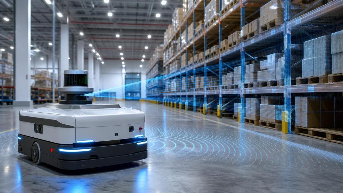
Solid-state LiDAR for robotics navigation refers to LiDAR architectures with few or no large rotating mechanical parts. The goal is improved durability, compactness, and manufacturability.
In robotics, this matters because navigation sensors face vibration, dust, temperature cycling, and continuous duty. Mechanical complexity often becomes a lifecycle risk before theoretical range does.
However, “solid-state” is not one single technology. It may include MEMS scanning, flash LiDAR, or optical phased approaches. Each behaves differently in robotics navigation.
That difference affects field of view, angular resolution, refresh rate, power draw, and interference behavior. Scaling decisions should start with architecture, not only datasheet headline range.
Why the term is often misunderstood
Many discussions reduce solid-state LiDAR for robotics navigation to a cost story. Cost matters, but deployment success usually depends first on data quality and stability.
A lower-cost sensor with unstable point clouds can increase mapping drift, false obstacle detection, and braking events. That cost then returns as downtime and software compensation effort.
TSV’s engineering view is simple: parameters do not lie. A navigation sensor must be judged by measurable output under repeatable operational stress.
Is solid-state LiDAR for robotics navigation technically ready for scale today?
The short answer is yes, but not universally. Solid-state LiDAR for robotics navigation is ready for scale in selected robotics classes, operating envelopes, and price bands.
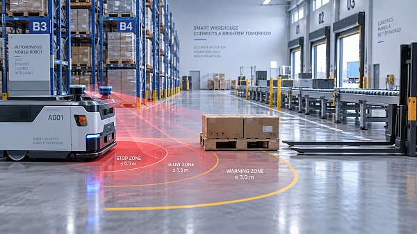
Indoor AMRs, warehouse vehicles, campus robots, and structured industrial routes are the most mature use cases. Environmental variability is lower, and perception requirements are easier to validate.
Readiness becomes less certain in heavy rain, reflective metal corridors, outdoor logistics yards, mixed pedestrian traffic, and high-speed edge cases.
Scale readiness depends on five engineering conditions:
- Consistent point cloud output across temperature and vibration ranges
- Reliable obstacle detection on dark, reflective, and irregular surfaces
- Stable latency for localization and path planning loops
- Low cross-talk risk in dense multi-robot deployments
- Supply continuity with revision control and calibration traceability
When these conditions are met, solid-state LiDAR for robotics navigation can move beyond pilots and support fleet economics with fewer maintenance variables.
Where scaling still fails
Some deployments fail because teams validate only ideal routes. They do not test dirty lenses, lighting transitions, partial occlusion, or sensor aging.
Others fail because software stacks are tuned to one vendor’s point cloud signature. Hardware substitution then creates revalidation delays and mapping instability.
Which performance metrics matter most when evaluating solid-state LiDAR for robotics navigation?
The most useful metrics are not always the most advertised ones. Maximum detection range alone says little about navigation quality in dense industrial space.
Focus on measurable navigation outcomes linked to raw sensor behavior:
- Angular resolution: influences edge definition and localization fidelity
- Point cloud density: affects object contour recognition and map richness
- Frame rate and latency: shape control response and stopping confidence
- Range precision: impacts docking, aisle centering, and clearance handling
- Field of view: determines blind zones and placement flexibility
- Interference resistance: critical in multi-robot and multi-sensor settings
- Ingress and thermal tolerance: define long-term uptime
For solid-state LiDAR for robotics navigation, the best benchmark is not a brochure chart. It is repeatable route performance after exposure to operational stress.
A practical benchmark matrix
How does solid-state LiDAR for robotics navigation compare with cameras, ultrasonic, and mechanical LiDAR?
No single sensor wins every condition. Solid-state LiDAR for robotics navigation often performs best as a core ranging layer, not as the only perception channel.
Compared with cameras, LiDAR provides direct distance measurement. This reduces dependence on texture, ambient lighting, and depth inference models.
Compared with ultrasonic sensors, LiDAR offers richer spatial detail and better mapping utility. Ultrasonic still helps at very short distances and for redundancy.
Compared with mechanical spinning LiDAR, solid-state LiDAR for robotics navigation usually offers better compactness, lower maintenance risk, and stronger suitability for volume deployment.
Mechanical LiDAR can still provide wider coverage or familiar software compatibility. Yet the trade-off may include larger form factor and higher moving-part exposure.
Quick comparison table
What are the biggest risks and misconceptions before scaling solid-state LiDAR for robotics navigation?
The first misconception is that all solid-state products behave similarly. In reality, beam steering methods and signal processing choices create major application differences.
The second misconception is that lab accuracy equals operational reliability. Warehouses, hospitals, campuses, and outdoor corridors all introduce reflective and dynamic clutter.
The third misconception is that sensor cost dominates system cost. Integration time, driver maturity, calibration workflow, and safety validation often outweigh unit price.
For solid-state LiDAR for robotics navigation, common scale risks include:
- Firmware changes that alter point cloud behavior
- Insufficient contamination testing for lenses and covers
- Poor synchronization with SLAM and control loops
- Vendor lock-in around proprietary processing stacks
- Underestimating electromagnetic and optical interference sources
How to reduce those risks
Build acceptance criteria around route completion rate, false stop frequency, localization drift, and maintenance intervals. Then map those outcomes back to sensor-level parameters.
This approach aligns with TSV’s data-first principle. It replaces generic “high performance” language with engineering evidence relevant to deployment economics.
How should implementation teams decide whether solid-state LiDAR for robotics navigation is the right next step?
Start with route geometry, speed profile, obstacle type, and environmental volatility. A sensor decision made without mission definition usually creates expensive iteration later.
Then test solid-state LiDAR for robotics navigation in phased conditions:
- Controlled path validation with reference objects
- Long-duration runs with heat, dust, and lighting variation
- Multi-robot interference and traffic stress tests
- Change-control review for firmware and hardware revisions
- Fallback planning with secondary sensing redundancy
If the sensor passes those stages with stable output, scale becomes an engineering decision rather than a leap of faith.
FAQ summary table
So, is solid-state LiDAR for robotics navigation ready for scale? In many robotics programs, yes. But readiness depends on measurable consistency, not category hype.
The strongest next step is to build a benchmark sheet covering point cloud density, latency, interference resistance, contamination tolerance, and revision traceability.
At TSV, the rule remains unchanged: engineering truth begins with verified parameters. If scaling is the goal, test solid-state LiDAR for robotics navigation where failure is most likely, not where demos look best.
Search News
Hot Articles
- Carbon Fiber StructuresHow to Specify Aerospace Carbon Fiber Assemblies for Lightweight, Load-Bearing PartsJul 11, 2026
- Machine VisionXiaomi, Alibaba DAMO Academy Drive Open-Source Robotics Model Ecosystem, Lowering Algorithm Development Barriers for Overseas SMEs Adopting Chinese Robotics SolutionsMar 30, 2026
- Cobots & ArmsShanxi 'AI+' Conference Showcases Embodied Intelligence with Multinational Buyer Engagement: Key Industry ImplicationsMar 30, 2026
Popular Tags
Recommended News
 Jul 11, 2026How to Specify Aerospace Carbon Fiber Assemblies for Lightweight, Load-Bearing PartsAerospace carbon fiber assemblies: learn how to specify laminate design, load data, joining methods, and inspection controls for lighter, reliable load-bearing aerospace parts.Elena Rostova (UAV Systems Researcher)
 Mar 30, 2026Xiaomi, Alibaba DAMO Academy Drive Open-Source Robotics Model Ecosystem, Lowering Algorithm Development Barriers for Overseas SMEs Adopting Chinese Robotics SolutionsXiaomi & Alibaba DAMO Academy's open-source robotics models lower algorithm barriers for global SMEs. Boost efficiency in manufacturing, logistics & smart retail with ROS 2 compatible solutions.TSV Data Lab
 Mar 30, 2026Shanxi 'AI+' Conference Showcases Embodied Intelligence with Multinational Buyer Engagement: Key Industry ImplicationsShanxi 'AI+' Conference highlights embodied intelligence with Tesla, Ubtech & Jiantao showcasing multimodal robotics. 40+ global buyers validated tech on-site, creating new B2B channels for industrial automation & AI solutions.Chen Wei (Automation Lead Engineer)
 Mar 30, 2026Zhongguancun Unveils 6G Integrated Sensing-Computing-Intelligence Platform to Empower Embodied Robots for Global Industrial ApplicationsZhongguancun's new 6G platform revolutionizes industrial robotics with <10ms latency, empowering global automotive, logistics & port automation. Discover how this tech boosts China's smart manufacturing exports.TSV Data Lab
 Mar 30, 2026Mech-Mind Tianjin Embodied Intelligence R&D and Production Base Goes Live, Cutting Delivery Time by 20%–30% for Global Customized AMR+Vision SolutionsMech-Mind's Tianjin AMR+Vision production base cuts delivery time by 20%-30% for欧美 & Latin American markets. Discover how this PLd-certified facility accelerates customized robotics solutions for smart manufacturing and logistics.Chen Wei (Automation Lead Engineer)
 Mar 30, 2026Boao Forum Reveals 'Co-evolution of Big and Small Brains' Trend in Humanoid Robots, China's Embodied Intelligence Accelerates Adaptation to Overseas Manufacturing Service ScenariosDiscover how China's humanoid robots, featuring 'Co-evolution of Big and Small Brains,' are revolutionizing global manufacturing. Learn about Embodied Tian Gong 3.0's ISO compliance and overseas deployment at Boao Forum 2026.Chen Wei (Automation Lead Engineer)
 Mar 30, 2026China Railway Industrial Secures Patent for Embodied Robotics in Material Handling, Boosting High-Precision Delivery Capabilities for Overseas Infrastructure and Manufacturing ProjectsChina Railway Industrial's new patent for embodied robotics in material handling boosts high-precision delivery for global infrastructure & manufacturing. Discover how this innovation enhances logistics accuracy in automotive, rail transit & EPC projects.Chen Wei (Automation Lead Engineer)
 Oct 06, 2026Navigation Fault Tolerance Standards for AMRs: What Safety Teams Must VerifyNavigation fault tolerance standards: learn what AMR safety teams must verify, from localization loss and sensor faults to stopping distance, safe restart, and site-specific validation.Chen Wei (Automation Lead Engineer)
 Oct 05, 2026Calculating Edge Computing Total Cost of Ownership Across Distributed SitesEdge computing ownership cost explained: calculate deployment, energy, connectivity, security, remote support, and refresh costs across distributed sites.TSV Data Lab
 Oct 04, 2026CAD/CAM Benchmarking in the GCC: What Manufacturers Should Ask a ConsultantCAD CAM benchmark consultant GCC guide: learn the key questions manufacturers should ask to validate post-processors, workflows, machine performance, and production risk.Victor Lin (Chief Software Architect)
 Oct 03, 2026Selecting Automotive Radar Sensor Modules for ADAS Range, Resolution, and IntegrationAutomotive radar sensor module selection guide for ADAS: compare range, resolution, field of view, latency, and integration to build safer, reliable vehicle systems.TSV Data Lab
 Oct 02, 2026How to Qualify Machined Parts Suppliers for Hard Tech ProgramsHard tech supply chain machined parts demand rigorous supplier qualification. Learn how to assess capability, traceability, quality controls, and delivery resilience.Dr. Marcus Vance
 Oct 01, 2026How to Select an Outdoor Security Radar Sensor for Perimeter Detection?Outdoor security radar sensor selection guide: compare range, accuracy, false-alarm control, integration, and field testing for reliable perimeter detection.TSV Data Lab
 Sep 30, 2026How to Evaluate Solid-State LiDAR Hardware for Outdoor Autonomous VehiclesSolid state LiDAR hardware evaluation guide for outdoor autonomous vehicles—compare range, point-cloud quality, environmental resilience, integration, and safety.TSV Data Lab
 Sep 29, 2026ISO 9283 Repeatability: How to Evaluate Cobot Positioning PerformanceISO 9283 cobot repeatability explained: learn how payload, reach, approach direction, and test conditions affect positioning performance and cell capability.Chen Wei (Automation Lead Engineer)
 Oct 06, 2026Are Collaborative Robots Safe Enough to Operate Without Fencing?Are collaborative robots safe enough to work without fencing? Explore risk assessment, safeguarding options, and practical guidance for safer, productive cobot cells.Chen Wei (Automation Lead Engineer)
 Oct 05, 2026What Causes Machine Vision Systems to Miss Small Defects?What causes machine vision systems to miss small defects? Discover how lighting, optics, motion, and AI thresholds affect detection—and prevent costly escapes.TSV Data Lab
 Oct 04, 2026How Should You Compare 5-Axis CNC Machine Accuracy Claims?How do I compare 5-axis CNC machine accuracy claims? Learn how to assess standards, thermal stability, TCP accuracy, and real-world test evidence.Dr. Marcus Vance
 Oct 03, 2026Is Edge Computing Necessary for Real-Time Quality Inspection?Is industrial edge computing necessary for real-time quality inspection? Explore how latency, data volume, reliability, and control integration shape the right architecture.TSV Data Lab
 Oct 02, 2026What Documents Prove a Precision Machining Supplier Can Hold Tolerance?What documents prove a precision machining supplier can hold tolerance? Explore certificates, FAI reports, calibration, SPC, and traceability evidence to qualify suppliers with confidence.Dr. Marcus Vance
 Oct 01, 2026Can a Machining Supplier Meet Aerospace Fatigue Testing Requirements?Can a machining supplier meet aerospace fatigue testing requirements? Learn the traceability, process control, and test evidence needed for reliable aerospace parts.Dr. Marcus Vance
 Sep 30, 2026Which Industrial Robot Specifications Matter for High-Precision Assembly?Which industrial robot specifications matter most for high-precision assembly? Explore repeatability, accuracy, stiffness, vibration, calibration, and force control for reliable yields.Chen Wei (Automation Lead Engineer)
 Sep 29, 2026How Do You Verify Servo Motor Torque Under Continuous Load?How do I verify servo motor torque under continuous load? Learn RMS torque checks, torque-speed limits, thermal derating, and real-machine testing.Chen Wei (Automation Lead Engineer)
 Oct 02, 2026ZD330 Software Configuration: Verifying Cut-List Import Before PurchaseZD330 software and machine configuration: verify cut-list imports, data mapping, labels, and workflow before purchase to reduce errors and choose with confidence.Victor Lin (Chief Software Architect)