Custom Drone for Power Line Inspection in Mountain Terrain
Publication Date
author
For project managers overseeing grid assets in steep, inaccessible regions, selecting a custom drone for power line inspection is no longer a matter of convenience but of operational accuracy, safety, and lifecycle cost control. This article examines the engineering realities behind mountain-terrain UAV deployment, from flight stability and payload design to data reliability and mission efficiency, helping decision-makers cut through marketing claims and evaluate what truly performs in the field.
In mountain grids, inspection conditions are rarely forgiving. Elevation changes of 500–2,000 meters, gust fronts moving through narrow valleys, unstable GNSS reception near rock faces, and long feeder distances can quickly expose the limits of standard off-the-shelf aircraft. For engineering-led procurement teams, the real question is not whether a UAV can fly, but whether a custom drone for power line inspection can deliver repeatable data, safe standoff control, and predictable operating cost across a 3–5 year deployment cycle.
This is where a data-first evaluation matters. At TechStat Vanguard, the focus is not on broad claims such as “high performance,” but on measurable thresholds: hover stability in crosswinds, flight time under payload, image resolution at inspection distance, obstacle-sensing latency, battery turnaround time, and maintenance intervals. For project managers responsible for uptime, contractor coordination, and capital allocation, those parameters directly affect outage risk, crew exposure, and total inspection throughput.
Why Mountain Terrain Changes the Inspection Equation
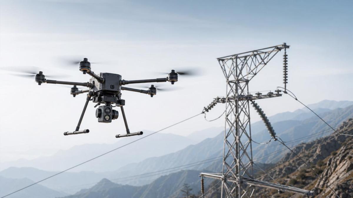
A mountain inspection mission is fundamentally different from a flatland patrol. Power lines often span deep ravines, slope angles may exceed 25–35 degrees, and access roads can add 2–4 hours to a manual inspection day. In such conditions, UAV selection becomes a systems engineering decision rather than a simple equipment purchase.
Environmental Loads Are the First Filter
Wind is usually the first constraint. In open ridges and saddle zones, sustained wind can reach 8–12 m/s, with gusts exceeding 15 m/s during seasonal shifts. A custom drone for power line inspection intended for mountain deployment should be evaluated not just on maximum wind resistance claims, but on controllability while carrying its actual sensor payload. A 1.2 kg optical-thermal package changes flight dynamics far more than a no-load brochure specification suggests.
Temperature and air density also matter. At higher altitude, thinner air reduces thrust margin and can shorten endurance by 10%–25%, depending on propeller design, battery chemistry, and takeoff weight. Procurement teams should ask for flight-time data at representative altitudes, such as 1,500 meters and 2,500 meters above sea level, rather than relying on sea-level endurance figures.
Inspection Quality Depends on Standoff Precision
Transmission and distribution assets in mountain corridors often leave little margin for pilot error. A useful platform must maintain stable offset from conductors, towers, insulators, and shield wires while compensating for terrain-following changes. For many operators, a practical target is lateral hover stability within ±0.3–0.8 meters and reliable positioning updates fast enough to avoid oscillation around structures.
Inspection output also depends on sensor geometry. If corona damage, cracked insulator caps, or connector overheating must be detected at 8–20 meters of standoff, the drone must support adequate optical zoom, thermal sensitivity, and vibration isolation. A custom drone for power line inspection is therefore a payload platform first and an airframe second.
Typical field constraints project managers should map before procurement
- Span length ranges, commonly 150–600 meters in mountainous transmission routes
- Average mission altitude and seasonal temperature windows
- Required defect classes: visual, thermal, corona, vegetation encroachment, or structure deformation
- Expected daily coverage target, such as 20–60 towers or 10–25 km per team
- Crew logistics, including battery charging access and emergency landing zones
The table below outlines how mountain-specific variables change technical requirements for a custom drone for power line inspection. This is a useful starting point when drafting a specification sheet or preparing a tender package.
The key conclusion is straightforward: mountain terrain multiplies technical risk. A platform that is adequate for basic patrol work on flat corridors may fail once payload, altitude, and wind are combined. That is why customized configuration, not generic platform branding, should anchor procurement decisions.
Core Engineering Criteria for a Custom Inspection Drone
When evaluating a custom drone for power line inspection, project managers should break the system into five engineering blocks: airframe, propulsion, sensors, navigation and control, and field serviceability. Weakness in any one block can compromise the full inspection chain.
1. Airframe and Propulsion Matching
For mountain work, multirotor platforms remain common because of their hover precision and close-structure maneuverability. However, not all multirotors perform equally once real payload is mounted. A useful benchmark range for takeoff weight is often 6–18 kg, depending on sensor suite and endurance target. Below that range, payload flexibility may be limited; above it, field logistics and regulatory burden usually increase.
Propeller diameter, motor torque, and battery configuration should be reviewed as a set. Teams should ask whether the system can maintain stable hover for at least 25–40 minutes under loaded conditions, not just ideal no-wind figures. For grid operators covering long mountain segments, an extra 8–10 minutes of effective endurance may translate into 15%–25% higher daily productivity.
2. Payload Design Drives Inspection Value
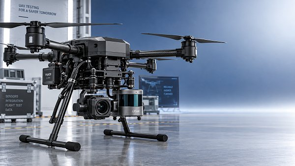
The payload package determines whether the mission yields actionable maintenance data or just attractive imagery. Typical inspection sets include a high-resolution visible camera, a radiometric thermal imager, and in some cases LiDAR for corridor modeling or conductor clearance analysis. Not every mission needs all three, but every configuration should match the defect library the utility actually tracks.
Common payload priorities by use case
- Visual detail inspection: insulators, clamps, spacers, corrosion, missing pins
- Thermal inspection: hot joints, overloaded connectors, phase imbalance indicators
- Vegetation and clearance assessment: terrain model, growth monitoring, right-of-way planning
- Post-storm assessment: rapid line tracing and damaged structure identification within 2–6 hours of dispatch
For thermal work, sensitivity and calibration repeatability matter more than general “AI enhancement” language. For visual inspection, zoom clarity at usable distance matters more than headline megapixel count. A custom drone for power line inspection should support stable gimbal performance, synchronized metadata, and enough onboard or linked storage to handle a full field day without creating transfer bottlenecks.
3. Navigation, Obstacle Avoidance, and EMI Resilience
Power line environments are operationally complex. Metallic structures, terrain shadowing, and electromagnetic interference can degrade navigation confidence. For close-up tasks, the control stack should combine GNSS, inertial sensing, visual positioning, and obstacle awareness rather than depending on a single localization source. Decision-makers should ask how the aircraft behaves during partial signal loss and whether it can transition smoothly to a safe manual or assisted mode.
Obstacle sensing should also be evaluated in context. Detecting a tower face is easier than reliably identifying thin conductors against bright sky or cluttered forest background. That is why field validation in representative corridors is more valuable than lab-only demonstrations.
4. Data Chain Integrity and Asset Management Integration
Inspection value is lost if data cannot move cleanly into maintenance workflows. A project manager should confirm file naming logic, GPS and timestamp integrity, thermal metadata completeness, and export compatibility with GIS, asset management, or digital twin environments. In practical terms, the best platform is one that reduces manual sorting and secondary interpretation steps by 20%–40%.
The following comparison table helps teams distinguish between baseline and mission-ready system capabilities when sourcing a custom drone for power line inspection.
These ranges are not universal pass-fail values, but they create a more disciplined comparison framework. They help separate an aircraft that can complete a demonstration mission from one that can support contracted, repeatable inspection operations across changing terrain and seasons.
Procurement, Deployment, and Lifecycle Cost Control
For project leaders, technical fit is only one side of the decision. The other is operational economics. The best custom drone for power line inspection is the one that balances mission capability with crew training demand, spare-part availability, support response time, and battery fleet planning.
Build a 4-Part Procurement Checklist
- Mission profile definition: line voltage class, terrain severity, defect categories, and expected monthly flight hours
- Configuration verification: payload mass, actual endurance, communication range, and environmental limits
- Support model: spare lead time, maintenance training, software updates, and fault diagnosis process
- Data integration scope: file outputs, API or export compatibility, and reporting workflow alignment
A practical sourcing cycle often takes 3–6 weeks for requirement alignment and technical clarification, followed by 1–3 field validation sessions. Skipping those validation steps may shorten procurement on paper, but it usually shifts cost into rework, retraining, and underutilized hardware later.
Do Not Underestimate Serviceability
Mountain operations punish equipment. Landing gear, propellers, gimbals, and battery connectors all experience accelerated wear when teams launch repeatedly from rough, dusty, or uneven sites. Ask suppliers to specify routine inspection intervals, recommended spare kits, and estimated turnaround for repairable modules. A replacement cycle of 200–300 flight hours for selected consumables is not unusual in demanding field conditions.
Battery planning deserves the same discipline. If one crew is expected to sustain 5–7 sorties per day, managers should examine not only nominal battery endurance but charging time, transport constraints, cold-weather performance, and degradation after repeated cycles. In many deployments, battery logistics determine daily output more than the aircraft itself.
Common Buying Mistakes in Mountain Inspection Programs
Mistake 1: Choosing on headline flight time alone
Advertised endurance often excludes wind, payload, altitude, and reserve margin. Always evaluate usable inspection time, not theoretical maximum time.
Mistake 2: Over-specifying sensors without workflow readiness
A high-end payload stack adds little value if the team lacks software, analyst capacity, or asset tagging discipline to process the outputs efficiently.
Mistake 3: Ignoring field repair and training burden
A technically impressive platform can still create delays if each fault requires factory-level intervention or if pilot transition training takes too long for contractor teams.
Questions to Ask Before Final Approval
- What is loaded endurance at our expected altitude and average wind condition?
- What defect types can be reliably identified at our preferred standoff distance?
- How many batteries, chargers, and spare modules are required for one full field crew?
- What happens during GNSS degradation or communications interruption near terrain obstacles?
- How fast can inspection data be transferred into maintenance reporting after landing?
For utilities, EPC contractors, and infrastructure operators, a custom drone for power line inspection should be judged as a field production asset, not a standalone device. When airframe design, payload fit, data integrity, and support structure are aligned, the result is safer access to hard-to-reach corridors, faster defect confirmation, and tighter control over lifecycle inspection cost.
Teams that approach procurement through measurable engineering criteria are far more likely to achieve repeatable outcomes than those guided mainly by generic marketing claims. If your project involves steep terrain, mixed defect requirements, or difficult maintenance logistics, now is the right time to define a clearer technical benchmark and request a configuration built around your actual mission profile.
To assess the right custom drone for power line inspection for your network, contact us to discuss performance criteria, payload options, and deployment priorities. You can also request a tailored specification framework to support vendor comparison, field validation, and long-term operational planning.
Search News
Hot Articles
- Carbon Fiber StructuresHow to Specify Aerospace Carbon Fiber Assemblies for Lightweight, Load-Bearing PartsJul 11, 2026
- Machine VisionXiaomi, Alibaba DAMO Academy Drive Open-Source Robotics Model Ecosystem, Lowering Algorithm Development Barriers for Overseas SMEs Adopting Chinese Robotics SolutionsMar 30, 2026
- Cobots & ArmsShanxi 'AI+' Conference Showcases Embodied Intelligence with Multinational Buyer Engagement: Key Industry ImplicationsMar 30, 2026
Popular Tags
Recommended News
 Jul 11, 2026How to Specify Aerospace Carbon Fiber Assemblies for Lightweight, Load-Bearing PartsAerospace carbon fiber assemblies: learn how to specify laminate design, load data, joining methods, and inspection controls for lighter, reliable load-bearing aerospace parts.Elena Rostova (UAV Systems Researcher)
 Mar 30, 2026Xiaomi, Alibaba DAMO Academy Drive Open-Source Robotics Model Ecosystem, Lowering Algorithm Development Barriers for Overseas SMEs Adopting Chinese Robotics SolutionsXiaomi & Alibaba DAMO Academy's open-source robotics models lower algorithm barriers for global SMEs. Boost efficiency in manufacturing, logistics & smart retail with ROS 2 compatible solutions.TSV Data Lab
 Mar 30, 2026Shanxi 'AI+' Conference Showcases Embodied Intelligence with Multinational Buyer Engagement: Key Industry ImplicationsShanxi 'AI+' Conference highlights embodied intelligence with Tesla, Ubtech & Jiantao showcasing multimodal robotics. 40+ global buyers validated tech on-site, creating new B2B channels for industrial automation & AI solutions.Chen Wei (Automation Lead Engineer)
 Mar 30, 2026Zhongguancun Unveils 6G Integrated Sensing-Computing-Intelligence Platform to Empower Embodied Robots for Global Industrial ApplicationsZhongguancun's new 6G platform revolutionizes industrial robotics with <10ms latency, empowering global automotive, logistics & port automation. Discover how this tech boosts China's smart manufacturing exports.TSV Data Lab
 Mar 30, 2026Mech-Mind Tianjin Embodied Intelligence R&D and Production Base Goes Live, Cutting Delivery Time by 20%–30% for Global Customized AMR+Vision SolutionsMech-Mind's Tianjin AMR+Vision production base cuts delivery time by 20%-30% for欧美 & Latin American markets. Discover how this PLd-certified facility accelerates customized robotics solutions for smart manufacturing and logistics.Chen Wei (Automation Lead Engineer)
 Mar 30, 2026Boao Forum Reveals 'Co-evolution of Big and Small Brains' Trend in Humanoid Robots, China's Embodied Intelligence Accelerates Adaptation to Overseas Manufacturing Service ScenariosDiscover how China's humanoid robots, featuring 'Co-evolution of Big and Small Brains,' are revolutionizing global manufacturing. Learn about Embodied Tian Gong 3.0's ISO compliance and overseas deployment at Boao Forum 2026.Chen Wei (Automation Lead Engineer)
 Mar 30, 2026China Railway Industrial Secures Patent for Embodied Robotics in Material Handling, Boosting High-Precision Delivery Capabilities for Overseas Infrastructure and Manufacturing ProjectsChina Railway Industrial's new patent for embodied robotics in material handling boosts high-precision delivery for global infrastructure & manufacturing. Discover how this innovation enhances logistics accuracy in automotive, rail transit & EPC projects.Chen Wei (Automation Lead Engineer)
 Sep 28, 2026Spindle Runout Measurement in Germany: DIN Standards, Methods, and Acceptance LimitsSpindle runout measurement Germany: explore DIN standards, proven methods, acceptance limits, and audit-ready practices for reliable machining quality.Dr. Marcus Vance
 Sep 27, 2026How to Select Wall-Mount Edge Devices for Space-Constrained Factory NetworksWall mount edge devices for space-constrained factories: evaluate workload, thermal design, power resilience, cable access, and network reliability for smarter deployments.TSV Data Lab
 Sep 26, 2026Machining Tolerance Analysis: How to Set Limits That Meet Function and Cost TargetsMachining tolerance analysis: learn how to set functional limits, control tolerance stacks, reduce inspection risk, and balance precision with production cost.Dr. Marcus Vance
 Sep 25, 2026How to Evaluate an Industrial Infrastructure Data Platform for Multi-Site OperationsIndustrial infrastructure data platform evaluation guide for multi-site operations: compare data quality, edge resilience, interoperability, governance, and scalable proof-of-value criteria.Victor Lin (Chief Software Architect)
 Sep 24, 2026How to Select Machine Vision Optics for Accurate Inspection at Different Working DistancesMachine vision optics selection guide for accurate inspection at every working distance. Compare FOV, pixel scale, DOF, distortion, lighting, and telecentric options.TSV Data Lab
 Sep 23, 2026How to Evaluate a Machine Vision System Integrator for High-Speed Inspection LinesChoose a machine vision system integrator with proven expertise in high-speed inspection, reliable reject timing, robust optics, and measurable acceptance criteria.TSV Data Lab
 Sep 28, 2026When is a SCADA API the right choice for connecting plant systems?SCADA API guide: learn when governed plant data integration improves traceability, security, and scalability—without compromising real-time control.Victor Lin (Chief Software Architect)
 Sep 27, 2026How SCADA data integration improves traceability across production linesSCADA data integration connects production-line data to improve traceability, accelerate quality investigations, and strengthen safety decisions.Victor Lin (Chief Software Architect)
 Sep 26, 2026What to define before starting SCADA integration planningSCADA integration planning starts with clear scope, control boundaries, data models, cybersecurity, and testing. Discover the definitions that reduce risk and costly rework.Victor Lin (Chief Software Architect)
 Sep 25, 2026How a smart factory with Industrial IoT reduces production blind spotsDiscover how a smart factory with Industrial IoT turns real-time machine, quality, and workflow data into actionable insights that reduce production blind spots and delivery risks.Victor Lin (Chief Software Architect)
 Sep 24, 2026When does Industrial IoT make smart manufacturing easier to scale?Smart manufacturing Industrial IoT scales when trusted data, interoperable systems, and secure workflows turn connected assets into measurable gains.TSV Data Lab
 Sep 23, 2026What drives ultra-precision machining cost at 1-micron tolerance?Ultra precision machining cost per part at 1 micron tolerance depends on process, material, metrology, and yield. Learn how to compare quotes confidently.Dr. Marcus Vance
 Sep 22, 2026Drone Engine-T550CC Applications: Build the UAV Power System Around the MissionAn application guide for Drone Engine-T550CC integration, covering payload planning, airframe matching, cooling, fuel, vibration, test procedures, documentation, and service preparation.Elena Rostova (UAV Systems Researcher)
 Sep 22, 2026How to Evaluate Industrial Edge Computing Vendors for Factory DeploymentIndustrial edge computing vendor evaluation guide for factories: compare latency, protocol fit, reliability, security, and lifecycle support before deployment.TSV Data Lab
 Sep 21, 2026Drone Payload Integration: Matching Power, Data, and Center of Gravity for Reliable FlightsDrone payload integration made practical: balance power, data, center of gravity, and endurance to build safer, more reliable mission-ready flights.Elena Rostova (UAV Systems Researcher)
 Sep 20, 2026Autonomous Navigation Pricing: Cost Drivers and Budget Benchmarks for AMR ProjectsAutonomous navigation price explained: compare AMR cost drivers, software, sensors, integration, safety, and lifecycle budgets to build a scalable project plan.Chen Wei (Automation Lead Engineer)
 Sep 19, 2026How to Scope Automation Integration Services for Multi-System Factory ProjectsAutomation integration services: learn how to scope multi-system factory projects with clear workflows, interface contracts, safety boundaries, and acceptance criteria.Victor Lin (Chief Software Architect)