Drone Inspection Systems Image Resolution: How Much Detail Is Enough for Asset Checks?
Publication Date
author
Choosing drone inspection systems image resolution is rarely about buying the largest number on a datasheet. The real decision sits at the intersection of defect size, standoff distance, lighting, lens quality, and evidence requirements. In asset checks, an image is useful only when it supports a confident engineering judgment.
That is why this topic now matters across utilities, energy, transport, civil infrastructure, and industrial plants. As UAV programs move from pilot projects to repeatable workflows, image resolution stops being a marketing feature and becomes a specification variable tied to risk, rework, and inspection credibility.
From the TSV perspective, this is exactly where noise must be removed. “High resolution” means little without context. What matters is whether the imaging chain can reveal corrosion edges, coating failures, loosened fasteners, delamination patterns, or hairline cracks at the required inspection distance.
What image resolution actually means in drone inspection
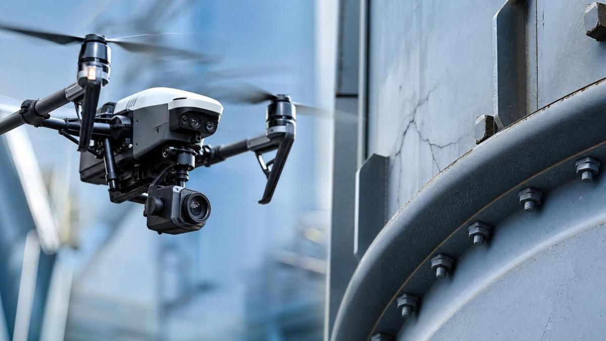
In practical terms, drone inspection systems image resolution is not just sensor megapixels. It includes lens sharpness, pixel size, compression behavior, stabilization, motion blur control, and the ground sampling distance achieved at the target.
A 48 MP camera can still fail an inspection task if the aircraft is too far away, the shutter is too slow, or the lens softens detail near the frame edge. A lower nominal resolution setup may outperform it when optics, flight control, and exposure are better matched.
This is why evaluators increasingly focus on actionable detail rather than advertised pixel count. The question is simple: can the system capture the smallest defect that matters, under repeatable field conditions?
Why the industry pays closer attention now
Asset owners are under pressure to inspect more frequently without multiplying rope access, scaffolding, or shutdown costs. Drones help, but only if the collected imagery can stand up to maintenance planning, regulatory review, and supplier comparison.
At the same time, the hard-tech supply chain is crowded with vague claims. TSV’s core position, “Parameters do not lie; tolerances dictate success,” fits this issue well. For drone inspection systems image resolution, vague phrases such as “ultra-clear” or “industrial-grade” do not support procurement or technical validation.
What supports decisions are measurable relationships: defect width in millimeters, target distance, field of view, pixel coverage per defect, and the probability of detection under real lighting and vibration conditions.
How much detail is enough depends on the defect class
Different assets fail in different ways. A wind turbine blade, a flare stack, a bridge joint, and a solar farm connector do not demand the same visual threshold. The needed drone inspection systems image resolution should therefore be derived from the smallest critical anomaly, not from a generic camera category.
Broadly, detail needs often fall into three levels.
In other words, “enough detail” is a defect-detection threshold. If the mission is only screening, the requirement is lower. If the mission must distinguish a surface stain from early corrosion pitting, the threshold rises quickly.
The variables that change image usefulness
Distance and field of view
Standoff distance is often the hidden driver. Safety rules, GPS-denied spaces, electromagnetic interference, or rotor wash concerns can force the aircraft farther from the asset. As distance grows, the same sensor spreads pixels over a larger area.
A narrow field of view or optical zoom can restore detail, but only if stabilization remains strong. Digital zoom alone does not create new information.
Sensor and lens quality
Megapixels without optical performance create false confidence. Lens distortion, edge softness, flare, and low dynamic range can hide defect boundaries. For reflective metals or painted composites, dynamic range and glare handling can matter as much as nominal resolution.
Motion and exposure control
Inspection flights are not studio shoots. Wind gusts, yaw correction, and asset proximity create motion risk. If shutter speed is too slow, drone inspection systems image resolution on paper becomes irrelevant in practice because blur destroys fine structure.
Compression and downstream workflow
Compression artifacts can erase the exact textures needed for crack edge review or coating lift assessment. Equally, poor asset management can make high-detail files unusable if teams cannot annotate, compare, and retrieve them efficiently.
Where resolution requirements differ across sectors
The value of drone inspection systems image resolution becomes clearer when tied to field use.
- Power transmission: insulator contamination, connector heating context, strand damage, and hardware loss often need different imaging thresholds.
- Oil and gas: flare tips, stack shells, pressure vessels, and offshore structures usually combine distance constraints with harsh lighting.
- Wind energy: blade leading-edge erosion and bond-line anomalies demand finer detail than simple lightning receptor checks.
- Bridges and civil assets: spalling, exposed rebar, coating failure, and connection fatigue indicators require reliable visual scale.
- Manufacturing facilities: roof membranes, elevated pipe racks, and process structures often need repeatable baseline imagery for trend comparison.
Across these sectors, the common pattern is this: resolution matters most when defect progression must be distinguished, not merely noticed.
A better way to evaluate specification claims
When reviewing platforms, it helps to translate camera claims into inspection questions rather than shopping categories. That approach aligns with TSV’s data-first method and avoids expensive mismatches between procurement language and field performance.
- What is the minimum defect size that must be detected or confirmed?
- At what distance must that detail be resolved safely and consistently?
- Does the mission require screening, diagnostics, or auditable evidence?
- How does the system perform in shadow, glare, haze, or high-contrast surfaces?
- Can the image set be repeated later for trending and supplier comparison?
- Is there proof from sample captures, not just brochure specifications?
This is also where field trials matter. Controlled capture of representative defects usually reveals more than headline camera numbers. A short benchmark mission often exposes whether the imaging chain holds detail under operational stress.
Why “more” can still be inefficient
There is a practical ceiling to useful detail. Very high resolution increases file size, storage cost, transmission burden, and review time. In some workflows, it also slows annotation, AI processing, and archival comparison.
That does not mean lower is better. It means the right drone inspection systems image resolution is the lowest level that still preserves decision-grade evidence. Anything beyond that should serve a defined purpose, such as forensic review or future re-analysis.
In cost-sensitive programs, this balance can be decisive. Overspecifying imaging hardware may deliver little field advantage while increasing payload weight, flight complexity, and data handling overhead.
What to standardize before scaling a program
Before expanding drone-based inspections across sites, it helps to document an internal imaging standard. That standard should link defect classes, flight envelopes, camera settings, and acceptance criteria.
A useful starting framework includes:
- minimum observable defect size by asset class
- allowed standoff range and lens configuration
- required overlap and image angle for comparison missions
- shutter, ISO, and lighting constraints for evidence capture
- file format, compression, and retention rules
This reduces ambiguity between operations, maintenance, and sourcing teams. It also makes supplier qualification easier because proposals can be tested against defined inspection outcomes rather than broad marketing claims.
A practical next step for resolution decisions
The best next move is usually not to ask which drone has the highest camera resolution. It is to define the smallest defect that changes a maintenance decision, then map backward to flight distance, optics, environmental limits, and data workflow.
That process turns drone inspection systems image resolution from a vague feature into a measurable requirement. It also reflects the broader TSV principle that engineering truth starts with parameters tied to real thresholds.
Once those thresholds are documented, platform comparison becomes clearer, pilot testing becomes shorter, and image evidence becomes more defensible. In asset checks, enough detail is not a guess. It is a standard that can be defined, tested, and repeated.
Search News
Hot Articles
- Carbon Fiber StructuresHow to Specify Aerospace Carbon Fiber Assemblies for Lightweight, Load-Bearing PartsJul 11, 2026
- Machine VisionXiaomi, Alibaba DAMO Academy Drive Open-Source Robotics Model Ecosystem, Lowering Algorithm Development Barriers for Overseas SMEs Adopting Chinese Robotics SolutionsMar 30, 2026
- Cobots & ArmsShanxi 'AI+' Conference Showcases Embodied Intelligence with Multinational Buyer Engagement: Key Industry ImplicationsMar 30, 2026
Popular Tags
Recommended News
 Jul 11, 2026How to Specify Aerospace Carbon Fiber Assemblies for Lightweight, Load-Bearing PartsAerospace carbon fiber assemblies: learn how to specify laminate design, load data, joining methods, and inspection controls for lighter, reliable load-bearing aerospace parts.Elena Rostova (UAV Systems Researcher)
 Mar 30, 2026Xiaomi, Alibaba DAMO Academy Drive Open-Source Robotics Model Ecosystem, Lowering Algorithm Development Barriers for Overseas SMEs Adopting Chinese Robotics SolutionsXiaomi & Alibaba DAMO Academy's open-source robotics models lower algorithm barriers for global SMEs. Boost efficiency in manufacturing, logistics & smart retail with ROS 2 compatible solutions.TSV Data Lab
 Mar 30, 2026Shanxi 'AI+' Conference Showcases Embodied Intelligence with Multinational Buyer Engagement: Key Industry ImplicationsShanxi 'AI+' Conference highlights embodied intelligence with Tesla, Ubtech & Jiantao showcasing multimodal robotics. 40+ global buyers validated tech on-site, creating new B2B channels for industrial automation & AI solutions.Chen Wei (Automation Lead Engineer)
 Mar 30, 2026Zhongguancun Unveils 6G Integrated Sensing-Computing-Intelligence Platform to Empower Embodied Robots for Global Industrial ApplicationsZhongguancun's new 6G platform revolutionizes industrial robotics with <10ms latency, empowering global automotive, logistics & port automation. Discover how this tech boosts China's smart manufacturing exports.TSV Data Lab
 Mar 30, 2026Mech-Mind Tianjin Embodied Intelligence R&D and Production Base Goes Live, Cutting Delivery Time by 20%–30% for Global Customized AMR+Vision SolutionsMech-Mind's Tianjin AMR+Vision production base cuts delivery time by 20%-30% for欧美 & Latin American markets. Discover how this PLd-certified facility accelerates customized robotics solutions for smart manufacturing and logistics.Chen Wei (Automation Lead Engineer)
 Mar 30, 2026Boao Forum Reveals 'Co-evolution of Big and Small Brains' Trend in Humanoid Robots, China's Embodied Intelligence Accelerates Adaptation to Overseas Manufacturing Service ScenariosDiscover how China's humanoid robots, featuring 'Co-evolution of Big and Small Brains,' are revolutionizing global manufacturing. Learn about Embodied Tian Gong 3.0's ISO compliance and overseas deployment at Boao Forum 2026.Chen Wei (Automation Lead Engineer)
 Mar 30, 2026China Railway Industrial Secures Patent for Embodied Robotics in Material Handling, Boosting High-Precision Delivery Capabilities for Overseas Infrastructure and Manufacturing ProjectsChina Railway Industrial's new patent for embodied robotics in material handling boosts high-precision delivery for global infrastructure & manufacturing. Discover how this innovation enhances logistics accuracy in automotive, rail transit & EPC projects.Chen Wei (Automation Lead Engineer)
 Sep 28, 2026Spindle Runout Measurement in Germany: DIN Standards, Methods, and Acceptance LimitsSpindle runout measurement Germany: explore DIN standards, proven methods, acceptance limits, and audit-ready practices for reliable machining quality.Dr. Marcus Vance
 Sep 27, 2026How to Select Wall-Mount Edge Devices for Space-Constrained Factory NetworksWall mount edge devices for space-constrained factories: evaluate workload, thermal design, power resilience, cable access, and network reliability for smarter deployments.TSV Data Lab
 Sep 26, 2026Machining Tolerance Analysis: How to Set Limits That Meet Function and Cost TargetsMachining tolerance analysis: learn how to set functional limits, control tolerance stacks, reduce inspection risk, and balance precision with production cost.Dr. Marcus Vance
 Sep 25, 2026How to Evaluate an Industrial Infrastructure Data Platform for Multi-Site OperationsIndustrial infrastructure data platform evaluation guide for multi-site operations: compare data quality, edge resilience, interoperability, governance, and scalable proof-of-value criteria.Victor Lin (Chief Software Architect)
 Sep 24, 2026How to Select Machine Vision Optics for Accurate Inspection at Different Working DistancesMachine vision optics selection guide for accurate inspection at every working distance. Compare FOV, pixel scale, DOF, distortion, lighting, and telecentric options.TSV Data Lab
 Sep 23, 2026How to Evaluate a Machine Vision System Integrator for High-Speed Inspection LinesChoose a machine vision system integrator with proven expertise in high-speed inspection, reliable reject timing, robust optics, and measurable acceptance criteria.TSV Data Lab
 Sep 28, 2026When is a SCADA API the right choice for connecting plant systems?SCADA API guide: learn when governed plant data integration improves traceability, security, and scalability—without compromising real-time control.Victor Lin (Chief Software Architect)
 Sep 27, 2026How SCADA data integration improves traceability across production linesSCADA data integration connects production-line data to improve traceability, accelerate quality investigations, and strengthen safety decisions.Victor Lin (Chief Software Architect)
 Sep 26, 2026What to define before starting SCADA integration planningSCADA integration planning starts with clear scope, control boundaries, data models, cybersecurity, and testing. Discover the definitions that reduce risk and costly rework.Victor Lin (Chief Software Architect)
 Sep 25, 2026How a smart factory with Industrial IoT reduces production blind spotsDiscover how a smart factory with Industrial IoT turns real-time machine, quality, and workflow data into actionable insights that reduce production blind spots and delivery risks.Victor Lin (Chief Software Architect)
 Sep 24, 2026When does Industrial IoT make smart manufacturing easier to scale?Smart manufacturing Industrial IoT scales when trusted data, interoperable systems, and secure workflows turn connected assets into measurable gains.TSV Data Lab
 Sep 23, 2026What drives ultra-precision machining cost at 1-micron tolerance?Ultra precision machining cost per part at 1 micron tolerance depends on process, material, metrology, and yield. Learn how to compare quotes confidently.Dr. Marcus Vance
 Sep 22, 2026Drone Engine-T550CC Applications: Build the UAV Power System Around the MissionAn application guide for Drone Engine-T550CC integration, covering payload planning, airframe matching, cooling, fuel, vibration, test procedures, documentation, and service preparation.Elena Rostova (UAV Systems Researcher)
 Sep 22, 2026How to Evaluate Industrial Edge Computing Vendors for Factory DeploymentIndustrial edge computing vendor evaluation guide for factories: compare latency, protocol fit, reliability, security, and lifecycle support before deployment.TSV Data Lab
 Sep 21, 2026Drone Payload Integration: Matching Power, Data, and Center of Gravity for Reliable FlightsDrone payload integration made practical: balance power, data, center of gravity, and endurance to build safer, more reliable mission-ready flights.Elena Rostova (UAV Systems Researcher)
 Sep 20, 2026Autonomous Navigation Pricing: Cost Drivers and Budget Benchmarks for AMR ProjectsAutonomous navigation price explained: compare AMR cost drivers, software, sensors, integration, safety, and lifecycle budgets to build a scalable project plan.Chen Wei (Automation Lead Engineer)
 Sep 19, 2026How to Scope Automation Integration Services for Multi-System Factory ProjectsAutomation integration services: learn how to scope multi-system factory projects with clear workflows, interface contracts, safety boundaries, and acceptance criteria.Victor Lin (Chief Software Architect)