Autonomous Navigation High Accuracy: Which Sensors and Conditions Matter Most?
Publication Date
author
Autonomous navigation high accuracy is often discussed as a sensor problem, yet field performance rarely depends on one device alone. Reliable positioning and path execution come from how LiDAR, GNSS, IMU, cameras, and radar behave together under real operating pressure.
That distinction matters across robotics, UAVs, industrial vehicles, and edge AI systems. In procurement and system design, the gap between a clean demo and a stable deployment usually appears in calibration quality, environmental interference, and tolerance to imperfect data.
For teams trying to separate measurable engineering value from broad marketing claims, the central question is straightforward: which sensors matter most, and under which conditions do they actually deliver autonomous navigation high accuracy?
Why Accuracy Has Become a Hard-Tech Decision Point

Navigation precision now affects more than route keeping. It influences throughput, collision risk, battery efficiency, inspection quality, and regulatory confidence.
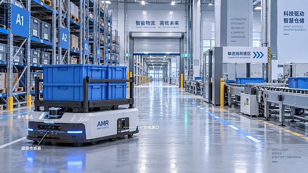
In a warehouse AMR, a few centimeters of drift may reduce docking consistency. In a mapping UAV, the same error can distort georeferenced outputs and weaken downstream analytics.
This is why data-first organizations such as TechStat Vanguard place so much emphasis on verified parameters. In autonomous systems, specifications only matter when they remain true in dust, multipath reflections, vibration, low light, and signal interruption.
Autonomous navigation high accuracy is therefore a systems benchmark. It reflects not only sensor quality, but also integration discipline and environmental robustness.
No Single Sensor Owns the Result
A common mistake is to ask which sensor is best in isolation. That framing sounds simple, but it hides the real engineering tradeoff.
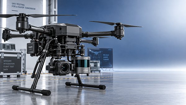
LiDAR delivers strong spatial geometry and works well for localization and obstacle mapping. Cameras add semantic detail, lane features, and texture. GNSS provides global reference. IMUs preserve motion continuity. Radar helps when weather or visual degradation hurts other sensors.
Each sensor also carries a failure mode. LiDAR can struggle with heavy rain, reflective surfaces, or sparse returns at long range. Cameras lose confidence in glare, darkness, fog, or feature-poor scenes. GNSS suffers near buildings, tunnels, canyons, and electromagnetic disturbance. IMUs drift over time. Radar offers resilience, but lower spatial richness.
For autonomous navigation high accuracy, the useful question is not which sensor wins. It is which combination preserves reliable state estimation when one data stream becomes weak.
How core sensors compare in practice
The Hidden Variables Behind Autonomous Navigation High Accuracy
Sensor fusion gets attention, but several less visible variables often determine the final result.
Calibration quality
A high-end sensor stack can underperform if spatial and temporal calibration drift is ignored. Millimeter-level mounting shifts or timing offsets can corrupt localization, especially during turns, acceleration, or uneven terrain.
Data synchronization
Accurate navigation needs aligned timestamps. When camera frames, inertial updates, and LiDAR scans do not match motion state, the fusion engine estimates the wrong world.
Mechanical stability
Vibration, thermal expansion, and housing deflection can alter sensor pose. This matters in drones, mobile robots, and vehicles exposed to speed, shock, or long duty cycles.
Computation and latency
Autonomous navigation high accuracy is also a timing problem. A correct estimate delivered too late may still produce poor path tracking or unstable control.
Map quality and update strategy
Localization against outdated maps creates systematic error. Dynamic sites with moving racks, changing layouts, or seasonal crop conditions need a realistic map maintenance policy.
Conditions That Most Often Break Accuracy Claims
Many performance claims are generated under controlled conditions. Field deployments expose a different set of realities.
- Urban canyons and metal structures increase GNSS multipath and false confidence.
- Dust, spray, fog, and rain reduce visual and laser clarity.
- Repetitive indoor geometry can confuse SLAM matching.
- Electromagnetic noise may disturb inertial or positioning subsystems.
- Low-feature agricultural terrain can weaken camera-based localization.
- Fast motion amplifies timing, blur, and control-loop errors.
This is where rigorous benchmarking matters. TSV’s engineering lens is useful because it asks for thresholds, repeatability, and failure boundaries rather than headline numbers.
Choosing by Scenario, Not by Spec Sheet Alone
The best sensor architecture changes with mission profile. Autonomous navigation high accuracy in a port yard is not the same problem as navigation in a hospital corridor or crop field.
Indoor AMRs and factory vehicles
LiDAR plus IMU is often strong indoors, especially where GNSS is absent. Cameras help when semantic landmarks matter, but lighting control becomes part of the system requirement.
Outdoor logistics and mining
GNSS/RTK remains valuable for global reference, yet redundancy is essential. Dust, slope, vibration, and partial signal loss favor combinations with LiDAR, IMU, and radar.
UAV mapping and inspection
Weight, power, and airframe vibration impose hard limits. Here, navigation accuracy depends as much on sensor placement and flight controller stability as on the nominal sensor specification.
Public road and mixed environments
No single modality remains dominant across glare, night, rain, signage, and traffic clutter. Multi-sensor redundancy becomes a safety function, not a luxury feature.
What to Examine Before Trusting Accuracy Claims
The most useful evaluations go beyond average error numbers. A better review asks how accuracy was measured, under which conditions, and with what failure handling.
This approach fits the broader shift in hard-tech sourcing. Buyers and designers increasingly need proof built on measurable tolerances, not polished language.
A Practical Reading of the Market
The market is moving toward tighter sensor fusion, stronger edge processing, and better anti-interference design. Still, more complexity does not automatically create autonomous navigation high accuracy.
In many cases, disciplined integration beats a premium component list. A balanced architecture with verified calibration, known failure modes, and realistic environmental testing often outperforms a more expensive but poorly characterized stack.
That is also why benchmark-oriented analysis remains valuable. It helps compare radar point density, visual recognition stability, GNSS correction performance, and inertial drift as engineering variables rather than marketing themes.
Where to Focus Next
A useful next step is to define the operating envelope before comparing suppliers or platforms. Start with route type, speed, weather exposure, vibration level, visibility conditions, and allowable positioning error.
Then examine which sensor failures are acceptable, how often recalibration is realistic, and whether claimed accuracy survives under partial degradation. That process usually reveals more than any headline specification.
Autonomous navigation high accuracy is ultimately a discipline of evidence. The strongest decisions come from matching sensor architecture to the mission, validating the edge cases, and using data to define what accuracy really means in operation.
Search News
Hot Articles
- Carbon Fiber StructuresHow to Specify Aerospace Carbon Fiber Assemblies for Lightweight, Load-Bearing PartsJul 11, 2026
- Machine VisionXiaomi, Alibaba DAMO Academy Drive Open-Source Robotics Model Ecosystem, Lowering Algorithm Development Barriers for Overseas SMEs Adopting Chinese Robotics SolutionsMar 30, 2026
- Cobots & ArmsShanxi 'AI+' Conference Showcases Embodied Intelligence with Multinational Buyer Engagement: Key Industry ImplicationsMar 30, 2026
Popular Tags
Recommended News
 Jul 11, 2026How to Specify Aerospace Carbon Fiber Assemblies for Lightweight, Load-Bearing PartsAerospace carbon fiber assemblies: learn how to specify laminate design, load data, joining methods, and inspection controls for lighter, reliable load-bearing aerospace parts.Elena Rostova (UAV Systems Researcher)
 Mar 30, 2026Xiaomi, Alibaba DAMO Academy Drive Open-Source Robotics Model Ecosystem, Lowering Algorithm Development Barriers for Overseas SMEs Adopting Chinese Robotics SolutionsXiaomi & Alibaba DAMO Academy's open-source robotics models lower algorithm barriers for global SMEs. Boost efficiency in manufacturing, logistics & smart retail with ROS 2 compatible solutions.TSV Data Lab
 Mar 30, 2026Shanxi 'AI+' Conference Showcases Embodied Intelligence with Multinational Buyer Engagement: Key Industry ImplicationsShanxi 'AI+' Conference highlights embodied intelligence with Tesla, Ubtech & Jiantao showcasing multimodal robotics. 40+ global buyers validated tech on-site, creating new B2B channels for industrial automation & AI solutions.Chen Wei (Automation Lead Engineer)
 Mar 30, 2026Zhongguancun Unveils 6G Integrated Sensing-Computing-Intelligence Platform to Empower Embodied Robots for Global Industrial ApplicationsZhongguancun's new 6G platform revolutionizes industrial robotics with <10ms latency, empowering global automotive, logistics & port automation. Discover how this tech boosts China's smart manufacturing exports.TSV Data Lab
 Mar 30, 2026Mech-Mind Tianjin Embodied Intelligence R&D and Production Base Goes Live, Cutting Delivery Time by 20%–30% for Global Customized AMR+Vision SolutionsMech-Mind's Tianjin AMR+Vision production base cuts delivery time by 20%-30% for欧美 & Latin American markets. Discover how this PLd-certified facility accelerates customized robotics solutions for smart manufacturing and logistics.Chen Wei (Automation Lead Engineer)
 Mar 30, 2026Boao Forum Reveals 'Co-evolution of Big and Small Brains' Trend in Humanoid Robots, China's Embodied Intelligence Accelerates Adaptation to Overseas Manufacturing Service ScenariosDiscover how China's humanoid robots, featuring 'Co-evolution of Big and Small Brains,' are revolutionizing global manufacturing. Learn about Embodied Tian Gong 3.0's ISO compliance and overseas deployment at Boao Forum 2026.Chen Wei (Automation Lead Engineer)
 Mar 30, 2026China Railway Industrial Secures Patent for Embodied Robotics in Material Handling, Boosting High-Precision Delivery Capabilities for Overseas Infrastructure and Manufacturing ProjectsChina Railway Industrial's new patent for embodied robotics in material handling boosts high-precision delivery for global infrastructure & manufacturing. Discover how this innovation enhances logistics accuracy in automotive, rail transit & EPC projects.Chen Wei (Automation Lead Engineer)
 Sep 28, 2026Spindle Runout Measurement in Germany: DIN Standards, Methods, and Acceptance LimitsSpindle runout measurement Germany: explore DIN standards, proven methods, acceptance limits, and audit-ready practices for reliable machining quality.Dr. Marcus Vance
 Sep 27, 2026How to Select Wall-Mount Edge Devices for Space-Constrained Factory NetworksWall mount edge devices for space-constrained factories: evaluate workload, thermal design, power resilience, cable access, and network reliability for smarter deployments.TSV Data Lab
 Sep 26, 2026Machining Tolerance Analysis: How to Set Limits That Meet Function and Cost TargetsMachining tolerance analysis: learn how to set functional limits, control tolerance stacks, reduce inspection risk, and balance precision with production cost.Dr. Marcus Vance
 Sep 25, 2026How to Evaluate an Industrial Infrastructure Data Platform for Multi-Site OperationsIndustrial infrastructure data platform evaluation guide for multi-site operations: compare data quality, edge resilience, interoperability, governance, and scalable proof-of-value criteria.Victor Lin (Chief Software Architect)
 Sep 24, 2026How to Select Machine Vision Optics for Accurate Inspection at Different Working DistancesMachine vision optics selection guide for accurate inspection at every working distance. Compare FOV, pixel scale, DOF, distortion, lighting, and telecentric options.TSV Data Lab
 Sep 23, 2026How to Evaluate a Machine Vision System Integrator for High-Speed Inspection LinesChoose a machine vision system integrator with proven expertise in high-speed inspection, reliable reject timing, robust optics, and measurable acceptance criteria.TSV Data Lab
 Sep 28, 2026When is a SCADA API the right choice for connecting plant systems?SCADA API guide: learn when governed plant data integration improves traceability, security, and scalability—without compromising real-time control.Victor Lin (Chief Software Architect)
 Sep 27, 2026How SCADA data integration improves traceability across production linesSCADA data integration connects production-line data to improve traceability, accelerate quality investigations, and strengthen safety decisions.Victor Lin (Chief Software Architect)
 Sep 26, 2026What to define before starting SCADA integration planningSCADA integration planning starts with clear scope, control boundaries, data models, cybersecurity, and testing. Discover the definitions that reduce risk and costly rework.Victor Lin (Chief Software Architect)
 Sep 25, 2026How a smart factory with Industrial IoT reduces production blind spotsDiscover how a smart factory with Industrial IoT turns real-time machine, quality, and workflow data into actionable insights that reduce production blind spots and delivery risks.Victor Lin (Chief Software Architect)
 Sep 24, 2026When does Industrial IoT make smart manufacturing easier to scale?Smart manufacturing Industrial IoT scales when trusted data, interoperable systems, and secure workflows turn connected assets into measurable gains.TSV Data Lab
 Sep 23, 2026What drives ultra-precision machining cost at 1-micron tolerance?Ultra precision machining cost per part at 1 micron tolerance depends on process, material, metrology, and yield. Learn how to compare quotes confidently.Dr. Marcus Vance
 Sep 22, 2026Drone Engine-T550CC Applications: Build the UAV Power System Around the MissionAn application guide for Drone Engine-T550CC integration, covering payload planning, airframe matching, cooling, fuel, vibration, test procedures, documentation, and service preparation.Elena Rostova (UAV Systems Researcher)
 Sep 22, 2026How to Evaluate Industrial Edge Computing Vendors for Factory DeploymentIndustrial edge computing vendor evaluation guide for factories: compare latency, protocol fit, reliability, security, and lifecycle support before deployment.TSV Data Lab
 Sep 21, 2026Drone Payload Integration: Matching Power, Data, and Center of Gravity for Reliable FlightsDrone payload integration made practical: balance power, data, center of gravity, and endurance to build safer, more reliable mission-ready flights.Elena Rostova (UAV Systems Researcher)
 Sep 20, 2026Autonomous Navigation Pricing: Cost Drivers and Budget Benchmarks for AMR ProjectsAutonomous navigation price explained: compare AMR cost drivers, software, sensors, integration, safety, and lifecycle budgets to build a scalable project plan.Chen Wei (Automation Lead Engineer)
 Sep 19, 2026How to Scope Automation Integration Services for Multi-System Factory ProjectsAutomation integration services: learn how to scope multi-system factory projects with clear workflows, interface contracts, safety boundaries, and acceptance criteria.Victor Lin (Chief Software Architect)