Radar Sensor for Traffic Monitoring in Crowded Urban Lanes
Publication Date
author
In crowded urban lanes, choosing the right radar sensor for traffic monitoring is no longer just a hardware decision—it is a matter of detection accuracy, signal stability, and reliable data under constant interference. For engineers and technical researchers, understanding how radar performs in dense, unpredictable traffic conditions is essential to building smarter, safer, and more measurable urban mobility systems.
For information researchers, urban transport planners, and technical procurement teams, the challenge is rarely a lack of products. The real problem is separating measurable performance from vague claims. A radar sensor for traffic monitoring in narrow city corridors must work through rain, glare, vibration, multipath reflections, metal clutter, and constant changes in vehicle density. That means procurement decisions should be based on detection range, angular resolution, update rate, interference resistance, installation geometry, and data integration effort rather than marketing language.
From a data-first engineering perspective, radar remains one of the most practical sensing technologies for urban traffic analytics because it can operate 24/7, often within temperature bands such as -40°C to 70°C, and with less dependency on lighting than camera-only systems. Yet crowded lanes create edge cases: motorcycles overlapping with buses, pedestrians crossing outside designated zones, and roadside structures creating false echoes. This is where specification discipline matters.
Why Urban Lanes Are a Difficult Environment for Traffic Radar
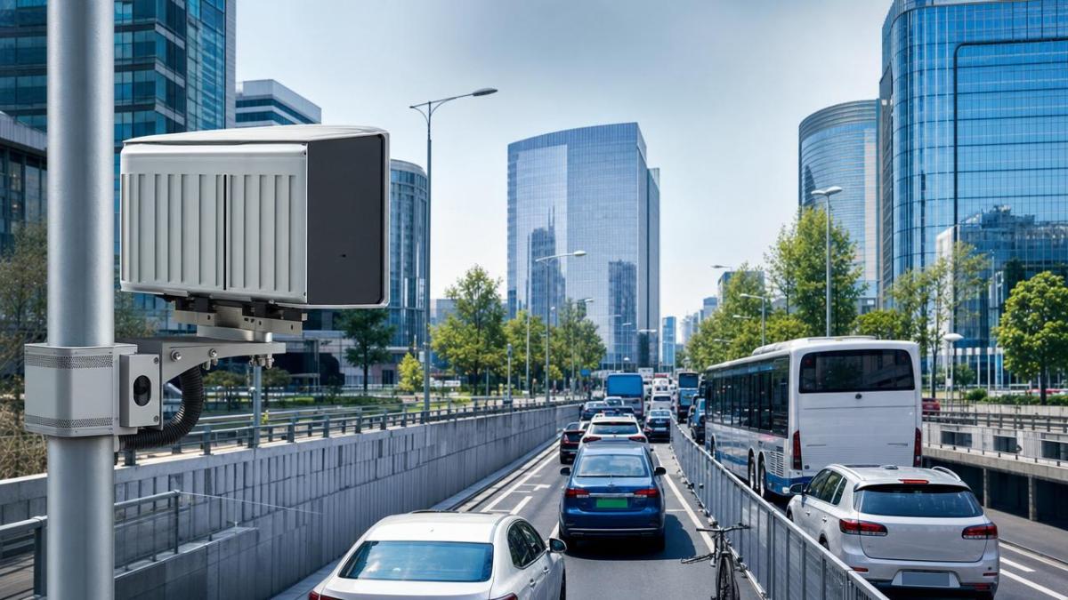
A radar sensor for traffic monitoring performs very differently on an open highway than in a dense urban lane. In city environments, lane widths may fall within 2.8-3.5 meters, installation heights are often limited to 4-8 meters, and line of sight can be disrupted by buses, parked vehicles, sign poles, trees, and building corners. These variables reduce clean target separation and increase the need for precise beam control and object tracking.
Key interference sources in crowded streets
The most common interference sources include multipath reflection from glass facades, metallic roadside infrastructure, moving pedestrian clusters, and stop-and-go traffic. In practical deployments, false detections often rise when relative target spacing falls below 1-2 meters and when mixed road users occupy the same field of view. Radar systems with weak filtering logic may merge separate objects into one track or repeatedly lose slow-moving targets near intersections.
Why this matters for decision-makers
For technical buyers, the cost of choosing the wrong sensor is not limited to hardware replacement. It may add 4-12 weeks of recalibration, software adaptation, pole remounting, and data validation. If the radar feed is used for adaptive signaling, vehicle counting, queue length estimation, or near-miss analysis, poor-quality detection can distort traffic models and reduce trust in the entire monitoring stack.
- Occlusion is common at intersections with 3-5 simultaneous movement directions.
- Mixed traffic requires classification across cars, buses, trucks, bicycles, and pedestrians.
- Urban clutter increases the importance of stable tracking algorithms and interference rejection.
- Low-speed motion detection is critical because lane congestion often means speeds below 20 km/h.
The table below outlines the main urban monitoring challenges and the corresponding radar performance areas engineers should examine during evaluation.
The takeaway is straightforward: dense lanes compress the margin for error. A radar sensor for traffic monitoring that looks acceptable in a brochure may fail when asked to distinguish 15-30 moving targets in a narrow road segment with reflective surfaces and partial occlusion.
How to Evaluate a Radar Sensor for Traffic Monitoring
Evaluation should begin with use case definition rather than sensor brand preference. A city authority measuring queue length at signalized intersections needs different performance priorities from a smart parking integrator or a mobility research institute. In most urban programs, the first 5 evaluation dimensions are detection range, field of view, point or object density, latency, and communication compatibility.
1. Detection geometry and lane coverage
Short urban corridors typically require effective coverage between 20 and 120 meters. Overspecifying range may increase noise and integration cost without improving usable data. More important is whether the sensor can maintain stable lane-level discrimination at the intended installation height and angle. In a 2-lane or 4-lane setup, beam shape and side-lobe behavior often matter more than maximum headline range.
2. Resolution, update rate, and object tracking
For crowded lane analytics, object refresh rates in the 10-20 Hz range are common reference points for responsive monitoring, while higher rates may be useful at complex intersections. Angular resolution and tracking persistence determine whether the system can distinguish a bicycle moving beside a van, or a pedestrian crossing close to roadside infrastructure. If your target application includes adaptive traffic lights, latency should be low enough to support near-real-time control logic.
3. Environmental stability and false alarm control
Urban radar should be validated across temperature variation, rain events, vibration, and electromagnetic noise from nearby equipment. While exact thresholds vary by system design, engineering teams should ask for performance data under at least 3 conditions: dry daytime, wet nighttime, and peak congestion with mixed vehicle classes. A reliable radar sensor for traffic monitoring should not show excessive false positives when traffic density spikes or when roadside reflectors enter the scene.
- Define the monitored zone in meters, lane count, and mounting constraints.
- List all object classes that matter to the project, including bicycles and pedestrians if required.
- Set acceptable thresholds for missed detections, false alarms, and response latency.
- Confirm output format, protocol, and integration path to VMS, edge gateway, or signal controller.
- Run a pilot test for 7-14 days before full deployment.
The table below provides a practical procurement checklist for comparing radar specifications in urban traffic projects.
The strongest procurement logic is not “highest specification wins.” It is “best-fit specification reduces deployment risk.” In crowded urban lanes, balanced performance across geometry, update rate, filtering, and interoperability usually delivers better lifecycle value than a single standout metric.
Deployment, Integration, and Data Quality Control
Even a capable radar sensor for traffic monitoring can underperform if deployment discipline is weak. Field installation should include a documented alignment process, test vehicle verification, and baseline data capture during at least 2 traffic periods: one off-peak window and one peak window. For many projects, the first 72 hours after installation are critical for tuning detection zones and suppressing static clutter.
A practical 4-step implementation workflow
Site survey
Record lane count, road curvature, pole availability, height constraints, and surrounding reflective objects. This stage often takes 1-3 days depending on whether power and network access are already present.
Pilot installation
Install one unit in the highest-risk zone first, such as a signalized lane merge or bus-heavy corridor. Use pilot data to test missed detections, false tracks, and object persistence before scaling to 10, 20, or more intersections.
System integration
Connect radar outputs to traffic management software, edge processors, or analytics dashboards. Integration effort can vary from 3-5 days in standard protocol environments to 2-4 weeks in customized municipal systems.
Validation and maintenance
Set routine checks for alignment drift, firmware consistency, and seasonal performance review. A quarterly validation cycle is a common starting point for urban deployments, especially where vibration or weather stress is high.
For information-led procurement teams, integration details deserve the same attention as sensor physics. A technically strong unit that exports data in a difficult format can create hidden cost. Ask early about API support, edge processing compatibility, event output logic, and whether the system provides raw detections, tracked objects, or both.
Common mistakes in urban radar projects
- Choosing sensors by maximum range while ignoring lane-level discrimination.
- Skipping pilot validation in rain or peak congestion periods.
- Assuming all radar outputs are equally useful for adaptive signal control.
- Underestimating installation angle sensitivity in narrow corridors.
- Failing to define acceptance criteria before supplier comparison.
These mistakes are avoidable when engineering teams use a benchmark-based review model. That is also where data-centric technical research adds value: by translating broad vendor claims into checkable variables such as refresh frequency, detection stability, mounting tolerance, integration workload, and operational maintenance intervals.
What Technical Researchers Should Ask Before Shortlisting Suppliers
A robust shortlist should come from technical evidence, not brochure styling. When assessing any radar sensor for traffic monitoring, researchers should ask for measurable deployment information linked to urban use cases. This is particularly important when projects involve public infrastructure budgets, long approval cycles, or multi-stakeholder review.
Five high-value supplier questions
- What is the validated detection performance at low speeds below 20 km/h in congested lanes?
- How does the system handle occlusion and target separation when spacing falls below 2 meters?
- What mounting height and angle ranges are recommended for 2-lane, 3-lane, and 4-lane urban roads?
- What integration protocols are available, and what is the typical commissioning timeline?
- What maintenance actions are expected over a 12-month operating cycle?
Why these questions improve procurement quality
Each question reduces ambiguity. Instead of asking whether a sensor is “advanced,” you ask whether it performs under a known urban condition. Instead of comparing slogans, you compare thresholds, ranges, cycles, and compatibility. This approach aligns with the engineering principle that useful traffic intelligence begins with trustworthy sensing data.
For organizations building specification sheets, a practical next step is to create a weighted scoring matrix across 4 categories: sensing performance, integration complexity, environmental resilience, and lifecycle support. Depending on project goals, sensing performance may carry 35-45% of total weight, while integration and maintenance may jointly represent another 30-40%.
A radar sensor for traffic monitoring is not simply a component. In urban mobility systems, it is an upstream source of operational truth. If that source is unstable, every downstream metric—from queue length to signal timing optimization—becomes less reliable. For technical teams that value measurable outcomes, the best choice is the one supported by site-fit geometry, validated detection behavior, and manageable integration effort.
For engineering-led organizations that need a clearer path through technical noise, TechStat Vanguard focuses on benchmark logic, parameter discipline, and decision support grounded in real operating conditions. If you are comparing urban sensing options, refining a specification sheet, or evaluating suppliers for a traffic monitoring project, contact us to discuss your application, request a tailored assessment framework, or explore more data-driven hard-tech solutions.
Search News
Hot Articles
- Carbon Fiber StructuresHow to Specify Aerospace Carbon Fiber Assemblies for Lightweight, Load-Bearing PartsJul 11, 2026
- Machine VisionXiaomi, Alibaba DAMO Academy Drive Open-Source Robotics Model Ecosystem, Lowering Algorithm Development Barriers for Overseas SMEs Adopting Chinese Robotics SolutionsMar 30, 2026
- Cobots & ArmsShanxi 'AI+' Conference Showcases Embodied Intelligence with Multinational Buyer Engagement: Key Industry ImplicationsMar 30, 2026
Popular Tags
Recommended News
 Jul 11, 2026How to Specify Aerospace Carbon Fiber Assemblies for Lightweight, Load-Bearing PartsAerospace carbon fiber assemblies: learn how to specify laminate design, load data, joining methods, and inspection controls for lighter, reliable load-bearing aerospace parts.Elena Rostova (UAV Systems Researcher)
 Mar 30, 2026Xiaomi, Alibaba DAMO Academy Drive Open-Source Robotics Model Ecosystem, Lowering Algorithm Development Barriers for Overseas SMEs Adopting Chinese Robotics SolutionsXiaomi & Alibaba DAMO Academy's open-source robotics models lower algorithm barriers for global SMEs. Boost efficiency in manufacturing, logistics & smart retail with ROS 2 compatible solutions.TSV Data Lab
 Mar 30, 2026Shanxi 'AI+' Conference Showcases Embodied Intelligence with Multinational Buyer Engagement: Key Industry ImplicationsShanxi 'AI+' Conference highlights embodied intelligence with Tesla, Ubtech & Jiantao showcasing multimodal robotics. 40+ global buyers validated tech on-site, creating new B2B channels for industrial automation & AI solutions.Chen Wei (Automation Lead Engineer)
 Mar 30, 2026Zhongguancun Unveils 6G Integrated Sensing-Computing-Intelligence Platform to Empower Embodied Robots for Global Industrial ApplicationsZhongguancun's new 6G platform revolutionizes industrial robotics with <10ms latency, empowering global automotive, logistics & port automation. Discover how this tech boosts China's smart manufacturing exports.TSV Data Lab
 Mar 30, 2026Mech-Mind Tianjin Embodied Intelligence R&D and Production Base Goes Live, Cutting Delivery Time by 20%–30% for Global Customized AMR+Vision SolutionsMech-Mind's Tianjin AMR+Vision production base cuts delivery time by 20%-30% for欧美 & Latin American markets. Discover how this PLd-certified facility accelerates customized robotics solutions for smart manufacturing and logistics.Chen Wei (Automation Lead Engineer)
 Mar 30, 2026Boao Forum Reveals 'Co-evolution of Big and Small Brains' Trend in Humanoid Robots, China's Embodied Intelligence Accelerates Adaptation to Overseas Manufacturing Service ScenariosDiscover how China's humanoid robots, featuring 'Co-evolution of Big and Small Brains,' are revolutionizing global manufacturing. Learn about Embodied Tian Gong 3.0's ISO compliance and overseas deployment at Boao Forum 2026.Chen Wei (Automation Lead Engineer)
 Mar 30, 2026China Railway Industrial Secures Patent for Embodied Robotics in Material Handling, Boosting High-Precision Delivery Capabilities for Overseas Infrastructure and Manufacturing ProjectsChina Railway Industrial's new patent for embodied robotics in material handling boosts high-precision delivery for global infrastructure & manufacturing. Discover how this innovation enhances logistics accuracy in automotive, rail transit & EPC projects.Chen Wei (Automation Lead Engineer)
 Sep 28, 2026Spindle Runout Measurement in Germany: DIN Standards, Methods, and Acceptance LimitsSpindle runout measurement Germany: explore DIN standards, proven methods, acceptance limits, and audit-ready practices for reliable machining quality.Dr. Marcus Vance
 Sep 27, 2026How to Select Wall-Mount Edge Devices for Space-Constrained Factory NetworksWall mount edge devices for space-constrained factories: evaluate workload, thermal design, power resilience, cable access, and network reliability for smarter deployments.TSV Data Lab
 Sep 26, 2026Machining Tolerance Analysis: How to Set Limits That Meet Function and Cost TargetsMachining tolerance analysis: learn how to set functional limits, control tolerance stacks, reduce inspection risk, and balance precision with production cost.Dr. Marcus Vance
 Sep 25, 2026How to Evaluate an Industrial Infrastructure Data Platform for Multi-Site OperationsIndustrial infrastructure data platform evaluation guide for multi-site operations: compare data quality, edge resilience, interoperability, governance, and scalable proof-of-value criteria.Victor Lin (Chief Software Architect)
 Sep 24, 2026How to Select Machine Vision Optics for Accurate Inspection at Different Working DistancesMachine vision optics selection guide for accurate inspection at every working distance. Compare FOV, pixel scale, DOF, distortion, lighting, and telecentric options.TSV Data Lab
 Sep 23, 2026How to Evaluate a Machine Vision System Integrator for High-Speed Inspection LinesChoose a machine vision system integrator with proven expertise in high-speed inspection, reliable reject timing, robust optics, and measurable acceptance criteria.TSV Data Lab
 Sep 28, 2026When is a SCADA API the right choice for connecting plant systems?SCADA API guide: learn when governed plant data integration improves traceability, security, and scalability—without compromising real-time control.Victor Lin (Chief Software Architect)
 Sep 27, 2026How SCADA data integration improves traceability across production linesSCADA data integration connects production-line data to improve traceability, accelerate quality investigations, and strengthen safety decisions.Victor Lin (Chief Software Architect)
 Sep 26, 2026What to define before starting SCADA integration planningSCADA integration planning starts with clear scope, control boundaries, data models, cybersecurity, and testing. Discover the definitions that reduce risk and costly rework.Victor Lin (Chief Software Architect)
 Sep 25, 2026How a smart factory with Industrial IoT reduces production blind spotsDiscover how a smart factory with Industrial IoT turns real-time machine, quality, and workflow data into actionable insights that reduce production blind spots and delivery risks.Victor Lin (Chief Software Architect)
 Sep 24, 2026When does Industrial IoT make smart manufacturing easier to scale?Smart manufacturing Industrial IoT scales when trusted data, interoperable systems, and secure workflows turn connected assets into measurable gains.TSV Data Lab
 Sep 23, 2026What drives ultra-precision machining cost at 1-micron tolerance?Ultra precision machining cost per part at 1 micron tolerance depends on process, material, metrology, and yield. Learn how to compare quotes confidently.Dr. Marcus Vance
 Sep 22, 2026Drone Engine-T550CC Applications: Build the UAV Power System Around the MissionAn application guide for Drone Engine-T550CC integration, covering payload planning, airframe matching, cooling, fuel, vibration, test procedures, documentation, and service preparation.Elena Rostova (UAV Systems Researcher)
 Sep 22, 2026How to Evaluate Industrial Edge Computing Vendors for Factory DeploymentIndustrial edge computing vendor evaluation guide for factories: compare latency, protocol fit, reliability, security, and lifecycle support before deployment.TSV Data Lab
 Sep 21, 2026Drone Payload Integration: Matching Power, Data, and Center of Gravity for Reliable FlightsDrone payload integration made practical: balance power, data, center of gravity, and endurance to build safer, more reliable mission-ready flights.Elena Rostova (UAV Systems Researcher)
 Sep 20, 2026Autonomous Navigation Pricing: Cost Drivers and Budget Benchmarks for AMR ProjectsAutonomous navigation price explained: compare AMR cost drivers, software, sensors, integration, safety, and lifecycle budgets to build a scalable project plan.Chen Wei (Automation Lead Engineer)
 Sep 19, 2026How to Scope Automation Integration Services for Multi-System Factory ProjectsAutomation integration services: learn how to scope multi-system factory projects with clear workflows, interface contracts, safety boundaries, and acceptance criteria.Victor Lin (Chief Software Architect)