How to Evaluate Solid-State LiDAR Hardware for Outdoor Autonomous Vehicles
Publication Date
author
A solid-state LiDAR selection should begin with the vehicle's operational decision, not the sensor's headline range. An autonomous utility vehicle moving slowly through a fenced industrial yard has different perception needs from a delivery robot crossing sunlit pavements, an agricultural platform operating in dust, or an off-road vehicle navigating uneven terrain at speed.
The practical question is whether the hardware can provide stable, usable object geometry throughout the conditions that matter to the vehicle. A long detection range is useful only when the point cloud remains sufficiently dense, accurately timed, and resistant to environmental interference for the perception stack to classify hazards and plan a safe path. The best solid state LiDAR hardware is therefore not automatically the unit with the largest data sheet value. It is the unit whose measured behavior matches the system's operating envelope, integration constraints, and safety strategy.
Start with the perception task, not the sensor category
Before comparing suppliers, define what the vehicle must detect, at what distance, and with what confidence. “Obstacle detection” is too broad to support a purchasing decision. A system may need to distinguish a person from a fence post, detect a low pallet fork, map a drivable corridor, identify a berm, or maintain localization against static site features. Each task places different demands on angular resolution, vertical field of view, update rate, range precision, and point-cloud consistency.
Write the requirement in terms of operational outcomes. For example, the relevant condition may be: detect a dark, low-profile obstruction early enough for the vehicle to stop on its worst expected surface. That requirement connects sensor performance with speed, braking distance, processing latency, mounting location, and the behavior of the planning software. It also prevents a common mistake: specifying a maximum range that exceeds the distance at which the system can collect enough reliable points to make a meaningful decision.
Solid-state designs cover several underlying architectures, including MEMS scanning, flash illumination, and optical phased approaches. The label “solid-state” does not guarantee equivalent coverage, reliability, or behavior around reflective surfaces. Treat architecture as a clue to evaluate, not as a shortcut to approval.
Range claims need reflectivity, sunlight, and resolution context
Published range figures are often derived from a particular target reflectivity, ambient-light condition, and detection threshold. Outdoor autonomous vehicles rarely encounter only cooperative targets. Black tires, dark clothing, wet asphalt, vegetation, dull painted metal, transparent materials, and retroreflective signs can all produce very different returns.
Ask for range performance across target types relevant to the deployment. A useful evaluation separates at least three questions:
- At what distance does the sensor register a return from a low-reflectivity object?
- At what distance does it collect enough spatial detail to support object segmentation or classification?
- At what distance does performance remain consistent in direct sun, low-angle sun, and high-background-light conditions?
A distant return may be adequate for mapping a large wall but inadequate for recognizing a narrow barrier or a partially obscured person. Point spacing changes with range and scanning pattern. Evaluate the point cloud at the planned detection distance, rather than relying on a near-field visualization that appears dense and clean.
Sunlight testing deserves particular attention. Strong ambient infrared energy can reduce contrast, increase noise, or create false returns depending on the sensor design and signal-processing method. Tests should include the sun within or close to the sensor's field of view, not only a bright day with the sensor facing away from it. Also inspect transitions: moving from shade into sunlight, passing reflective glass, or approaching a highly reflective surface can be more disruptive than steady illumination.
Field of view is a coverage design problem
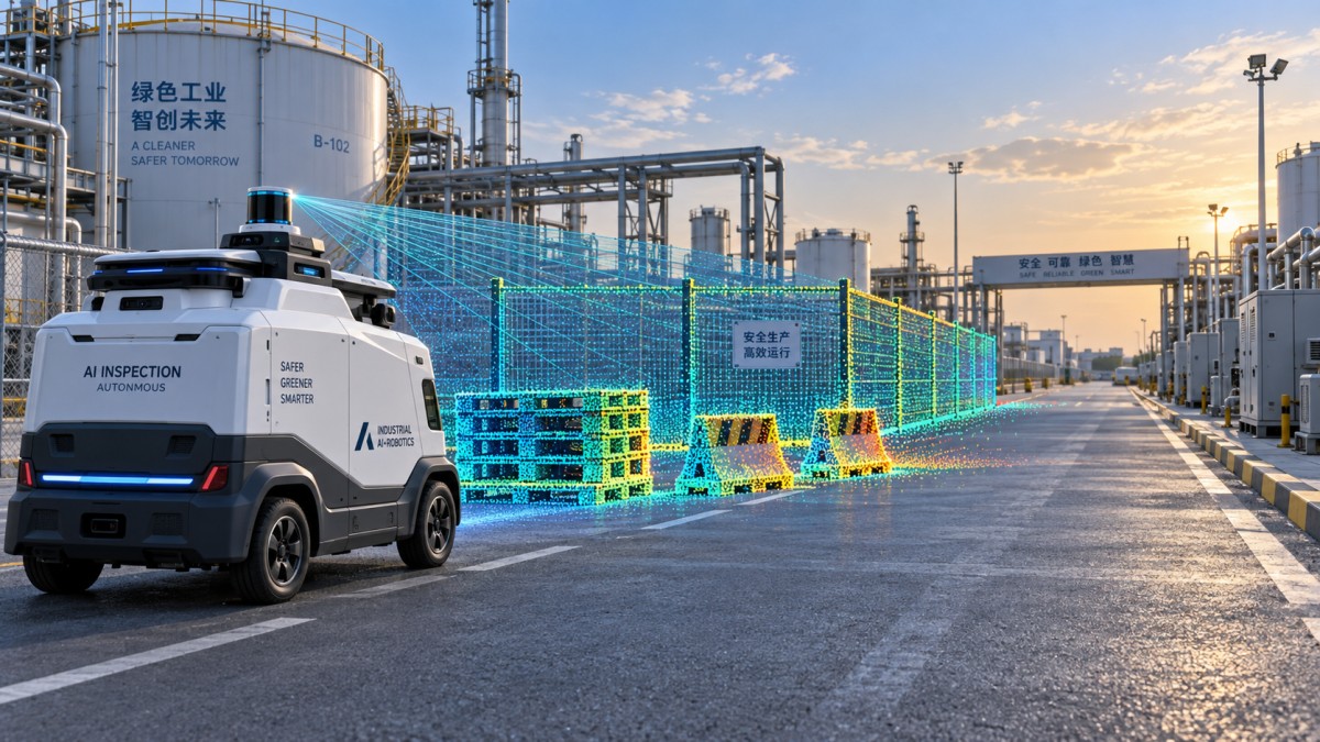
Horizontal and vertical field of view should be assessed in relation to the vehicle body, suspension motion, expected terrain, and camera or radar coverage. A wide horizontal view is valuable for maneuvering and cross-traffic detection, but it may distribute a fixed point budget over a larger area. A narrower forward-facing unit may offer better detail at distance, yet leave lateral blind zones during turns.
Vertical coverage is often underestimated. For outdoor vehicles, the sensor must handle changes in grade, curbs, ramps, potholes, tall grass, loading areas, and objects that enter the path from above or below the nominal scan plane. A LiDAR mounted high on a vehicle can see farther over small obstacles, but may miss close-range ground hazards or create self-occlusion from the roofline, bumper, payload, or protective housing. A low-mounted unit improves near-field ground coverage but is more exposed to mud, splash, and dust.
Multiple sensors can solve coverage gaps, but they create their own requirements: time synchronization, extrinsic calibration, overlapping fields for validation, additional network bandwidth, and more failure modes. Add a second sensor because it closes a documented perception gap, not simply because a coverage diagram looks incomplete.
Test the conditions that cause degradation
Outdoor performance is governed by more than optical range. Rain droplets, airborne dust, fog, dirt on the window, vibration, temperature variation, and electrical noise can alter the usable signal or the mechanical stability of the installation. A hardware evaluation should identify how the sensor fails, how quickly performance changes, and whether the vehicle can recognize the degraded state.
Environmental ratings can indicate intended exposure, but they do not replace vehicle-level tests. The installed sensor sees different airflow, heat buildup, vibration frequencies, and contamination patterns than a standalone laboratory unit. Test the production-intent enclosure, mount, harness, and cleaning arrangement together. A good sensor mounted behind an optically unsuitable protective window can become a poor sensing system.
Inspect point-cloud quality, not just point count
Point rate and frame rate are useful only when they translate into perception quality. High point counts can include noise, redundant points, or measurements concentrated in areas that do not help the driving task. Review raw or minimally processed captures from representative scenes and look for several characteristics: stable ground returns, continuous edges on relevant objects, low ghosting around reflective surfaces, sensible behavior at range boundaries, and repeatable geometry across consecutive frames.
Angular resolution matters because it governs object separation. If two hazards merge into a sparse cluster at the required stopping distance, the detector may receive insufficient shape information even though the sensor technically reports a target. Assess both horizontal and vertical sampling. A scan pattern with uneven density may work well when aligned with the expected driving corridor but perform poorly when objects approach from the side.
Range accuracy and repeatability should also be separated. A small consistent offset can often be modeled or calibrated. Random variation, intermittent dropouts, and frame-to-frame jitter are harder for localization and tracking systems to manage. For moving vehicles, timing quality is equally important. The perception stack needs a clear understanding of when each measurement was taken and whether the sensor provides reliable timestamps that can be synchronized with cameras, inertial sensors, wheel odometry, and vehicle control.
Evaluate integration as part of the hardware decision
A LiDAR unit that is optically capable but difficult to integrate can add more project risk than a slightly less ambitious alternative with a mature interface. Confirm the data interface, packet format, configuration workflow, power requirements, connector type, thermal path, software development tools, and diagnostic outputs before final selection.
Network load is easy to overlook. Raw point-cloud output, multiple sensors, cameras, and other edge devices may compete for bandwidth and processing capacity. Determine whether the sensor can provide the data modes needed for development and production. Some teams need raw returns for algorithm tuning; others prioritize filtered data, object lists, or a lower-bandwidth operational mode. The correct choice depends on where perception responsibilities sit in the system and how much control the team needs over filtering and classification.
Mechanical integration should be reviewed with the vehicle designer early. Check the sensor's optical reference point, physical envelope, service access, cable bend radius, sealing strategy, and mounting tolerances. Small changes in pitch, yaw, or height can affect near-field visibility and calibration. A mount should be stiff enough to preserve alignment under vibration, yet practical to inspect and replace without rebuilding the front of the vehicle.
Do not confuse sensor health reporting with system safety
Diagnostics are valuable when they reveal problems that affect usable perception: blocked optics, communication loss, internal temperature limits, timing faults, degraded returns, or calibration issues. However, a health flag alone does not establish whether the vehicle can still operate safely. The system needs a defined response when LiDAR confidence falls below the required level.
That response may be reduced speed, a controlled stop, fallback to another sensing modality, or restricted operation in defined areas. The appropriate behavior depends on the vehicle's design and operating environment. The important selection question is whether the hardware exposes enough status information, with usable timing, for the vehicle controller to make that decision.
This is also where redundant sensing should be evaluated carefully. Camera, radar, ultrasonic sensing, and additional LiDAR units have different strengths and failure patterns. Redundancy is meaningful when the alternate sensor can support a clearly defined fallback behavior under the condition that degraded the primary unit. Two sensors that share the same contamination exposure or blind zone may improve availability less than expected.
A practical validation sequence before purchase
Short supplier demonstrations rarely reproduce the conditions that determine field reliability. Build an acceptance plan around the vehicle's route, speed, object set, and maintenance model. The plan should produce comparable evidence across shortlisted units rather than relying on subjective impressions.
- Define the operational envelope. Document terrain, maximum speed, stopping behavior, expected light conditions, weather exposure, object types, and allowable downtime.
- Convert it into measurable perception cases. Include low-reflectivity objects, close-range hazards, partially occluded targets, turns, slopes, and representative background surfaces.
- Evaluate raw behavior first. Capture point clouds before aggressive downstream filtering hides sensor artifacts or dropouts.
- Run installed tests. Use the intended mount, protective cover, harness, compute platform, and synchronization arrangement.
- Measure degraded behavior. Observe contamination, sun exposure, vibration, and temperature transitions, then define the vehicle response to each condition.
- Review lifecycle support. Consider firmware control, documentation quality, configuration stability, replacement process, and the ability to maintain calibration over the vehicle's service life.
For benchmarking work, the comparison is most useful when every supplier is tested against the same target materials, approach angles, lighting conditions, and integration constraints. TechStat Vanguard's engineering-first approach is relevant here: parameter tables become decision evidence only when measurement conditions are explicit. A range figure without target reflectivity, a point-cloud image without distance, or an environmental claim without installed-system validation should not carry the same weight as repeatable test data.
Choose the sensor that supports the full operating model
There is no universal specification threshold for outdoor autonomy. A low-speed campus shuttle, an agricultural rover, an industrial yard vehicle, and an autonomous inspection platform may all select different LiDAR layouts for sound engineering reasons. The appropriate hardware balances required detection performance with field of view, environmental resilience, latency, compute load, mounting feasibility, maintenance effort, and failure handling.
Make the final decision from the weakest credible operating condition, not the strongest demonstration. When the sensor, enclosure, software, and vehicle response are evaluated as one perception system, the selection becomes more defensible and far less dependent on marketing language.
Search News
Hot Articles
- Carbon Fiber StructuresHow to Specify Aerospace Carbon Fiber Assemblies for Lightweight, Load-Bearing PartsJul 11, 2026
- Machine VisionXiaomi, Alibaba DAMO Academy Drive Open-Source Robotics Model Ecosystem, Lowering Algorithm Development Barriers for Overseas SMEs Adopting Chinese Robotics SolutionsMar 30, 2026
- Cobots & ArmsShanxi 'AI+' Conference Showcases Embodied Intelligence with Multinational Buyer Engagement: Key Industry ImplicationsMar 30, 2026
Popular Tags
Recommended News
 Jul 11, 2026How to Specify Aerospace Carbon Fiber Assemblies for Lightweight, Load-Bearing PartsAerospace carbon fiber assemblies: learn how to specify laminate design, load data, joining methods, and inspection controls for lighter, reliable load-bearing aerospace parts.Elena Rostova (UAV Systems Researcher)
 Mar 30, 2026Xiaomi, Alibaba DAMO Academy Drive Open-Source Robotics Model Ecosystem, Lowering Algorithm Development Barriers for Overseas SMEs Adopting Chinese Robotics SolutionsXiaomi & Alibaba DAMO Academy's open-source robotics models lower algorithm barriers for global SMEs. Boost efficiency in manufacturing, logistics & smart retail with ROS 2 compatible solutions.TSV Data Lab
 Mar 30, 2026Shanxi 'AI+' Conference Showcases Embodied Intelligence with Multinational Buyer Engagement: Key Industry ImplicationsShanxi 'AI+' Conference highlights embodied intelligence with Tesla, Ubtech & Jiantao showcasing multimodal robotics. 40+ global buyers validated tech on-site, creating new B2B channels for industrial automation & AI solutions.Chen Wei (Automation Lead Engineer)
 Mar 30, 2026Zhongguancun Unveils 6G Integrated Sensing-Computing-Intelligence Platform to Empower Embodied Robots for Global Industrial ApplicationsZhongguancun's new 6G platform revolutionizes industrial robotics with <10ms latency, empowering global automotive, logistics & port automation. Discover how this tech boosts China's smart manufacturing exports.TSV Data Lab
 Mar 30, 2026Mech-Mind Tianjin Embodied Intelligence R&D and Production Base Goes Live, Cutting Delivery Time by 20%–30% for Global Customized AMR+Vision SolutionsMech-Mind's Tianjin AMR+Vision production base cuts delivery time by 20%-30% for欧美 & Latin American markets. Discover how this PLd-certified facility accelerates customized robotics solutions for smart manufacturing and logistics.Chen Wei (Automation Lead Engineer)
 Mar 30, 2026Boao Forum Reveals 'Co-evolution of Big and Small Brains' Trend in Humanoid Robots, China's Embodied Intelligence Accelerates Adaptation to Overseas Manufacturing Service ScenariosDiscover how China's humanoid robots, featuring 'Co-evolution of Big and Small Brains,' are revolutionizing global manufacturing. Learn about Embodied Tian Gong 3.0's ISO compliance and overseas deployment at Boao Forum 2026.Chen Wei (Automation Lead Engineer)
 Mar 30, 2026China Railway Industrial Secures Patent for Embodied Robotics in Material Handling, Boosting High-Precision Delivery Capabilities for Overseas Infrastructure and Manufacturing ProjectsChina Railway Industrial's new patent for embodied robotics in material handling boosts high-precision delivery for global infrastructure & manufacturing. Discover how this innovation enhances logistics accuracy in automotive, rail transit & EPC projects.Chen Wei (Automation Lead Engineer)
 Sep 30, 2026How to Evaluate Solid-State LiDAR Hardware for Outdoor Autonomous VehiclesSolid state LiDAR hardware evaluation guide for outdoor autonomous vehicles—compare range, point-cloud quality, environmental resilience, integration, and safety.TSV Data Lab
 Sep 29, 2026ISO 9283 Repeatability: How to Evaluate Cobot Positioning PerformanceISO 9283 cobot repeatability explained: learn how payload, reach, approach direction, and test conditions affect positioning performance and cell capability.Chen Wei (Automation Lead Engineer)
 Sep 29, 2026How Do You Verify Servo Motor Torque Under Continuous Load?How do I verify servo motor torque under continuous load? Learn RMS torque checks, torque-speed limits, thermal derating, and real-machine testing.Chen Wei (Automation Lead Engineer)
 Sep 28, 2026Spindle Runout Measurement in Germany: DIN Standards, Methods, and Acceptance LimitsSpindle runout measurement Germany: explore DIN standards, proven methods, acceptance limits, and audit-ready practices for reliable machining quality.Dr. Marcus Vance
 Sep 27, 2026How to Select Wall-Mount Edge Devices for Space-Constrained Factory NetworksWall mount edge devices for space-constrained factories: evaluate workload, thermal design, power resilience, cable access, and network reliability for smarter deployments.TSV Data Lab
 Sep 26, 2026Machining Tolerance Analysis: How to Set Limits That Meet Function and Cost TargetsMachining tolerance analysis: learn how to set functional limits, control tolerance stacks, reduce inspection risk, and balance precision with production cost.Dr. Marcus Vance
 Sep 25, 2026How to Evaluate an Industrial Infrastructure Data Platform for Multi-Site OperationsIndustrial infrastructure data platform evaluation guide for multi-site operations: compare data quality, edge resilience, interoperability, governance, and scalable proof-of-value criteria.Victor Lin (Chief Software Architect)
 Sep 24, 2026How to Select Machine Vision Optics for Accurate Inspection at Different Working DistancesMachine vision optics selection guide for accurate inspection at every working distance. Compare FOV, pixel scale, DOF, distortion, lighting, and telecentric options.TSV Data Lab
 Sep 23, 2026How to Evaluate a Machine Vision System Integrator for High-Speed Inspection LinesChoose a machine vision system integrator with proven expertise in high-speed inspection, reliable reject timing, robust optics, and measurable acceptance criteria.TSV Data Lab
 Sep 29, 2026How MES and OEE work together to identify production lossesMES and OEE work together to uncover hidden production losses, connect downtime, speed, and quality data, and drive smarter shop-floor improvements.Victor Lin (Chief Software Architect)
 Sep 28, 2026When is a SCADA API the right choice for connecting plant systems?SCADA API guide: learn when governed plant data integration improves traceability, security, and scalability—without compromising real-time control.Victor Lin (Chief Software Architect)
 Sep 27, 2026How SCADA data integration improves traceability across production linesSCADA data integration connects production-line data to improve traceability, accelerate quality investigations, and strengthen safety decisions.Victor Lin (Chief Software Architect)
 Sep 26, 2026What to define before starting SCADA integration planningSCADA integration planning starts with clear scope, control boundaries, data models, cybersecurity, and testing. Discover the definitions that reduce risk and costly rework.Victor Lin (Chief Software Architect)
 Sep 25, 2026How a smart factory with Industrial IoT reduces production blind spotsDiscover how a smart factory with Industrial IoT turns real-time machine, quality, and workflow data into actionable insights that reduce production blind spots and delivery risks.Victor Lin (Chief Software Architect)
 Sep 24, 2026When does Industrial IoT make smart manufacturing easier to scale?Smart manufacturing Industrial IoT scales when trusted data, interoperable systems, and secure workflows turn connected assets into measurable gains.TSV Data Lab
 Sep 23, 2026What drives ultra-precision machining cost at 1-micron tolerance?Ultra precision machining cost per part at 1 micron tolerance depends on process, material, metrology, and yield. Learn how to compare quotes confidently.Dr. Marcus Vance
 Sep 22, 2026Drone Engine-T550CC Applications: Build the UAV Power System Around the MissionAn application guide for Drone Engine-T550CC integration, covering payload planning, airframe matching, cooling, fuel, vibration, test procedures, documentation, and service preparation.Elena Rostova (UAV Systems Researcher)