Mapping Drone for Construction Survey: Accuracy, Flight Time, and Payload Factors
Publication Date
author
Choosing a mapping drone for construction survey work now affects far more than aerial coverage. It shapes measurement confidence, rework risk, schedule control, and how quickly teams can turn field conditions into decisions.
That is why the conversation has moved beyond camera resolution alone. In practice, accuracy, flight time, and payload define whether a dataset supports engineering judgement or creates expensive ambiguity.
For a data-first platform such as TechStat Vanguard, the useful question is straightforward: which parameters actually determine whether a mapping drone for construction survey delivers reliable, repeatable site intelligence?
Why construction teams are looking harder at drone mapping data
Construction projects now run on tighter sequencing, denser documentation, and faster reporting cycles. Earthworks, utilities, concrete progress, stockpile volumes, and as-built verification all depend on current site data.
The pressure comes from multiple directions. Owners want traceable progress. Contractors need fewer site revisits. Consultants need models that align with ground control, design files, and downstream software.
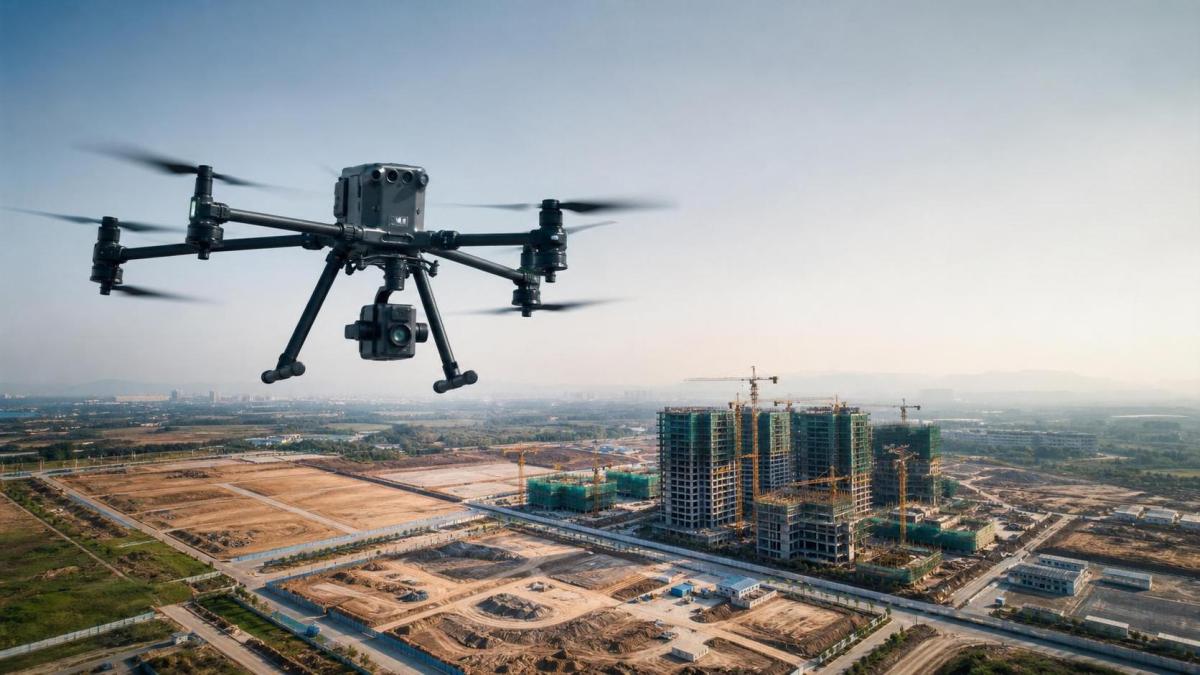
In that environment, a mapping drone for construction survey is not simply a flying camera. It is a field data acquisition platform connected to estimation, planning, claims support, and quality control.
This is also where market noise becomes a problem. Marketing terms often hide the real variables: positional consistency, sensor stability, mission efficiency, and payload suitability for the site condition.
What a mapping drone for construction survey really needs to do
At a basic level, the platform must capture images or spatial data with enough geometric reliability to produce usable outputs. Those outputs usually include orthomosaics, point clouds, surface models, and volume calculations.
However, useful does not always mean maximum precision. A weekly cut-and-fill update needs one level of confidence. Structural facade inspection or control point validation may require another.
The right mapping drone for construction survey therefore depends on tolerances, not general promises. TSV’s position is consistent with hard-tech procurement logic: parameters matter more than adjectives.
Three outputs matter most
- Survey-grade relative accuracy for surfaces, boundaries, and elevation changes.
- Operational endurance that matches the site scale and weather window.
- Payload flexibility that fits optical mapping, oblique capture, or LiDAR workflows.
Accuracy is the first filter, but not a single number
Accuracy in drone surveying is often compressed into one advertised specification. That is rarely enough for construction decisions. A more useful view separates absolute accuracy, relative accuracy, and repeatability between missions.
Absolute accuracy affects how well the map aligns to a known coordinate system. Relative accuracy matters when comparing grades, slopes, and object placement within the same dataset. Repeatability matters when progress is tracked over time.
RTK or PPK capability can improve georeferencing, but they do not eliminate the need for disciplined field practice. Ground control points, checkpoint verification, flight planning, and stable camera calibration still influence results.
Construction sites also create complications that brochure specs rarely mention. Dust, reflective surfaces, rebar, elevation changes, moving equipment, and incomplete features can degrade model quality even when GNSS performance looks acceptable.
Where accuracy usually breaks down
- Poor overlap planning across irregular site boundaries.
- Insufficient checkpoints for independent validation.
- Wind-induced blur or gimbal instability during low-light flights.
- Using a wide-area platform for detail work requiring denser capture.
A capable mapping drone for construction survey should therefore be judged by the quality system around the sensor, not only by megapixels or claimed centimeter performance.
Flight time decides whether the data plan survives site reality
Published endurance figures are usually based on ideal conditions. Construction surveying happens in crosswinds, heat, uneven launch areas, constrained airspace, and compressed work windows.
That makes effective flight time more important than laboratory flight time. Effective time includes transit, turning, reserve margin, sensor draw, and the lost minutes caused by battery swaps and setup interruptions.
On a large linear project, endurance can determine whether one mission captures a full corridor or leaves gaps requiring another mobilization. On a dense urban site, shorter flights may be acceptable if positioning and image geometry stay consistent.
This is why fixed-wing and multirotor platforms solve different problems. Fixed-wing systems usually cover more area per flight. Multirotors are better where vertical detail, tight takeoff zones, or repeated low-altitude passes matter.
Payload is where mission intent becomes clear
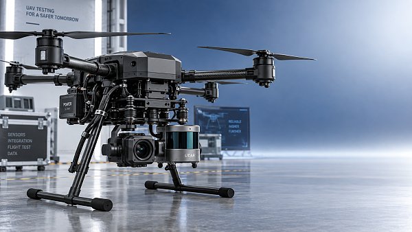
Payload is often treated as a secondary detail, yet it defines what kind of survey is actually possible. A mapping drone for construction survey may carry RGB, oblique, thermal, multispectral, or LiDAR payloads.
For many civil sites, a calibrated RGB camera remains the most economical starting point. It supports topographic mapping, progress records, haul-road visibility, and stockpile measurement when the surface is visible and textured.
LiDAR becomes more relevant where vegetation, complex grade transitions, or low-texture surfaces limit photogrammetry. It also helps when faster surface extraction matters more than visual realism.
Heavier or more advanced payloads introduce tradeoffs. Endurance falls, costs rise, calibration demands increase, and data processing becomes more specialized. The benefit must match a measurable site requirement.
Payload questions worth asking
- Does the mission require realistic imagery, surface penetration, or dense elevation capture?
- Can the airframe support the sensor without compromising stability?
- Will processing software integrate with current BIM, GIS, or quantity workflows?
- Is the added payload solving a recurring problem or a rare exception?
How these factors play out across common construction scenarios
The best mapping drone for construction survey depends on the business question behind the flight. Different site tasks reward different parameter balances.
Earthwork and volume management
Accuracy and repeatability dominate here. Small elevation errors can distort quantity calculations. Broad coverage also matters, since borrow pits, fill zones, and stockpiles may span large, changing footprints.
Road, rail, and utility corridors
Flight time becomes critical. Long linear assets reward efficient missions and fewer launch cycles. Payload choice depends on vegetation, terrain complexity, and required asset visibility.
Commercial buildings and industrial plants
Payload flexibility and maneuverability matter more. Oblique capture, facade detail, and tighter airspace call for stable low-speed performance rather than maximum area coverage.
Claims support and progress documentation
Repeatable mission plans are essential. The point is not only to create attractive maps, but to preserve defensible records that align with dates, coordinates, and site status.
A practical evaluation framework
When comparing platforms, it helps to reduce the decision to measurable thresholds. That is consistent with TSV’s broader approach to hard-tech sourcing: separate operational claims from engineering evidence.
Start by defining the tolerances that matter to the project. Then match those tolerances to capture method, endurance requirement, and payload type.
- Set acceptable horizontal and vertical error ranges.
- Estimate real mission area per battery under local conditions.
- Specify whether RGB is sufficient or LiDAR is justified.
- Check integration with processing, CAD, BIM, and reporting tools.
- Review maintenance, battery logistics, and pilot training burden.
This process usually reveals whether a lower-cost platform is enough, or whether a more advanced mapping drone for construction survey will reduce rework and shorten the qualification cycle.
What to do next with the shortlist
A shortlist should be tested against one real site use case, not just brochure comparisons. Run the same corridor, stockpile field, or building zone through two candidate workflows and compare the outputs.
Look at checkpoint error, coverage efficiency, processing time, and how easily the data supports quantity review or as-built verification. That will tell more than generic ranking tables.
The most useful mapping drone for construction survey is the one that consistently turns site capture into decisions with traceable confidence. Once the required tolerances, endurance, and payload logic are clear, the market becomes far easier to judge.
Search News
Hot Articles
- Carbon Fiber StructuresHow to Specify Aerospace Carbon Fiber Assemblies for Lightweight, Load-Bearing PartsJul 11, 2026
- Machine VisionXiaomi, Alibaba DAMO Academy Drive Open-Source Robotics Model Ecosystem, Lowering Algorithm Development Barriers for Overseas SMEs Adopting Chinese Robotics SolutionsMar 30, 2026
- Cobots & ArmsShanxi 'AI+' Conference Showcases Embodied Intelligence with Multinational Buyer Engagement: Key Industry ImplicationsMar 30, 2026
Popular Tags
Recommended News
 Jul 11, 2026How to Specify Aerospace Carbon Fiber Assemblies for Lightweight, Load-Bearing PartsAerospace carbon fiber assemblies: learn how to specify laminate design, load data, joining methods, and inspection controls for lighter, reliable load-bearing aerospace parts.Elena Rostova (UAV Systems Researcher)
 Mar 30, 2026Xiaomi, Alibaba DAMO Academy Drive Open-Source Robotics Model Ecosystem, Lowering Algorithm Development Barriers for Overseas SMEs Adopting Chinese Robotics SolutionsXiaomi & Alibaba DAMO Academy's open-source robotics models lower algorithm barriers for global SMEs. Boost efficiency in manufacturing, logistics & smart retail with ROS 2 compatible solutions.TSV Data Lab
 Mar 30, 2026Shanxi 'AI+' Conference Showcases Embodied Intelligence with Multinational Buyer Engagement: Key Industry ImplicationsShanxi 'AI+' Conference highlights embodied intelligence with Tesla, Ubtech & Jiantao showcasing multimodal robotics. 40+ global buyers validated tech on-site, creating new B2B channels for industrial automation & AI solutions.Chen Wei (Automation Lead Engineer)
 Mar 30, 2026Zhongguancun Unveils 6G Integrated Sensing-Computing-Intelligence Platform to Empower Embodied Robots for Global Industrial ApplicationsZhongguancun's new 6G platform revolutionizes industrial robotics with <10ms latency, empowering global automotive, logistics & port automation. Discover how this tech boosts China's smart manufacturing exports.TSV Data Lab
 Mar 30, 2026Mech-Mind Tianjin Embodied Intelligence R&D and Production Base Goes Live, Cutting Delivery Time by 20%–30% for Global Customized AMR+Vision SolutionsMech-Mind's Tianjin AMR+Vision production base cuts delivery time by 20%-30% for欧美 & Latin American markets. Discover how this PLd-certified facility accelerates customized robotics solutions for smart manufacturing and logistics.Chen Wei (Automation Lead Engineer)
 Mar 30, 2026Boao Forum Reveals 'Co-evolution of Big and Small Brains' Trend in Humanoid Robots, China's Embodied Intelligence Accelerates Adaptation to Overseas Manufacturing Service ScenariosDiscover how China's humanoid robots, featuring 'Co-evolution of Big and Small Brains,' are revolutionizing global manufacturing. Learn about Embodied Tian Gong 3.0's ISO compliance and overseas deployment at Boao Forum 2026.Chen Wei (Automation Lead Engineer)
 Mar 30, 2026China Railway Industrial Secures Patent for Embodied Robotics in Material Handling, Boosting High-Precision Delivery Capabilities for Overseas Infrastructure and Manufacturing ProjectsChina Railway Industrial's new patent for embodied robotics in material handling boosts high-precision delivery for global infrastructure & manufacturing. Discover how this innovation enhances logistics accuracy in automotive, rail transit & EPC projects.Chen Wei (Automation Lead Engineer)
 Sep 27, 2026How to Select Wall-Mount Edge Devices for Space-Constrained Factory NetworksWall mount edge devices for space-constrained factories: evaluate workload, thermal design, power resilience, cable access, and network reliability for smarter deployments.TSV Data Lab
 Sep 26, 2026Machining Tolerance Analysis: How to Set Limits That Meet Function and Cost TargetsMachining tolerance analysis: learn how to set functional limits, control tolerance stacks, reduce inspection risk, and balance precision with production cost.Dr. Marcus Vance
 Sep 25, 2026How to Evaluate an Industrial Infrastructure Data Platform for Multi-Site OperationsIndustrial infrastructure data platform evaluation guide for multi-site operations: compare data quality, edge resilience, interoperability, governance, and scalable proof-of-value criteria.Victor Lin (Chief Software Architect)
 Sep 24, 2026How to Select Machine Vision Optics for Accurate Inspection at Different Working DistancesMachine vision optics selection guide for accurate inspection at every working distance. Compare FOV, pixel scale, DOF, distortion, lighting, and telecentric options.TSV Data Lab
 Sep 23, 2026How to Evaluate a Machine Vision System Integrator for High-Speed Inspection LinesChoose a machine vision system integrator with proven expertise in high-speed inspection, reliable reject timing, robust optics, and measurable acceptance criteria.TSV Data Lab
 Sep 27, 2026How SCADA data integration improves traceability across production linesSCADA data integration connects production-line data to improve traceability, accelerate quality investigations, and strengthen safety decisions.Victor Lin (Chief Software Architect)
 Sep 26, 2026What to define before starting SCADA integration planningSCADA integration planning starts with clear scope, control boundaries, data models, cybersecurity, and testing. Discover the definitions that reduce risk and costly rework.Victor Lin (Chief Software Architect)
 Sep 25, 2026How a smart factory with Industrial IoT reduces production blind spotsDiscover how a smart factory with Industrial IoT turns real-time machine, quality, and workflow data into actionable insights that reduce production blind spots and delivery risks.Victor Lin (Chief Software Architect)
 Sep 24, 2026When does Industrial IoT make smart manufacturing easier to scale?Smart manufacturing Industrial IoT scales when trusted data, interoperable systems, and secure workflows turn connected assets into measurable gains.TSV Data Lab
 Sep 23, 2026What drives ultra-precision machining cost at 1-micron tolerance?Ultra precision machining cost per part at 1 micron tolerance depends on process, material, metrology, and yield. Learn how to compare quotes confidently.Dr. Marcus Vance
 Sep 22, 2026Drone Engine-T550CC Applications: Build the UAV Power System Around the MissionAn application guide for Drone Engine-T550CC integration, covering payload planning, airframe matching, cooling, fuel, vibration, test procedures, documentation, and service preparation.Elena Rostova (UAV Systems Researcher)
 Sep 22, 2026How to Evaluate Industrial Edge Computing Vendors for Factory DeploymentIndustrial edge computing vendor evaluation guide for factories: compare latency, protocol fit, reliability, security, and lifecycle support before deployment.TSV Data Lab
 Sep 21, 2026Drone Payload Integration: Matching Power, Data, and Center of Gravity for Reliable FlightsDrone payload integration made practical: balance power, data, center of gravity, and endurance to build safer, more reliable mission-ready flights.Elena Rostova (UAV Systems Researcher)
 Sep 20, 2026Autonomous Navigation Pricing: Cost Drivers and Budget Benchmarks for AMR ProjectsAutonomous navigation price explained: compare AMR cost drivers, software, sensors, integration, safety, and lifecycle budgets to build a scalable project plan.Chen Wei (Automation Lead Engineer)
 Sep 19, 2026How to Scope Automation Integration Services for Multi-System Factory ProjectsAutomation integration services: learn how to scope multi-system factory projects with clear workflows, interface contracts, safety boundaries, and acceptance criteria.Victor Lin (Chief Software Architect)
 Sep 18, 2026Selecting UAV Aerospace Structural Parts for Strength, Weight, and Fatigue LifeUAV aerospace structural parts guide: compare strength, weight, stiffness, fatigue life, joints, and traceability to select reliable flight-ready components.Elena Rostova (UAV Systems Researcher)
 Sep 17, 2026Selecting Commercial Drone Payloads for European Inspection ProjectsCommercial drone payloads Europe: learn how to select RGB, thermal and LiDAR systems for compliant, reliable inspection data and better project outcomes.Elena Rostova (UAV Systems Researcher)