Drone thermal camera resolution comparison that actually helps
Publication Date
author
If you are weighing a drone thermal camera resolution comparison for real field work, the answer is not just pixel count. For teams evaluating a vtol drone for pipeline inspection or planning around tethered uav continuous flight time, resolution directly affects defect visibility, inspection speed, and procurement risk. This guide focuses on practical engineering trade-offs that actually support better technical and buying decisions.
Why thermal resolution changes inspection outcomes more than many buyers expect
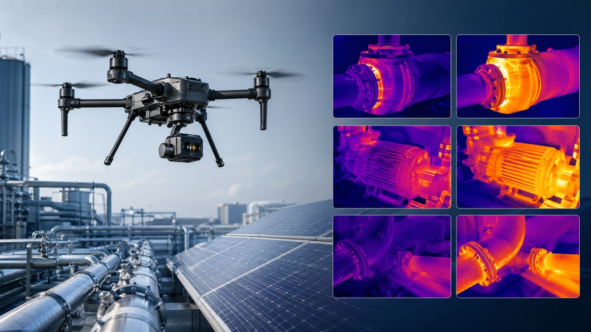
A useful drone thermal camera resolution comparison starts with one question: what defect size must your team detect at what distance? In UAV inspection, a 160×120 thermal core, a 320×256 sensor, and a 640×512 sensor do not simply represent three price points. They represent different limits in anomaly detection, flight planning, reporting confidence, and rework risk across power lines, tanks, rooftops, solar arrays, and pipeline corridors.
This matters to four different stakeholders at once. Researchers need trustworthy parameter logic. Operators need images they can actually interpret in wind, glare, and uneven terrain. Procurement teams need a defensible specification sheet. Enterprise decision-makers need to avoid overbuying for simple surveys and underbuying for compliance-critical inspection. In practice, thermal resolution sits at the center of all four concerns.
TechStat Vanguard approaches the topic from an engineering benchmark perspective rather than a marketing one. The real issue is not whether a higher-resolution thermal payload sounds advanced. The issue is whether it reduces trial cycles, lowers false negatives, and matches the operational envelope of the airframe, whether that platform is a multirotor, a vtol drone for pipeline inspection, or a tethered uav built for long-duration monitoring.
In many field programs, the thermal decision also affects mission structure. A low-resolution sensor may require shorter stand-off distance, more flight lines, and more image review time. A higher-resolution unit may reduce the number of passes by 20%–40% in broad-area inspection planning, but only when altitude, lens choice, target emissivity, and reporting workflow are aligned. That is why resolution should never be read in isolation.
Three questions that define the right resolution band
- What is the minimum defect footprint you need to see: a hot connector, a leaking valve area, insulation voids, or broad heat loss across a roof section?
- What is the normal inspection distance or altitude: close manual hover, 30–60 m corridor inspection, or extended-range survey from a safer offset?
- How will the images be used after flight: rapid maintenance triage, formal engineering reporting, supplier verification, or evidence for asset management decisions?
When teams answer those three questions clearly, the drone thermal camera resolution comparison becomes much easier. It shifts from generic product browsing to a measurable fit between sensor capability and operating requirement.
What do common thermal resolutions really mean in field conditions?
The table below summarizes how common thermal sensor classes are typically understood in practical UAV operations. It does not replace a flight test, but it gives a reliable starting point for comparing payload suitability, especially when teams are balancing image detail, airframe endurance, and project cost.
A common mistake is to assume that 640×512 is always the right answer. If an operator is flying close-range building envelope surveys at modest altitude and only needs thermal pattern indication, a 320×256 system may be fully adequate. By contrast, if the mission involves a vtol drone for pipeline inspection where safer standoff and long linear coverage matter, the higher-resolution option becomes easier to justify.
Resolution also interacts with the lens and field of view. A wider view captures more area per frame but can dilute target detail. A narrower view improves target emphasis but may increase required passes. In real procurement work, teams should compare at least 4 variables together: sensor resolution, lens configuration, normal flight altitude, and required report evidence. Looking at only one number often creates avoidable mismatch.
Why pixel count is only one part of thermal image quality
For technical buyers, image quality is shaped by more than resolution. Sensitivity, calibration stability, refresh performance, environmental robustness, and software export options all influence whether a thermal payload supports repeatable decisions. In short, a better drone thermal camera resolution comparison includes both image detail and measurement reliability.
Key supporting parameters to review
- Thermal sensitivity and scene contrast handling, especially when temperature differences are small.
- Radiometric capability if the workflow requires temperature extraction instead of visual hotspot indication only.
- Frame rate and image stability during movement, particularly on faster corridor or perimeter missions.
- Data export, reporting, and integration with maintenance or GIS systems over a 6–24 month operational cycle.
These checks are especially important for procurement teams comparing supplier claims that use vague language such as “high precision” without clarifying whether the benefit comes from resolution, calibration, optics, or software processing.
Which resolution fits which scenario: roof, solar, pipeline, utility, and continuous monitoring
Different sectors create different thresholds for useful thermal detail. That is why the same sensor can feel underpowered in one workflow and completely sufficient in another. Teams comparing a drone thermal camera resolution comparison should map the sensor to mission geometry, not just to product catalog tiers.
For rooftop diagnostics and building envelope surveys, thermal pattern detection often matters more than pinpoint component identification. In these jobs, flight heights are usually moderate and targets are broad. A 320×256 payload often covers the middle ground well, especially for contractors who need a practical balance between image clarity and budget control over a 2–8 week project cycle.
For solar inspection, the requirement depends on whether the goal is fast hotspot screening or module-level anomaly reporting. Large solar fields benefit from efficient area coverage, yet small thermal deviations can matter. In many programs, 640×512 offers stronger confidence when teams must review a high volume of panels while minimizing repeat flights. However, for preliminary scanning and maintenance prioritization, 320×256 may still be acceptable.
For a vtol drone for pipeline inspection, the logic changes again. Linear assets extend for kilometers, safe standoff may be required, and wind conditions can reduce loiter quality. Higher thermal resolution can support longer-range interpretation and reduce the number of low-altitude verification passes. That becomes even more valuable where launch and recovery windows are tight and the cost of revisiting the site is high.
How tethered UAV operations affect resolution decisions
Tethered uav continuous flight time changes the inspection logic because endurance may move from tens of minutes to multi-hour station keeping, depending on the system architecture and site constraints. In that context, a lower-resolution sensor is not automatically enough. Continuous observation often means the customer expects persistent awareness, trend confirmation, and event capture quality that remains useful after the live feed ends.
A tethered setup for perimeter security, flare stack monitoring, industrial tank observation, or emergency standby can justify a 640×512 thermal camera if target interpretation must remain clear at extended stand-off. On the other hand, if the mission is mainly wide-area thermal watch with coarse anomaly detection, a 320×256 payload may deliver better cost efficiency. The key is to define whether the output is live awareness, evidence retention, or engineering analysis.
The table below helps match common scenarios to a practical resolution starting point. It is not a fixed rulebook, but it is a strong planning tool for discussions between operations, procurement, and management.
The practical lesson is simple: mission type decides whether extra pixels create real operational value. When the target is small, the stand-off is long, or the revisit cost is high, higher resolution tends to pay back faster. When the mission is broad screening with close access, mid-range resolution may be the more rational choice.
How procurement teams should compare thermal payloads without falling for vague claims
In B2B sourcing, the biggest risk is not choosing a cheaper payload. The bigger risk is approving a thermal package whose specification looks acceptable on paper but fails the first serious field deployment. Procurement should therefore evaluate a drone thermal camera resolution comparison as part of a full system review that includes aircraft, software, support, and reporting fit.
For many organizations, a practical buying process can be divided into 4 steps over roughly 2–6 weeks, depending on internal approval complexity. Step 1 is defining the defect detection goal. Step 2 is shortlisting the sensor class. Step 3 is checking compatibility with the chosen airframe, whether multirotor, vtol, or tethered. Step 4 is validating deliverables, training needs, and support boundaries before purchase order release.
This is where TSV’s data-first approach is valuable. Instead of relying on adjectives, teams should request verifiable operational parameters: thermal resolution, radiometric status, lens option, payload weight, export format, normal operating temperature range, endurance impact, and recommended flight envelope. That level of filtering shortens supplier qualification cycles and makes internal sign-off easier.
Five procurement checks that reduce downstream risk
- Confirm whether the use case requires qualitative thermal viewing or radiometric measurement for formal reporting.
- Review how the thermal payload changes flight time, especially if endurance margins are already tight by 10%–20%.
- Check image workflow: live stream only, onboard recording, post-processing software, and maintenance system export.
- Ask whether the supplier can describe the limits of the system in wind, distance, and low-contrast scenes instead of only listing headline strengths.
- Define acceptance criteria before purchase, such as minimum interpretable image quality at a given altitude or route speed.
Operators should also be involved early. A payload that looks excellent in a quotation can still create field friction if the gimbal response is slow, the software interface is awkward, or the image review process doubles the post-flight workload. Good selection is cross-functional, not purely financial.
Typical decision matrix for shortlisting
The matrix below can help teams compare options quickly across technical and commercial dimensions before requesting demos or formal quotations.
This type of matrix also helps enterprise decision-makers compare bids objectively. It shifts the conversation from “which one looks better” to “which one delivers the lowest technical uncertainty for the intended mission.”
Common misconceptions, compliance concerns, and practical implementation advice
One frequent misconception is that higher thermal resolution automatically means higher temperature accuracy. It does not. Resolution improves spatial detail, but temperature interpretation still depends on calibration, emissivity assumptions, environmental conditions, and operator method. Teams should separate visual detectability from measurement confidence during evaluation.
A second misconception is that one successful demo flight proves long-term suitability. Many issues only appear after repeated use over 3–6 months: image management burden, battery logistics, inconsistent operator settings, or weak integration with reporting systems. Pilot projects should therefore include not only flight tests but also post-flight data review and maintenance workflow validation.
Compliance considerations also deserve attention. Depending on jurisdiction and industry, UAV operations may involve aviation permissions, site safety procedures, data handling rules, and asset-owner reporting requirements. Where thermal results inform maintenance or safety decisions, teams should document inspection conditions, flight altitude, lens setting, weather context, and operator procedure to improve traceability.
Implementation works best when organizations define a 3-layer operating standard. Layer 1 covers equipment setup and pre-flight checks. Layer 2 covers mission profile, including speed, altitude, and image overlap. Layer 3 covers evidence handling and decision thresholds. Even simple internal structure can reduce interpretation drift between operators and improve repeatability across monthly or quarterly inspections.
FAQ: the questions buyers and operators ask most often
Is 320×256 enough for most industrial UAV thermal work?
For many routine tasks, yes. It often fits general building diagnostics, basic utility inspection, and entry-level solar review. It becomes less convincing when defect size is small, stand-off distance is large, or the report must support higher-stakes engineering decisions. In those cases, 640×512 usually offers stronger operational margin.
When does a vtol drone for pipeline inspection need higher thermal resolution?
Higher resolution is more justified when the route is long, hover time is limited, low-altitude rechecks are expensive, or the team must identify subtle anomalies while keeping safer separation from terrain or infrastructure. The longer and more complex the corridor, the more valuable extra image detail becomes.
Does tethered uav continuous flight time reduce the need for a better sensor?
Not necessarily. Longer endurance increases observation opportunity, but it does not improve image detail. If the site needs evidence-quality monitoring over hours rather than simple live awareness, the thermal payload still has to provide enough resolution for meaningful review after the event.
What is the safest way to validate a thermal payload before procurement?
Define 3–5 acceptance scenarios, such as rooftop scan, corridor pass, low-contrast target check, and reporting export test. Run the shortlisted payloads against those tasks at realistic altitude and speed. Then review not only the images but also operator workload, reporting time, and airframe endurance impact.
Why work with a data-driven technical benchmark partner
When thermal UAV buying decisions affect inspection quality, supplier qualification, and asset risk, generic product summaries are not enough. Teams need structured comparison logic. That is the value of a data-driven technical benchmark approach: it removes noise, clarifies parameters, and helps stakeholders make the same decision for the same reason.
TechStat Vanguard supports organizations that need engineering-grounded clarity across UAV and aerospace metrics, sensor evaluation, and hard-tech procurement reasoning. If your team is building a drone thermal camera resolution comparison, reviewing options for a vtol drone for pipeline inspection, or evaluating tethered uav continuous flight time against image-quality needs, the most useful next step is not a generic brochure. It is a parameter-level discussion tied to your mission profile.
You can contact us to discuss concrete decision items such as thermal resolution bands, payload compatibility, reporting requirements, expected delivery windows, pilot test criteria, and technical trade-offs between cost and defect visibility. We can also help structure a shortlist, define supplier questions, and turn field requirements into a clearer spec sheet for internal approval.
If you want to reduce R&D trial-and-error costs, shorten supplier qualification cycles, and base procurement on parameters rather than slogans, start the conversation with your inspection target, flight envelope, and reporting standard. That is where better UAV decisions begin.
Search News
Hot Articles
- Carbon Fiber StructuresHow to Specify Aerospace Carbon Fiber Assemblies for Lightweight, Load-Bearing PartsJul 11, 2026
- Machine VisionXiaomi, Alibaba DAMO Academy Drive Open-Source Robotics Model Ecosystem, Lowering Algorithm Development Barriers for Overseas SMEs Adopting Chinese Robotics SolutionsMar 30, 2026
- Cobots & ArmsShanxi 'AI+' Conference Showcases Embodied Intelligence with Multinational Buyer Engagement: Key Industry ImplicationsMar 30, 2026
Popular Tags
Recommended News
 Jul 11, 2026How to Specify Aerospace Carbon Fiber Assemblies for Lightweight, Load-Bearing PartsAerospace carbon fiber assemblies: learn how to specify laminate design, load data, joining methods, and inspection controls for lighter, reliable load-bearing aerospace parts.Elena Rostova (UAV Systems Researcher)
 Mar 30, 2026Xiaomi, Alibaba DAMO Academy Drive Open-Source Robotics Model Ecosystem, Lowering Algorithm Development Barriers for Overseas SMEs Adopting Chinese Robotics SolutionsXiaomi & Alibaba DAMO Academy's open-source robotics models lower algorithm barriers for global SMEs. Boost efficiency in manufacturing, logistics & smart retail with ROS 2 compatible solutions.TSV Data Lab
 Mar 30, 2026Shanxi 'AI+' Conference Showcases Embodied Intelligence with Multinational Buyer Engagement: Key Industry ImplicationsShanxi 'AI+' Conference highlights embodied intelligence with Tesla, Ubtech & Jiantao showcasing multimodal robotics. 40+ global buyers validated tech on-site, creating new B2B channels for industrial automation & AI solutions.Chen Wei (Automation Lead Engineer)
 Mar 30, 2026Zhongguancun Unveils 6G Integrated Sensing-Computing-Intelligence Platform to Empower Embodied Robots for Global Industrial ApplicationsZhongguancun's new 6G platform revolutionizes industrial robotics with <10ms latency, empowering global automotive, logistics & port automation. Discover how this tech boosts China's smart manufacturing exports.TSV Data Lab
 Mar 30, 2026Mech-Mind Tianjin Embodied Intelligence R&D and Production Base Goes Live, Cutting Delivery Time by 20%–30% for Global Customized AMR+Vision SolutionsMech-Mind's Tianjin AMR+Vision production base cuts delivery time by 20%-30% for欧美 & Latin American markets. Discover how this PLd-certified facility accelerates customized robotics solutions for smart manufacturing and logistics.Chen Wei (Automation Lead Engineer)
 Mar 30, 2026Boao Forum Reveals 'Co-evolution of Big and Small Brains' Trend in Humanoid Robots, China's Embodied Intelligence Accelerates Adaptation to Overseas Manufacturing Service ScenariosDiscover how China's humanoid robots, featuring 'Co-evolution of Big and Small Brains,' are revolutionizing global manufacturing. Learn about Embodied Tian Gong 3.0's ISO compliance and overseas deployment at Boao Forum 2026.Chen Wei (Automation Lead Engineer)
 Mar 30, 2026China Railway Industrial Secures Patent for Embodied Robotics in Material Handling, Boosting High-Precision Delivery Capabilities for Overseas Infrastructure and Manufacturing ProjectsChina Railway Industrial's new patent for embodied robotics in material handling boosts high-precision delivery for global infrastructure & manufacturing. Discover how this innovation enhances logistics accuracy in automotive, rail transit & EPC projects.Chen Wei (Automation Lead Engineer)
 Oct 26, 2026AMAXiMAL Releases Open-Source TopMod 3D v3 With Claude AIExplore AMAXiMAL’s free, open-source TopMod 3D v3 with Claude AI assistance, topology-based modeling and plywood fabrication tools that connect complex designs to physical builds.Dr. Marcus Vance
 Oct 26, 2026Choosing a SCADA System Integrator Company: PLC Compatibility and Long-Term SupportChoose a scada system integrator company with proven PLC compatibility and reliable long-term support. Discover what to test, compare, and require before investing.Victor Lin (Chief Software Architect)
 Oct 25, 2026Hesai Leads Global ADAS Main Lidar Shipments in Yole’s 2026 ReportHesai led global ADAS main lidar shipments with a 43% share in 2025, according to Yole’s 2026 report. Explore what this ranking reveals about its automotive market position.TSV Data Lab
 Oct 25, 2026Choosing an Aerospace Materials Manufacturer: Quality and Traceability ChecksChoosing an aerospace materials manufacturer? Learn how to verify certifications, test reports, and lot traceability to qualify suppliers confidently and reduce costly sourcing risks.Dr. Marcus Vance
 Oct 24, 2026Guotai Haitong: Global Entry-Level 3D Printer Shipments Rose 39% in Q1 2026Entry-level 3D printer shipments rose 39% in Q1 2026, Guotai Haitong reports. Explore how AI, multicolor printing and print farms are shaping market growth.Dr. Marcus Vance
 Oct 24, 2026Choosing an Industrial Vision Inspection Supplier: Acceptance Tests That MatterChoose an industrial vision inspection supplier with confidence. Discover acceptance tests for defect detection, false rejects, production speed, and reliable part rejection before you buy.TSV Data Lab
 Oct 23, 2026US Navy Raises Gecko Robotics Contract Ceiling to $300M for Robotic Fleet MaintenanceUS Navy raises Gecko Robotics’ contract ceiling to $300M for Pacific Fleet robotic inspections. Explore potential opportunities for maintenance suppliers and key procurement considerations.Chen Wei (Automation Lead Engineer)
 Oct 23, 2026Choosing Industrial Sensing Systems for Global Plants: Protocol CompatibilityCompare industrial sensing systems international buyers can trust. Explore protocol compatibility, reduce integration risks, and select proven configurations for reliable global plant deployments.TSV Data Lab
 Oct 22, 2026KUKA Showcases Physical AI and iiQKA.AI Vision at NVIDIA GTC BerlinExplore KUKA’s Physical AI showcase at NVIDIA GTC Berlin and discover how iiQKA.AI Vision aims to simplify robotic vision integration and improve 2D and 3D scene recognition.TSV Data Lab
 Oct 22, 2026Robotic Machining of Advanced Composites: What Tolerances Are Achievable?Explore advanced materials machining robotics: discover what drives achievable composite tolerances and how to validate accuracy before investing in your next machining system.Dr. Marcus Vance
 Oct 21, 2026China’s Industrial Robot Exports Near RMB 10 Billion in First Nine Months of 2026China’s industrial robot exports neared RMB 10 billion in January–September 2026, with value rising faster than volume. Explore the data and what it could mean for suppliers.Chen Wei (Automation Lead Engineer)
 Oct 21, 2026Low-Latency Industrial Data Processing: Pricing and Key Cost DriversExplore industrial data latency price drivers, from edge hardware to integration and support. Learn how to compare quotes, verify performance, and avoid unnecessary costs.TSV Data Lab
 Oct 20, 2026KUKA Launches iiQKA.AI Vision to Simplify Industrial Image ProcessingKUKA iiQKA.AI Vision simplifies industrial image processing with controller-based 2D and 3D vision. Explore drag-and-drop setup for vision-guided automation.TSV Data Lab
 Oct 20, 2026Smart Industrial Edge Devices: Key Criteria for Legacy PLC IntegrationChoose smart industrial edge devices for legacy PLC integration. Discover key criteria for compatibility, data quality, security, and reliable collection without disrupting control.TSV Data Lab
 Oct 19, 2026Choosing a Radar Sensor by Application: Range, Resolution, and Field of ViewSimplify radar sensor application based product selection. Compare range, resolution, and field of view to avoid blind spots and choose with confidence. Explore the guide.TSV Data Lab
 Oct 18, 2026Comparing Material Options for Procurement: Specs, Costs, and Supply RisksExplore procurement oriented technical content on material options, specs, costs, and supply risks. Compare alternatives to cut hidden expenses and make confident sourcing decisions.Dr. Marcus Vance
 Oct 17, 20265-Axis CNC Positioning Accuracy: How to Interpret ISO 230-2 Test ResultsAssess 5 axis CNC machining positioning accuracy with ISO 230-2. Learn to interpret repeatability, reversal error, and test conditions to compare suppliers and make confident acceptance decisions.Dr. Marcus Vance