How a drone telemetry range test can mislead field planning
Publication Date
author
A drone telemetry range test can look convincing in a lab sheet or marketing summary. Yet field planning often fails when that single result is treated as an operational guarantee.
Terrain masking, antenna orientation, payload changes, battery sag, and electromagnetic noise all reshape link behavior. A drone telemetry range test is useful, but only when translated into mission reality.
For data-driven engineering teams, the key question is not whether a benchmark exists. The real question is whether the benchmark reflects actual deployment constraints, safety reserves, and coverage assumptions.
What does a drone telemetry range test actually measure?
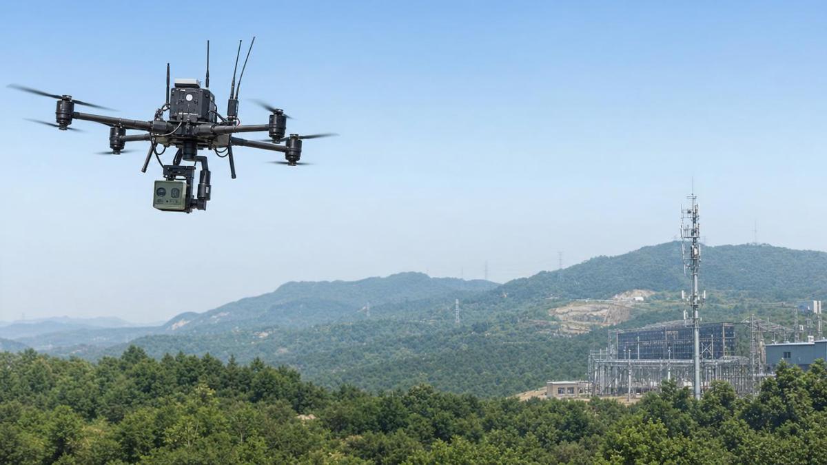
A drone telemetry range test usually measures command and data link stability over distance. It may include signal strength, packet loss, latency, and failsafe trigger points.
That sounds simple, but test conditions matter more than the headline number. Open fields, clear line of sight, fixed altitude, and low interference can produce very optimistic readings.
Many reports also isolate telemetry from video transmission, payload power draw, or autopilot workload. In practice, those factors interact and can shorten usable control distance.
A drone telemetry range test is therefore not a universal field radius. It is a controlled benchmark tied to a specific aircraft, firmware version, antenna setup, and environment.
Why the published number often feels larger than reality
- Line-of-sight is cleaner than real operating corridors.
- Ground reflections can temporarily improve results.
- Fresh batteries deliver stronger system performance.
- Empty payload bays reduce power and vibration stress.
- Single-direction flights do not reflect full mission geometry.
Why can a drone telemetry range test mislead field planning?
Field planning needs more than maximum distance. It needs reliable distance under changing conditions, with enough margin for return, contingency, and data integrity.
A drone telemetry range test can mislead planning when teams convert best-case distance into routine mission radius. That shortcut often shrinks safety buffers without anyone noticing.
Consider a corridor inspection near metal structures. Multipath reflections may create unstable packets even when nominal range still looks acceptable. The map says coverage exists. The mission says otherwise.
Or consider agricultural mapping. The outbound leg may look stable with tailwind and high battery voltage. The return leg can degrade after voltage drop, crosswind corrections, and increased processor load.
In both cases, the original drone telemetry range test was not false. It was simply incomplete for planning decisions.
Common planning errors linked to benchmark misuse
- Using maximum range as normal operating range.
- Ignoring altitude changes across the route.
- Assuming urban and rural interference are similar.
- Skipping retests after payload or antenna changes.
- Forgetting that telemetry quality affects automation confidence.
Which real-world variables most distort a drone telemetry range test?
Several variables consistently distort interpretation. These are not edge cases. They are normal operational conditions across infrastructure, surveying, emergency response, and industrial UAV programs.
1. Terrain and obstacles
Hills, tree lines, buildings, and towers interrupt line-of-sight. Even partial obstruction can cause sudden link degradation long before the benchmark distance is reached.
2. Electromagnetic interference
Industrial sites, substations, telecom infrastructure, and crowded urban bands can raise noise floors. A drone telemetry range test from a quiet location will not predict those effects well.
3. Payload and power budget
Additional sensors increase current draw and can alter center of gravity. That affects endurance, vibration, and thermal behavior, which indirectly influence communications stability.
4. Antenna placement and orientation
A small mounting change can create shadowing from carbon frames, batteries, or payloads. The drone telemetry range test may not remain valid after mechanical redesign.
5. Mission profile complexity
Hovering, turning, descending behind structures, or flying at uneven altitudes introduces link variability. Straight outbound tests rarely capture this behavior.
How should benchmark data be translated into operational planning?
The best approach is to treat a drone telemetry range test as a baseline, not a final answer. Then apply structured derating based on environment, aircraft configuration, and mission risk.
This aligns with TSV’s engineering-first philosophy. Parameters matter, but decision quality depends on context, traceability, and repeatable interpretation.
A practical translation workflow
- Document the exact test configuration and firmware.
- Match the benchmark against target terrain types.
- Apply a range derating factor for interference exposure.
- Retest with full payload and mission battery state.
- Include return-leg and emergency reserve assumptions.
- Validate packet stability, not only maximum distance.
For example, an 8-kilometer drone telemetry range test in ideal conditions may support only a much smaller routine planning radius in industrial terrain.
That reduced number is not conservative guesswork. It is better engineering because it reflects communication quality, navigation confidence, and recovery margin together.
When should a new drone telemetry range test be required?
Retesting is necessary whenever the communication ecosystem changes enough to invalidate previous assumptions. Many teams postpone this step and inherit hidden reliability gaps.
Retest triggers to watch closely
- New antenna design or controller hardware.
- Payload additions, removals, or mounting relocation.
- Firmware updates affecting transmission logic.
- New region with different spectrum congestion.
- Mission type shift from mapping to inspection or response.
A drone telemetry range test should also be refreshed after repeated field anomalies, even if official specifications appear unchanged. Stable paperwork does not guarantee stable operations.
How can teams compare telemetry claims more intelligently?
Comparison should focus on transparency, not headline range alone. A shorter but better-documented drone telemetry range test may be more valuable than a longer unsupported claim.
This type of comparison prevents procurement and deployment errors. It also shortens qualification cycles because assumptions become visible and testable.
What is the safest next step before using test data in deployment plans?
Start with the available drone telemetry range test, then build a field-relevant validation matrix. Include route type, weather envelope, payload set, interference category, and minimum acceptable link quality.
Next, run limited pilot missions in representative environments. Compare observed telemetry behavior against the benchmark, and update planning radius with evidence rather than optimism.
Finally, keep records traceable. Engineering decisions improve when every drone telemetry range test is linked to conditions, revisions, and operational outcomes.
The core lesson is simple. A drone telemetry range test is valuable, but only as one layer in a broader decision model. Field planning becomes safer when benchmark distance is translated into operational truth.
If the objective is reliable coverage, resilient missions, and lower trial-and-error cost, validate the test before trusting the number. Data should inform judgment, not replace it.
Search News
Hot Articles
- Carbon Fiber StructuresHow to Specify Aerospace Carbon Fiber Assemblies for Lightweight, Load-Bearing PartsJul 11, 2026
- Machine VisionXiaomi, Alibaba DAMO Academy Drive Open-Source Robotics Model Ecosystem, Lowering Algorithm Development Barriers for Overseas SMEs Adopting Chinese Robotics SolutionsMar 30, 2026
- Cobots & ArmsShanxi 'AI+' Conference Showcases Embodied Intelligence with Multinational Buyer Engagement: Key Industry ImplicationsMar 30, 2026
Popular Tags
Recommended News
 Jul 11, 2026How to Specify Aerospace Carbon Fiber Assemblies for Lightweight, Load-Bearing PartsAerospace carbon fiber assemblies: learn how to specify laminate design, load data, joining methods, and inspection controls for lighter, reliable load-bearing aerospace parts.Elena Rostova (UAV Systems Researcher)
 Mar 30, 2026Xiaomi, Alibaba DAMO Academy Drive Open-Source Robotics Model Ecosystem, Lowering Algorithm Development Barriers for Overseas SMEs Adopting Chinese Robotics SolutionsXiaomi & Alibaba DAMO Academy's open-source robotics models lower algorithm barriers for global SMEs. Boost efficiency in manufacturing, logistics & smart retail with ROS 2 compatible solutions.TSV Data Lab
 Mar 30, 2026Shanxi 'AI+' Conference Showcases Embodied Intelligence with Multinational Buyer Engagement: Key Industry ImplicationsShanxi 'AI+' Conference highlights embodied intelligence with Tesla, Ubtech & Jiantao showcasing multimodal robotics. 40+ global buyers validated tech on-site, creating new B2B channels for industrial automation & AI solutions.Chen Wei (Automation Lead Engineer)
 Mar 30, 2026Zhongguancun Unveils 6G Integrated Sensing-Computing-Intelligence Platform to Empower Embodied Robots for Global Industrial ApplicationsZhongguancun's new 6G platform revolutionizes industrial robotics with <10ms latency, empowering global automotive, logistics & port automation. Discover how this tech boosts China's smart manufacturing exports.TSV Data Lab
 Mar 30, 2026Mech-Mind Tianjin Embodied Intelligence R&D and Production Base Goes Live, Cutting Delivery Time by 20%–30% for Global Customized AMR+Vision SolutionsMech-Mind's Tianjin AMR+Vision production base cuts delivery time by 20%-30% for欧美 & Latin American markets. Discover how this PLd-certified facility accelerates customized robotics solutions for smart manufacturing and logistics.Chen Wei (Automation Lead Engineer)
 Mar 30, 2026Boao Forum Reveals 'Co-evolution of Big and Small Brains' Trend in Humanoid Robots, China's Embodied Intelligence Accelerates Adaptation to Overseas Manufacturing Service ScenariosDiscover how China's humanoid robots, featuring 'Co-evolution of Big and Small Brains,' are revolutionizing global manufacturing. Learn about Embodied Tian Gong 3.0's ISO compliance and overseas deployment at Boao Forum 2026.Chen Wei (Automation Lead Engineer)
 Mar 30, 2026China Railway Industrial Secures Patent for Embodied Robotics in Material Handling, Boosting High-Precision Delivery Capabilities for Overseas Infrastructure and Manufacturing ProjectsChina Railway Industrial's new patent for embodied robotics in material handling boosts high-precision delivery for global infrastructure & manufacturing. Discover how this innovation enhances logistics accuracy in automotive, rail transit & EPC projects.Chen Wei (Automation Lead Engineer)
 Oct 03, 2026Selecting Automotive Radar Sensor Modules for ADAS Range, Resolution, and IntegrationAutomotive radar sensor module selection guide for ADAS: compare range, resolution, field of view, latency, and integration to build safer, reliable vehicle systems.TSV Data Lab
 Oct 02, 2026How to Qualify Machined Parts Suppliers for Hard Tech ProgramsHard tech supply chain machined parts demand rigorous supplier qualification. Learn how to assess capability, traceability, quality controls, and delivery resilience.Dr. Marcus Vance
 Oct 01, 2026How to Select an Outdoor Security Radar Sensor for Perimeter Detection?Outdoor security radar sensor selection guide: compare range, accuracy, false-alarm control, integration, and field testing for reliable perimeter detection.TSV Data Lab
 Sep 30, 2026How to Evaluate Solid-State LiDAR Hardware for Outdoor Autonomous VehiclesSolid state LiDAR hardware evaluation guide for outdoor autonomous vehicles—compare range, point-cloud quality, environmental resilience, integration, and safety.TSV Data Lab
 Sep 29, 2026ISO 9283 Repeatability: How to Evaluate Cobot Positioning PerformanceISO 9283 cobot repeatability explained: learn how payload, reach, approach direction, and test conditions affect positioning performance and cell capability.Chen Wei (Automation Lead Engineer)
 Oct 03, 2026Is Edge Computing Necessary for Real-Time Quality Inspection?Is industrial edge computing necessary for real-time quality inspection? Explore how latency, data volume, reliability, and control integration shape the right architecture.TSV Data Lab
 Oct 02, 2026What Documents Prove a Precision Machining Supplier Can Hold Tolerance?What documents prove a precision machining supplier can hold tolerance? Explore certificates, FAI reports, calibration, SPC, and traceability evidence to qualify suppliers with confidence.Dr. Marcus Vance
 Oct 01, 2026Can a Machining Supplier Meet Aerospace Fatigue Testing Requirements?Can a machining supplier meet aerospace fatigue testing requirements? Learn the traceability, process control, and test evidence needed for reliable aerospace parts.Dr. Marcus Vance
 Sep 30, 2026Which Industrial Robot Specifications Matter for High-Precision Assembly?Which industrial robot specifications matter most for high-precision assembly? Explore repeatability, accuracy, stiffness, vibration, calibration, and force control for reliable yields.Chen Wei (Automation Lead Engineer)
 Sep 29, 2026How Do You Verify Servo Motor Torque Under Continuous Load?How do I verify servo motor torque under continuous load? Learn RMS torque checks, torque-speed limits, thermal derating, and real-machine testing.Chen Wei (Automation Lead Engineer)
 Oct 02, 2026ZD330 Software Configuration: Verifying Cut-List Import Before PurchaseZD330 software and machine configuration: verify cut-list imports, data mapping, labels, and workflow before purchase to reduce errors and choose with confidence.Victor Lin (Chief Software Architect)
 Sep 28, 2026Spindle Runout Measurement in Germany: DIN Standards, Methods, and Acceptance LimitsSpindle runout measurement Germany: explore DIN standards, proven methods, acceptance limits, and audit-ready practices for reliable machining quality.Dr. Marcus Vance
 Sep 27, 2026How to Select Wall-Mount Edge Devices for Space-Constrained Factory NetworksWall mount edge devices for space-constrained factories: evaluate workload, thermal design, power resilience, cable access, and network reliability for smarter deployments.TSV Data Lab
 Sep 26, 2026Machining Tolerance Analysis: How to Set Limits That Meet Function and Cost TargetsMachining tolerance analysis: learn how to set functional limits, control tolerance stacks, reduce inspection risk, and balance precision with production cost.Dr. Marcus Vance
 Sep 25, 2026How to Evaluate an Industrial Infrastructure Data Platform for Multi-Site OperationsIndustrial infrastructure data platform evaluation guide for multi-site operations: compare data quality, edge resilience, interoperability, governance, and scalable proof-of-value criteria.Victor Lin (Chief Software Architect)
 Sep 24, 2026How to Select Machine Vision Optics for Accurate Inspection at Different Working DistancesMachine vision optics selection guide for accurate inspection at every working distance. Compare FOV, pixel scale, DOF, distortion, lighting, and telecentric options.TSV Data Lab
 Sep 23, 2026How to Evaluate a Machine Vision System Integrator for High-Speed Inspection LinesChoose a machine vision system integrator with proven expertise in high-speed inspection, reliable reject timing, robust optics, and measurable acceptance criteria.TSV Data Lab