UAV fleet management system gaps that appear at scale
Publication Date
author
As UAV programs expand from pilot projects to multi-site operations, hidden gaps in a uav fleet management system begin to surface—data silos, weak drone photogrammetry software integration, unstable uav data link supplier performance, and limited support for uav thermal inspection solar panels or vtol drone for pipeline inspection workflows. This article examines the scale-stage failures that matter most to researchers, operators, buyers, and decision-makers.
At small scale, teams often tolerate manual exports, fragmented flight logs, and inconsistent maintenance records. At scale, those same weaknesses translate into delayed missions, compliance exposure, and procurement mistakes that can lock an enterprise into the wrong software and hardware stack for 24–36 months.
For B2B operators in mapping, utilities, solar O&M, corridor inspection, and industrial asset monitoring, the question is no longer whether a platform can manage 5 drones. The real question is whether it can support 50–500 aircraft, multiple payload types, mixed pilots, and site-level data governance without degrading decision quality.
A data-driven review matters here. Marketing claims around “all-in-one” fleet control often hide practical gaps in telemetry normalization, battery lifecycle traceability, mission repeatability, and vendor interoperability. Scale reveals what specifications and demos often conceal.
Where a UAV fleet management system breaks first when operations scale
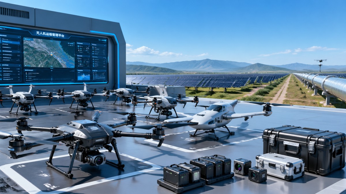
The first failure point is usually not flight control. It is operational coherence. A UAV fleet management system may look stable in a 1-site deployment, but once 3–10 locations, 20+ pilots, and several mission types are added, inconsistency appears in permissions, reporting logic, and maintenance accountability.
Researchers and technical evaluators often focus on architecture, API availability, and data retention. Operators care about mission setup time, no-fly alerts, battery status, and incident logging. Buyers and enterprise leaders need a single environment where those requirements coexist without creating duplicate systems or manual reconciliation work every week.
The common scale-stage gaps
Most breakdowns fall into 4 categories: fragmented device data, weak integration with mission outputs, unreliable communications metadata, and incomplete workflow coverage for specialized inspection tasks. In practice, teams start noticing these issues after 6–12 months, especially when monthly flight volume exceeds 150–300 sorties.
- Flight records are stored in one system, maintenance logs in another, and imagery processing status in a third.
- Permissions are role-based in theory, but not granular enough for site managers, analysts, contractors, and auditors.
- Alerting focuses on flight anomalies but misses battery health drift, firmware mismatch, or recurring GNSS degradation.
- The platform supports general missions but lacks structured workflows for thermal solar inspection or long-range corridor tasks.
The table below summarizes the most visible scale failures and the operational effect they create. These are not theoretical problems. They directly influence downtime, rework, and supplier qualification cycles.
A mature UAV fleet management system should not merely aggregate drones on a dashboard. It should standardize mission logic, consolidate equipment records, and preserve traceability from pre-flight planning to post-flight data use. If any of these links remain manual, scale will expose them quickly.
What advanced teams should test before expansion
Before approving a wider rollout, enterprises should simulate 90-day operational load. That test should include at least 3 mission types, 2 pilot roles, 1 external contractor role, and a realistic failure event such as telemetry interruption or a failed battery check. Scale-readiness is proven in exception handling, not in a perfect demo flow.
Data silos and drone photogrammetry software integration problems
One of the most expensive hidden gaps is the disconnect between flight operations and downstream analytics. Mapping and inspection teams often discover that their UAV fleet management system cannot pass mission metadata cleanly into drone photogrammetry software, asset databases, or internal reporting platforms. The result is a broken digital thread.
For photogrammetry-heavy programs, metadata matters as much as imagery. Ground control references, altitude settings, overlap ratios, weather windows, camera parameters, and pilot identifiers all affect output quality. If the software handoff loses even 2–3 critical fields, reprocessing and interpretation become slower and less reliable.
Why integration quality matters more at scale
At pilot stage, a skilled analyst can manually correct naming conventions and mission folders. At enterprise scale, that approach becomes unsustainable. A team handling 50 projects per month, each generating 20–200 GB of imagery, cannot depend on manual renaming, spreadsheet reconciliation, or ad hoc export scripts.
This is especially important for organizations comparing suppliers or sites. If one region labels orthomosaic versions differently or logs flight heights in a separate tool, cross-site benchmarking loses validity. For procurement teams, poor integration creates hidden labor cost that is rarely visible in initial software pricing.
Integration checkpoints buyers should demand
- Automatic transfer of mission ID, pilot ID, payload type, timestamp, and site code into downstream processing workflows.
- Support for batch export and API-based exchange rather than file-by-file manual upload.
- Version traceability for datasets, especially where reprocessing may happen 2–4 times during QA review.
- Retention rules aligned with enterprise storage policies, typically 90 days for raw temp files and 1–3 years for audited deliverables.
The following table shows how integration weakness appears in daily operations and what a better system should enable.
The key lesson is simple: drone photogrammetry software integration should be evaluated as a business process, not just a compatibility statement. If the fleet platform cannot preserve context from collection to analysis, the organization is not truly operating a scalable data system.
Supplier instability in data links and its effect on flight continuity
Another scale-stage issue is underestimating the role of the uav data link supplier. In many programs, data link performance is treated as a hardware procurement detail rather than a system-level risk factor. That is a mistake. Link reliability affects telemetry continuity, command responsiveness, mission confidence, and compliance records.
At small range and open sites, intermittent link degradation may seem rare. But corridor inspections, industrial areas with electromagnetic interference, and multi-site deployments with mixed topography change the picture. When packet loss, latency spikes, or handoff inconsistency increase, the fleet platform may continue displaying “connected” while the mission quality is already compromised.
What procurement teams should measure
A serious evaluation of a uav data link supplier should include more than nominal range. Buyers should ask for operating conditions, interference tolerance ranges, firmware update cadence, redundancy options, and how telemetry gaps are flagged in logs. A stated 10 km link means little without context on throughput stability and command latency under field conditions.
For most enterprise users, 4 metrics deserve particular attention: effective control latency, packet loss frequency, recovery time after interruption, and data logging completeness during degraded connectivity. Even a 2–5 second telemetry blind spot can matter for inspection repeatability and incident review.
Practical warning signs
- Frequent disconnect events in dense industrial environments but no structured root-cause reporting.
- Vendor documentation emphasizes peak range yet omits sustained throughput under interference.
- Firmware changes alter radio behavior without a documented validation window of 14–30 days.
- No clear process exists for validating replacement modules from different production batches.
The more specialized the mission, the more the data link affects downstream value. A corridor flight for a vtol drone for pipeline inspection can cover long linear assets and changing terrain. In that context, communication resilience influences not only flight safety but also the continuity of georeferenced defect documentation.
Decision-makers should therefore treat the data link supplier as part of the total fleet architecture. If the communications layer is weak, even strong software dashboards and capable airframes will fail to deliver dependable enterprise output.
Specialized workflows: thermal solar inspection and VTOL pipeline missions
A common reason a UAV fleet management system fails at scale is that it is designed for generic aerial operations, not for specialized industrial workflows. Two examples stand out: uav thermal inspection solar panels and vtol drone for pipeline inspection. Both require structured data capture rules that are operationally different from basic visual inspection flights.
Solar thermal inspection typically depends on repeatable flight altitude, irradiance-aware scheduling, thermal calibration discipline, and defect classification workflows. Pipeline inspection often needs longer endurance, route segmentation, terrain-aware planning, beyond-visual-line considerations depending on jurisdiction, and stronger event tagging for geospatial review.
Why generic mission templates are not enough
If a platform cannot encode task-specific checklists, operators compensate with paper notes or disconnected mobile apps. That creates data loss. In solar O&M, for instance, a hotspot finding without a linked string ID, panel row reference, and thermal threshold note may require a return visit. In a 50 MW to 200 MW site, that wasted cycle is costly.
For VTOL pipeline operations, the mission record must often link aircraft mode transitions, route sections, weather changes, and anomaly categories. If the system logs only flight duration and battery use, it does not provide enough context for engineering review or contractor comparison.
Minimum workflow fields by mission type
The table below outlines field-level differences that should be built into mission templates rather than handled manually after the fact.
The conclusion is operationally important: specialized missions need specialized data structures. Enterprises should avoid platforms that treat thermal, corridor, and mapping jobs as simple variants of one generic flight template. That shortcut may work for 10 flights per month, but it fails under sustained industrial use.
Implementation guidance
- Define 3–5 mission archetypes and lock the required fields for each.
- Map each field to downstream maintenance, GIS, or analytics systems before rollout.
- Run a 30-day validation with operators and analysts, not just IT staff.
- Review failure cases where missions were completed but outputs were still unusable.
A practical selection framework for buyers and decision-makers
Selecting a UAV fleet management system for scale requires more than feature comparison. It requires a decision model that aligns operations, data governance, supplier risk, and mission economics. Procurement teams should evaluate the platform as a long-cycle infrastructure layer, not as a short-term convenience tool.
A robust buying process usually spans 4 stages: requirement mapping, technical validation, field pilot, and contract risk review. In many industrial settings, this takes 6–12 weeks depending on security review, integration complexity, and the number of sites involved. Rushed purchases often ignore the downstream cost of poor interoperability.
Core evaluation dimensions
Decision-makers should prioritize 5 dimensions: data integrity, workflow fit, supplier stability, operational usability, and change management support. A platform can score highly in UI design yet still fail on telemetry traceability or mission-specific workflow coverage. Those failures are much harder to fix after contract signature.
- Data integrity: Can the system preserve mission context across flight, payload, processing, and reporting layers?
- Workflow fit: Does it support solar thermal, mapping, and corridor inspection without manual workaround steps?
- Supplier stability: Are release cycles, support channels, and interoperability commitments clear over 12–24 months?
- Operational usability: Can new operators complete routine tasks with limited retraining after 2–3 sessions?
- Governance: Are audit logs, role permissions, and retention policies suitable for enterprise oversight?
The table below can be used as a practical procurement scorecard during supplier review.
The most effective purchasing teams also define rejection criteria before vendor demos begin. For example, if batch export is unavailable, if mission metadata cannot be mapped to downstream systems, or if communications events are not auditable, the solution should not move forward regardless of interface quality.
Questions leaders should ask internally
Before selecting any platform, companies should ask whether they are optimizing for fleet visibility, engineering traceability, regulatory defensibility, or contractor control. These priorities shape the right system architecture. A platform that looks cost-effective in year 1 may create expensive operational debt by year 2 if it cannot support expanding mission complexity.
How to close scale-stage gaps without rebuilding the entire stack
Not every organization needs a full replacement. In many cases, the better path is a structured gap-closure program built around integration cleanup, workflow redesign, supplier accountability, and phased governance controls. The first objective should be to reduce mission-to-report friction within 60–90 days.
A practical improvement roadmap begins with data mapping. List every system involved in the UAV lifecycle: mission planning, fleet control, maintenance tracking, imagery processing, reporting, and archiving. Then identify where metadata is duplicated, dropped, or manually re-entered. Those points usually explain 70% of recurring inefficiency.
A phased remediation model
- Phase 1, 2–4 weeks: standardize mission templates, pilot roles, asset IDs, and battery records.
- Phase 2, 4–8 weeks: fix drone photogrammetry software integration and define required metadata transfer fields.
- Phase 3, 2–6 weeks: validate uav data link supplier performance under real site conditions and document threshold alerts.
- Phase 4, ongoing: tailor workflows for uav thermal inspection solar panels and vtol drone for pipeline inspection missions.
This staged approach reduces disruption. It also creates measurable checkpoints. Teams can track setup time per mission, incident closure time, metadata completeness rate, and analyst rework frequency before and after each change. Even a 15–20% reduction in manual handling can materially improve the economics of a growing program.
Operational disciplines that matter
Governance is as important as software. Establish monthly review cycles for fleet health, communications anomalies, failed missions, and output quality defects. Assign ownership across operations, engineering, and procurement. If everyone uses the platform but no one owns the data model, the same gaps will reappear.
For organizations evaluating future growth, the best benchmark is not current convenience. It is whether the UAV fleet management system can preserve engineering truth as complexity increases. That means fewer assumptions, clearer parameter tracking, and better evidence for every operational decision.
Scale-stage failures in UAV programs rarely begin with dramatic crashes or obvious software outages. More often, they begin with invisible loss of structure: disconnected records, weak integration, uncertain link performance, and mission templates that do not match real industrial work. Those weaknesses compound as fleets, sites, and stakeholders expand.
For researchers, operators, procurement teams, and enterprise leaders, the priority is clear: evaluate the UAV fleet management system as an end-to-end operational infrastructure layer. Test data continuity, validate specialized workflows, review the uav data link supplier with discipline, and make sure drone photogrammetry software integration is fit for enterprise use.
If your organization is planning a larger UAV rollout or reassessing an existing stack, now is the time to benchmark system gaps against real mission requirements. Contact TechStat Vanguard to discuss a data-driven evaluation framework, request a tailored assessment model, or explore more hard-tech decision support for scalable UAV operations.
Search News
Hot Articles
- Carbon Fiber StructuresHow to Specify Aerospace Carbon Fiber Assemblies for Lightweight, Load-Bearing PartsJul 11, 2026
- Machine VisionXiaomi, Alibaba DAMO Academy Drive Open-Source Robotics Model Ecosystem, Lowering Algorithm Development Barriers for Overseas SMEs Adopting Chinese Robotics SolutionsMar 30, 2026
- Cobots & ArmsShanxi 'AI+' Conference Showcases Embodied Intelligence with Multinational Buyer Engagement: Key Industry ImplicationsMar 30, 2026
Popular Tags
Recommended News
 Jul 11, 2026How to Specify Aerospace Carbon Fiber Assemblies for Lightweight, Load-Bearing PartsAerospace carbon fiber assemblies: learn how to specify laminate design, load data, joining methods, and inspection controls for lighter, reliable load-bearing aerospace parts.Elena Rostova (UAV Systems Researcher)
 Mar 30, 2026Xiaomi, Alibaba DAMO Academy Drive Open-Source Robotics Model Ecosystem, Lowering Algorithm Development Barriers for Overseas SMEs Adopting Chinese Robotics SolutionsXiaomi & Alibaba DAMO Academy's open-source robotics models lower algorithm barriers for global SMEs. Boost efficiency in manufacturing, logistics & smart retail with ROS 2 compatible solutions.TSV Data Lab
 Mar 30, 2026Shanxi 'AI+' Conference Showcases Embodied Intelligence with Multinational Buyer Engagement: Key Industry ImplicationsShanxi 'AI+' Conference highlights embodied intelligence with Tesla, Ubtech & Jiantao showcasing multimodal robotics. 40+ global buyers validated tech on-site, creating new B2B channels for industrial automation & AI solutions.Chen Wei (Automation Lead Engineer)
 Mar 30, 2026Zhongguancun Unveils 6G Integrated Sensing-Computing-Intelligence Platform to Empower Embodied Robots for Global Industrial ApplicationsZhongguancun's new 6G platform revolutionizes industrial robotics with <10ms latency, empowering global automotive, logistics & port automation. Discover how this tech boosts China's smart manufacturing exports.TSV Data Lab
 Mar 30, 2026Mech-Mind Tianjin Embodied Intelligence R&D and Production Base Goes Live, Cutting Delivery Time by 20%–30% for Global Customized AMR+Vision SolutionsMech-Mind's Tianjin AMR+Vision production base cuts delivery time by 20%-30% for欧美 & Latin American markets. Discover how this PLd-certified facility accelerates customized robotics solutions for smart manufacturing and logistics.Chen Wei (Automation Lead Engineer)
 Mar 30, 2026Boao Forum Reveals 'Co-evolution of Big and Small Brains' Trend in Humanoid Robots, China's Embodied Intelligence Accelerates Adaptation to Overseas Manufacturing Service ScenariosDiscover how China's humanoid robots, featuring 'Co-evolution of Big and Small Brains,' are revolutionizing global manufacturing. Learn about Embodied Tian Gong 3.0's ISO compliance and overseas deployment at Boao Forum 2026.Chen Wei (Automation Lead Engineer)
 Mar 30, 2026China Railway Industrial Secures Patent for Embodied Robotics in Material Handling, Boosting High-Precision Delivery Capabilities for Overseas Infrastructure and Manufacturing ProjectsChina Railway Industrial's new patent for embodied robotics in material handling boosts high-precision delivery for global infrastructure & manufacturing. Discover how this innovation enhances logistics accuracy in automotive, rail transit & EPC projects.Chen Wei (Automation Lead Engineer)
 Oct 25, 2026Hesai Leads Global ADAS Main Lidar Shipments in Yole’s 2026 ReportHesai led global ADAS main lidar shipments with a 43% share in 2025, according to Yole’s 2026 report. Explore what this ranking reveals about its automotive market position.TSV Data Lab
 Oct 25, 2026Choosing an Aerospace Materials Manufacturer: Quality and Traceability ChecksChoosing an aerospace materials manufacturer? Learn how to verify certifications, test reports, and lot traceability to qualify suppliers confidently and reduce costly sourcing risks.Dr. Marcus Vance
 Oct 24, 2026Guotai Haitong: Global Entry-Level 3D Printer Shipments Rose 39% in Q1 2026Entry-level 3D printer shipments rose 39% in Q1 2026, Guotai Haitong reports. Explore how AI, multicolor printing and print farms are shaping market growth.Dr. Marcus Vance
 Oct 24, 2026Choosing an Industrial Vision Inspection Supplier: Acceptance Tests That MatterChoose an industrial vision inspection supplier with confidence. Discover acceptance tests for defect detection, false rejects, production speed, and reliable part rejection before you buy.TSV Data Lab
 Oct 23, 2026US Navy Raises Gecko Robotics Contract Ceiling to $300M for Robotic Fleet MaintenanceUS Navy raises Gecko Robotics’ contract ceiling to $300M for Pacific Fleet robotic inspections. Explore potential opportunities for maintenance suppliers and key procurement considerations.Chen Wei (Automation Lead Engineer)
 Oct 23, 2026Choosing Industrial Sensing Systems for Global Plants: Protocol CompatibilityCompare industrial sensing systems international buyers can trust. Explore protocol compatibility, reduce integration risks, and select proven configurations for reliable global plant deployments.TSV Data Lab
 Oct 22, 2026KUKA Showcases Physical AI and iiQKA.AI Vision at NVIDIA GTC BerlinExplore KUKA’s Physical AI showcase at NVIDIA GTC Berlin and discover how iiQKA.AI Vision aims to simplify robotic vision integration and improve 2D and 3D scene recognition.TSV Data Lab
 Oct 22, 2026Robotic Machining of Advanced Composites: What Tolerances Are Achievable?Explore advanced materials machining robotics: discover what drives achievable composite tolerances and how to validate accuracy before investing in your next machining system.Dr. Marcus Vance
 Oct 21, 2026China’s Industrial Robot Exports Near RMB 10 Billion in First Nine Months of 2026China’s industrial robot exports neared RMB 10 billion in January–September 2026, with value rising faster than volume. Explore the data and what it could mean for suppliers.Chen Wei (Automation Lead Engineer)
 Oct 21, 2026Low-Latency Industrial Data Processing: Pricing and Key Cost DriversExplore industrial data latency price drivers, from edge hardware to integration and support. Learn how to compare quotes, verify performance, and avoid unnecessary costs.TSV Data Lab
 Oct 20, 2026KUKA Launches iiQKA.AI Vision to Simplify Industrial Image ProcessingKUKA iiQKA.AI Vision simplifies industrial image processing with controller-based 2D and 3D vision. Explore drag-and-drop setup for vision-guided automation.TSV Data Lab
 Oct 20, 2026Smart Industrial Edge Devices: Key Criteria for Legacy PLC IntegrationChoose smart industrial edge devices for legacy PLC integration. Discover key criteria for compatibility, data quality, security, and reliable collection without disrupting control.TSV Data Lab
 Oct 19, 2026Choosing a Radar Sensor by Application: Range, Resolution, and Field of ViewSimplify radar sensor application based product selection. Compare range, resolution, and field of view to avoid blind spots and choose with confidence. Explore the guide.TSV Data Lab
 Oct 18, 2026Comparing Material Options for Procurement: Specs, Costs, and Supply RisksExplore procurement oriented technical content on material options, specs, costs, and supply risks. Compare alternatives to cut hidden expenses and make confident sourcing decisions.Dr. Marcus Vance
 Oct 17, 20265-Axis CNC Positioning Accuracy: How to Interpret ISO 230-2 Test ResultsAssess 5 axis CNC machining positioning accuracy with ISO 230-2. Learn to interpret repeatability, reversal error, and test conditions to compare suppliers and make confident acceptance decisions.Dr. Marcus Vance
 Oct 16, 2026Choosing a Rugged Edge AI Box Supplier: Thermal Tests and Lifecycle SupportChoose a rugged edge AI box supplier with proven thermal performance and reliable lifecycle support. Discover the tests and commitments to verify before you buy.TSV Data Lab
 Oct 15, 2026R&D Cost Reduction Services: How to Evaluate Fees, Savings, and ROIEvaluate R&D cost reduction services with confidence. Compare fees, verify savings, and calculate ROI without compromising performance. Discover how to choose a provider that delivers real value.Chen Wei (Automation Lead Engineer)