When Does a Heavy Lift UAV Really Save Time on Site?
Publication Date
author
On demanding job sites, a heavy lift UAV for construction only saves time when its drone payload capacity vs flight time, UAV wind resistance rating, and flight controller latency benchmark match real operational constraints. For teams comparing a mapping drone for mining industry use or validating UAV GPS RTK accuracy millimeter claims, the real question is not hype—it is whether measured performance reduces survey cycles, lift delays, and costly rework.
The short answer is this: a heavy lift UAV really saves time on site only when it removes at least one bottleneck better than conventional methods. That bottleneck is usually one of four things: repeated manual transport, slow or unsafe access, delayed surveying, or stop-start coordination between crews. If the aircraft cannot carry the needed payload for a meaningful duration, hold position in actual wind, or deliver data with reliable positional accuracy, it does not save time—it simply shifts labor from one place to another.
For procurement teams, site managers, pilots, and technical evaluators, the decision should not start with brochure-level payload claims. It should start with a workflow question: which site task becomes faster, safer, and more predictable if moved to a heavy lift UAV platform? Once that is clear, the right performance metrics become obvious.
What job-site bottlenecks does a heavy lift UAV actually remove?
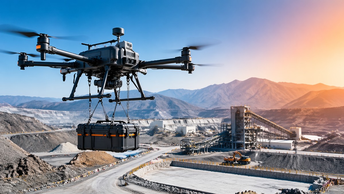
A heavy lift UAV creates time savings only when it compresses a sequence that currently consumes labor hours, machine idle time, or access delays. In practice, the strongest use cases tend to be highly specific rather than general.
In construction, that usually means moving tools, cable reels, inspection devices, or small but urgent materials to hard-to-reach elevation points without waiting for cranes, hoists, or manual carry teams. If a crew is blocked because a component is missing on an upper deck or remote structure, a heavy lift UAV for construction can eliminate non-productive waiting time.
In mining and quarry environments, the bigger gain is often not transport but data speed. A mapping drone for mining industry use can shorten survey cycles before blasting, after earth movement, or during stockpile reconciliation. The value is highest when survey updates affect production planning on the same shift, not days later.
In infrastructure and energy sites, savings come from reduced access complexity. When technicians do not need scaffolding, rope access, or repeated vehicle movement just to inspect or deliver a small payload, schedule compression becomes measurable.
By contrast, a UAV usually delivers weak time savings when:
- The payload is too heavy for practical flight duration.
- The site has frequent winds beyond the platform’s stable operating envelope.
- The workflow still requires the same number of people waiting on the ground.
- The mission requires repeated battery changes that break continuity.
- The collected data still needs extensive manual cleanup before use.
So the question is not whether UAVs are faster in theory. It is whether they remove a real operational choke point in the field.
Drone payload capacity vs flight time: the metric that most often decides real productivity
For most buyers, the biggest misunderstanding is treating payload and flight time as independent specifications. On site, they are inseparable. A drone may advertise impressive lift capacity, but if endurance collapses under real payload, the number is operationally misleading.
The useful evaluation is drone payload capacity vs flight time under mission conditions, not no-load endurance. Teams should ask:
- What is the actual payload including mounting hardware, sensors, packaging, and safety margin?
- What flight time remains at that payload in realistic temperature and altitude conditions?
- How many useful trips can be completed per battery cycle?
- How much turnaround time is added by landing, swapping batteries, and re-validating mission readiness?
For example, if a heavy lift UAV can carry a part in one trip but requires frequent swaps and reset checks, the claimed speed advantage may disappear. On the other hand, if it can reliably complete multiple deliveries or a full survey block before recovery, the gain becomes operationally meaningful.
This matters especially in procurement reviews. A platform that looks cheaper or stronger on paper may produce lower daily throughput if its loaded endurance is poor. The right KPI is not “maximum payload.” It is useful payload moved or useful data captured per shift.
When wind resistance determines whether the UAV saves time or creates delay
On exposed sites, wind is often the hidden reason a UAV program underperforms. Marketing language about stability means very little unless teams can tie it to an actual UAV wind resistance rating and understand what that rating means during hover, transition, and precision placement.
If the aircraft struggles to hold position in gusts, several losses appear at once:
- Delivery accuracy drops.
- Survey consistency suffers.
- Abort rates increase.
- Crew confidence falls, leading to slower go/no-go decisions.
For construction lifts, wind tolerance affects whether the payload can be positioned precisely enough to avoid re-handling. For mapping or inspection work, unstable flight affects overlap quality, image sharpness, and data usability. In both cases, poor wind performance turns a potential time saver into a source of repeat work.
Decision-makers should therefore ask for more than a single top-level wind number. They should want to know:
- At what wind speed is stable hover maintained with payload?
- How does gust performance differ from steady-state wind performance?
- What happens to endurance and control margin at higher winds?
- How often were missions interrupted in comparable field conditions?
Real time savings come from dispatch confidence. If teams trust that the aircraft will fly within the site’s normal weather window, they plan around it. If not, they keep fallback methods active, which erodes the benefit.
Why flight controller latency and control stability matter more than many buyers expect
For a heavy lift platform, flight controller latency benchmark is not a niche engineering detail. It directly affects how precisely and safely the aircraft responds during load handling, obstacle avoidance, and corrections in turbulent air.
Latency problems show up as hesitation, overshoot, or unstable compensation behavior. On site, that can mean slower final approach, more cautious operator input, and larger safety buffers around structures and personnel. Every one of those effects adds time.
This becomes even more important when the UAV is carrying expensive sensors, specialized tools, or awkward loads with shifting dynamics. A platform may have enough thrust to lift the weight, but if its control loop is not responsive under load, operators will have to fly more conservatively. That reduces throughput and increases fatigue.
Technical teams should evaluate:
- Control responsiveness under maximum and typical payloads
- Hover precision near structures
- Recovery behavior after gust disturbance
- Latency impact when GNSS quality degrades or local interference appears
In short, stable control is not just about safety. It is about whether the aircraft can complete the job quickly without forcing the operator into constant correction.
For mapping and survey work, data accuracy matters more than airborne speed
In survey-driven operations, a fast flight is useless if the output cannot be trusted. This is why teams comparing a mapping drone for mining industry workflows should focus on data reliability, not just area coverage rates.
The key issue is whether the UAV reduces the total survey cycle: planning, capture, processing, validation, and decision use. If downstream teams still need to re-fly, manually correct georeferencing, or verify uncertain surfaces, then time savings disappear.
That is where UAV GPS RTK accuracy millimeter claims need careful scrutiny. Millimeter-level language often sounds impressive, but users should separate controlled-condition positioning statements from full field reality. Actual accuracy depends on satellite geometry, base station setup, interference environment, terrain reflectivity, mission altitude, and processing workflow.
What really helps site teams is not a headline claim, but answers to questions like:
- What horizontal and vertical accuracy is repeatably achieved in field conditions?
- How much ground control is still required?
- How often does rework occur because of poor fix quality or drift?
- How quickly can survey outputs be used by engineers, planners, or machine operators?
For mining and earthworks, the best time-saving drone is often the one that produces dependable volume, contour, and change-detection outputs on the first pass. Accuracy that is merely advertised but not repeatable can become more expensive than slower conventional survey methods.
How to tell whether a heavy lift UAV will improve ROI before you buy
For enterprise decision-makers, the cleanest way to evaluate ROI is to compare the UAV against the exact process it would replace or reduce. That means measuring labor hours, waiting time, access cost, rework frequency, and safety overhead in the current workflow.
A practical evaluation framework includes five checkpoints:
- Task fit: Is the UAV solving a frequent, high-friction task rather than an occasional edge case?
- Mission economics: How many useful missions can be completed per shift, including battery logistics and operator setup?
- Field robustness: Can the aircraft perform in the site’s normal wind, dust, temperature, and signal conditions?
- Data or delivery quality: Does it reduce follow-up work, not merely shift it downstream?
- Operational integration: Can crews, planners, and safety teams use it without creating parallel complexity?
If the UAV reduces crane dependency, shortens survey-to-decision time, or cuts idle crew waiting across repeated jobs, ROI can be strong. If it only performs well in ideal conditions or requires a specialist team for every mission, returns become much weaker.
For procurement and technical review teams, pilot projects should therefore be built around measurable site KPIs such as:
- Minutes saved per delivery cycle
- Survey turnaround time
- Reduction in manual access events
- Rework avoided due to better data or faster material movement
- Utilization rate across a full month, not a showcase day
Common buying mistakes that make a heavy lift UAV look useful on paper but fail on site
Several predictable mistakes cause disappointment after deployment.
- Buying by maximum payload alone: This ignores useful endurance and cycle throughput.
- Ignoring weather realism: A UAV that rarely flies in actual site wind is not a time-saving tool.
- Overvaluing nominal RTK claims: Positioning quality must be validated in the intended environment.
- Underestimating operational friction: Battery management, pilot availability, permissions, and maintenance can reduce effective productivity.
- Skipping workflow integration: If site teams do not change scheduling and coordination around the UAV, much of the value is lost.
The best-performing deployments are usually the least glamorous. They are tightly matched to a repeatable site problem, backed by measured benchmarks, and integrated into daily operations with clear dispatch rules.
Conclusion: a heavy lift UAV saves time only when benchmarked against the real job, not the brochure
A heavy lift UAV really saves time on site when it reliably removes a costly bottleneck: delayed material movement, difficult access, slow survey updates, or repeated manual handling. The deciding factors are not marketing superlatives but measurable field performance—especially drone payload capacity vs flight time, UAV wind resistance rating, flight controller latency benchmark, and trustworthy positioning results.
For construction, mining, infrastructure, and industrial operators, the right buying question is simple: what process becomes faster, safer, and more predictable with this platform in our actual site conditions? If the answer is specific and supported by field data, a heavy lift UAV can compress schedules and reduce rework. If not, it is just another machine with impressive specifications and weak operational impact.
At TSV, the engineering view is straightforward: parameters do not save time by themselves. Verified performance in real workflows does.
Search News
Hot Articles
- Carbon Fiber StructuresHow to Specify Aerospace Carbon Fiber Assemblies for Lightweight, Load-Bearing PartsJul 11, 2026
- Machine VisionXiaomi, Alibaba DAMO Academy Drive Open-Source Robotics Model Ecosystem, Lowering Algorithm Development Barriers for Overseas SMEs Adopting Chinese Robotics SolutionsMar 30, 2026
- Cobots & ArmsShanxi 'AI+' Conference Showcases Embodied Intelligence with Multinational Buyer Engagement: Key Industry ImplicationsMar 30, 2026
Popular Tags
Recommended News
 Jul 11, 2026How to Specify Aerospace Carbon Fiber Assemblies for Lightweight, Load-Bearing PartsAerospace carbon fiber assemblies: learn how to specify laminate design, load data, joining methods, and inspection controls for lighter, reliable load-bearing aerospace parts.Elena Rostova (UAV Systems Researcher)
 Mar 30, 2026Xiaomi, Alibaba DAMO Academy Drive Open-Source Robotics Model Ecosystem, Lowering Algorithm Development Barriers for Overseas SMEs Adopting Chinese Robotics SolutionsXiaomi & Alibaba DAMO Academy's open-source robotics models lower algorithm barriers for global SMEs. Boost efficiency in manufacturing, logistics & smart retail with ROS 2 compatible solutions.TSV Data Lab
 Mar 30, 2026Shanxi 'AI+' Conference Showcases Embodied Intelligence with Multinational Buyer Engagement: Key Industry ImplicationsShanxi 'AI+' Conference highlights embodied intelligence with Tesla, Ubtech & Jiantao showcasing multimodal robotics. 40+ global buyers validated tech on-site, creating new B2B channels for industrial automation & AI solutions.Chen Wei (Automation Lead Engineer)
 Mar 30, 2026Zhongguancun Unveils 6G Integrated Sensing-Computing-Intelligence Platform to Empower Embodied Robots for Global Industrial ApplicationsZhongguancun's new 6G platform revolutionizes industrial robotics with <10ms latency, empowering global automotive, logistics & port automation. Discover how this tech boosts China's smart manufacturing exports.TSV Data Lab
 Mar 30, 2026Mech-Mind Tianjin Embodied Intelligence R&D and Production Base Goes Live, Cutting Delivery Time by 20%–30% for Global Customized AMR+Vision SolutionsMech-Mind's Tianjin AMR+Vision production base cuts delivery time by 20%-30% for欧美 & Latin American markets. Discover how this PLd-certified facility accelerates customized robotics solutions for smart manufacturing and logistics.Chen Wei (Automation Lead Engineer)
 Mar 30, 2026Boao Forum Reveals 'Co-evolution of Big and Small Brains' Trend in Humanoid Robots, China's Embodied Intelligence Accelerates Adaptation to Overseas Manufacturing Service ScenariosDiscover how China's humanoid robots, featuring 'Co-evolution of Big and Small Brains,' are revolutionizing global manufacturing. Learn about Embodied Tian Gong 3.0's ISO compliance and overseas deployment at Boao Forum 2026.Chen Wei (Automation Lead Engineer)
 Mar 30, 2026China Railway Industrial Secures Patent for Embodied Robotics in Material Handling, Boosting High-Precision Delivery Capabilities for Overseas Infrastructure and Manufacturing ProjectsChina Railway Industrial's new patent for embodied robotics in material handling boosts high-precision delivery for global infrastructure & manufacturing. Discover how this innovation enhances logistics accuracy in automotive, rail transit & EPC projects.Chen Wei (Automation Lead Engineer)
 Oct 23, 2026US Navy Raises Gecko Robotics Contract Ceiling to $300M for Robotic Fleet MaintenanceUS Navy raises Gecko Robotics’ contract ceiling to $300M for Pacific Fleet robotic inspections. Explore potential opportunities for maintenance suppliers and key procurement considerations.Chen Wei (Automation Lead Engineer)
 Oct 23, 2026Choosing Industrial Sensing Systems for Global Plants: Protocol CompatibilityCompare industrial sensing systems international buyers can trust. Explore protocol compatibility, reduce integration risks, and select proven configurations for reliable global plant deployments.TSV Data Lab
 Oct 22, 2026KUKA Showcases Physical AI and iiQKA.AI Vision at NVIDIA GTC BerlinExplore KUKA’s Physical AI showcase at NVIDIA GTC Berlin and discover how iiQKA.AI Vision aims to simplify robotic vision integration and improve 2D and 3D scene recognition.TSV Data Lab
 Oct 22, 2026Robotic Machining of Advanced Composites: What Tolerances Are Achievable?Explore advanced materials machining robotics: discover what drives achievable composite tolerances and how to validate accuracy before investing in your next machining system.Dr. Marcus Vance
 Oct 21, 2026China’s Industrial Robot Exports Near RMB 10 Billion in First Nine Months of 2026China’s industrial robot exports neared RMB 10 billion in January–September 2026, with value rising faster than volume. Explore the data and what it could mean for suppliers.Chen Wei (Automation Lead Engineer)
 Oct 21, 2026Low-Latency Industrial Data Processing: Pricing and Key Cost DriversExplore industrial data latency price drivers, from edge hardware to integration and support. Learn how to compare quotes, verify performance, and avoid unnecessary costs.TSV Data Lab
 Oct 20, 2026KUKA Launches iiQKA.AI Vision to Simplify Industrial Image ProcessingKUKA iiQKA.AI Vision simplifies industrial image processing with controller-based 2D and 3D vision. Explore drag-and-drop setup for vision-guided automation.TSV Data Lab
 Oct 20, 2026Smart Industrial Edge Devices: Key Criteria for Legacy PLC IntegrationChoose smart industrial edge devices for legacy PLC integration. Discover key criteria for compatibility, data quality, security, and reliable collection without disrupting control.TSV Data Lab
 Oct 19, 2026Choosing a Radar Sensor by Application: Range, Resolution, and Field of ViewSimplify radar sensor application based product selection. Compare range, resolution, and field of view to avoid blind spots and choose with confidence. Explore the guide.TSV Data Lab
 Oct 18, 2026Comparing Material Options for Procurement: Specs, Costs, and Supply RisksExplore procurement oriented technical content on material options, specs, costs, and supply risks. Compare alternatives to cut hidden expenses and make confident sourcing decisions.Dr. Marcus Vance
 Oct 17, 20265-Axis CNC Positioning Accuracy: How to Interpret ISO 230-2 Test ResultsAssess 5 axis CNC machining positioning accuracy with ISO 230-2. Learn to interpret repeatability, reversal error, and test conditions to compare suppliers and make confident acceptance decisions.Dr. Marcus Vance
 Oct 16, 2026Choosing a Rugged Edge AI Box Supplier: Thermal Tests and Lifecycle SupportChoose a rugged edge AI box supplier with proven thermal performance and reliable lifecycle support. Discover the tests and commitments to verify before you buy.TSV Data Lab
 Oct 15, 2026R&D Cost Reduction Services: How to Evaluate Fees, Savings, and ROIEvaluate R&D cost reduction services with confidence. Compare fees, verify savings, and calculate ROI without compromising performance. Discover how to choose a provider that delivers real value.Chen Wei (Automation Lead Engineer)
 Oct 23, 2026How Do You Evaluate Solid-State LiDAR Point Cloud Density?Evaluate solid-state LiDAR point cloud density using valid returns, angular spacing, and real-world coverage. Discover how to compare sensors and choose the right fit for your application.TSV Data Lab
 Oct 22, 2026How Do You Test AMR Navigation Accuracy in a Warehouse?Test AMR navigation accuracy in warehouses with practical methods for localization, path tracking, and docking. Learn to set tolerances and compare robots before deployment.Chen Wei (Automation Lead Engineer)
 Oct 21, 2026How Should You Balance Cobot Payload Against Reach?Explore cobot payload versus reach to choose the right robot. Learn how tooling, load limits, workspace, and cycle time affect performance—and avoid costly selection mistakes.Chen Wei (Automation Lead Engineer)
 Oct 20, 2026How Do You Measure Industrial IoT Gateway Latency Under Load?Measure industrial IoT gateway latency under load with reliable timestamps, realistic traffic, and tail-latency analysis. Discover how to expose bottlenecks and choose the right gateway.TSV Data Lab