What makes a drone effective for search and rescue operations?
Publication Date
author
In search and rescue, an effective drone is defined by measurable performance: stable flight, fast deployment, reliable sensing, and secure data links. From drone for search and rescue operations to uav thermal inspection solar panels, solid state lidar manufacturer china solutions, and uav fleet management system integration, the real value lies in mission-ready engineering data that helps operators, buyers, and decision-makers evaluate capability with confidence.
What actually makes a drone effective in search and rescue missions?
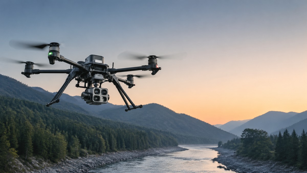
A search and rescue platform is not judged by flight time alone. It becomes effective when it can launch within 5–15 minutes, maintain stable control in variable wind, transmit usable imagery in real time, and keep positional accuracy tight enough for responders to act on what they see. In practical terms, a drone for search and rescue operations is a systems decision, not a single-airframe decision.
For information researchers and procurement teams, the biggest obstacle is noisy product language. Terms such as long range, high precision, or professional grade often hide the absence of hard parameters. TechStat Vanguard approaches UAV evaluation from an engineering benchmark perspective: payload tolerance, sensing reliability, electromagnetic resilience, control link redundancy, and the operational limits that define whether a platform can perform in fog, forest canopy, shoreline glare, or partial GNSS denial.
For operators, effectiveness means fewer missed targets and fewer aborted sorties. For enterprise decision-makers, it means lower trial-and-error cost across a 12–36 month deployment cycle. A drone that flies well in a demo but cannot integrate thermal payloads, map search grids, or export standard mission logs creates downstream cost in training, maintenance, and fleet management.
The most reliable evaluation model usually includes 4 core dimensions: flight performance, sensor capability, communications integrity, and mission workflow integration. When these four areas are measured together, teams can compare different UAV architectures without depending on exaggerated vendor claims.
Four engineering questions every team should ask first
- Can the drone maintain stable hover and route tracking in wind conditions commonly seen in the target area, such as coastal gusts or mountain turbulence?
- Does the payload suite support both wide-area detection and close-range confirmation, typically combining RGB, thermal, or LiDAR depending on terrain?
- How resilient is the control and video link over 2–10 km operational envelopes, especially in urban clutter or low-visibility environments?
- Can mission data be exported into a uav fleet management system, incident review workflow, or GIS platform without manual rework?
Which technical parameters matter most under real field conditions?
Search and rescue teams operate across different terrains, so no single specification tells the full story. Endurance matters, but so do climb rate, descent control, payload power budget, sensor refresh rate, and data-link latency. In missions where a lost hiker or flood victim may only be visible for a few seconds, a delay of even 300–800 milliseconds in the video chain can reduce detection confidence.
Thermal sensing is often the first screening layer. Yet thermal cameras vary widely in practical usefulness based on resolution, lens selection, temperature contrast, and onboard image processing. The same discipline applies in adjacent applications such as uav thermal inspection solar panels, where a thermal payload must distinguish small anomalies under changing ambient conditions. The procurement lesson is clear: sensor data quality depends on the full mission stack, not just the camera label.
LiDAR also has a role in advanced rescue scenarios, especially where vegetation, terrain contour, or collapsed structures affect visibility. Buyers evaluating a solid state lidar manufacturer china source or any global supplier should focus on point density, interference resistance, effective detection range, and integration burden. A LiDAR module that performs well in static mapping may still underperform in low-altitude, time-critical emergency scanning if vibration tolerance and synchronization are weak.
The table below summarizes parameter categories that usually carry the highest decision weight for drone for search and rescue operations programs. These are not universal pass-fail numbers; they are practical review points for matching mission profile to hardware capability.
This table shows why a specification sheet should be interpreted as a mission matrix. A 45-minute endurance figure means little if payload draw cuts practical sortie time to 28–32 minutes. Likewise, a high-resolution sensor is less valuable when stabilization, compression, or low-light tuning is weak. TSV’s engineering-first lens is useful here because it forces comparison at the operating threshold, not at the marketing headline.
How sensor choice changes by terrain
Open terrain and flood zones
In open areas, longer flight endurance and wide-area thermal sweeps usually bring the highest return. Teams often prioritize coverage rate, waypoint repeatability, and daylight glare control. Here, fixed-wing or hybrid VTOL options may enter the discussion if launch and recovery conditions permit.
Forest, mountain, and broken terrain
In dense or vertical terrain, multirotor control precision and obstacle awareness become more important. Rescue teams may prefer shorter but more controlled sorties of 20–35 minutes with better hover quality, terrain following, and close-in thermal verification.
Collapsed structures or industrial incidents
In confined and hazardous zones, sensing diversity matters. RGB plus thermal is often the minimum useful combination. In some programs, LiDAR or depth-aware perception adds value for structure understanding, but only if the system remains lightweight and fast to deploy.
How should buyers compare multirotor, VTOL, and sensor configurations?
The right architecture depends on search area size, deployment constraints, and recovery environment. Procurement teams often compare aircraft by top-line range, but operational suitability is more nuanced. A platform that covers 20–50 square km efficiently may still be a poor fit if the team needs rooftop launch, quick redeployment, or close inspection around trees, cliffs, or damaged buildings.
The same holds for payload strategy. A basic RGB-only setup may work for daytime shoreline sweeps, but night operations or heat-signature detection usually require thermal. Some programs also add spotlight or loudspeaker payloads for final localization and communication. In larger organizations, these decisions should align with uav fleet management system standards so that logs, batteries, maintenance records, and mission templates remain consistent across 3–20 aircraft fleets.
The comparison table below helps teams translate mission profile into selection logic. It is especially useful when engineering staff, operations leads, and procurement managers need a shared language for evaluation.
The key insight is that the most advanced configuration is not automatically the most effective. Effectiveness comes from fit: fit to terrain, operator skill, maintenance capacity, and response timeline. That is why TSV emphasizes benchmarking by use case. A rescue unit with 2 trained pilots and 30-minute deployment windows should not buy as if it were a mapping contractor with dedicated post-processing staff.
A practical 5-point selection checklist
- Define target search area per sortie, such as compact urban blocks, 5–10 km corridors, or wide flood plains.
- List mandatory payloads and confirm whether simultaneous mounting is required or modular swapping is acceptable.
- Check communications architecture, including encrypted data links, redundancy, and interoperability with existing command systems.
- Estimate battery, spare part, and training burden over a 12-month operating cycle.
- Request evidence of integration readiness, especially for uav fleet management system workflows and reporting export.
What do procurement teams often miss during vendor evaluation?
Many procurement failures come from comparing only aircraft brochures while ignoring system readiness. A drone for search and rescue operations should be evaluated as an operational package: airframe, sensors, batteries, charging method, software, maintenance process, training path, and data governance. If one link is weak, the mission chain suffers.
The second common blind spot is overvaluing peak specifications. A nominal 50-minute flight time may be measured with no wind and minimal payload. A rescue team should request practical ranges under loaded conditions and ask whether endurance drops into the 25–35 minute band when thermal, spotlight, or speaker payloads are active. This kind of questioning filters out non-comparable offers quickly.
Another missed issue is software maturity. As fleets grow from 1–2 aircraft to 6–12 units across regional teams, maintenance visibility and mission logging become procurement issues, not just operations issues. Without structured uav fleet management system support, battery health, spare usage, firmware control, and incident traceability become fragmented.
Finally, teams often separate sensor sourcing from mission integration. Whether the discussion involves thermal payloads, mapping cameras, or a solid state lidar manufacturer china channel, the real question is integration friction. How many steps are needed for calibration, data synchronization, export, and retraining? In a rescue environment, 2–4 extra setup steps can be the difference between usable and unusable equipment.
Procurement review dimensions that reduce decision risk
- Operational readiness: deployment time, battery swap efficiency, and field packaging for vehicle-based response.
- Data quality: thermal interpretability, video latency, geotag consistency, and mission replay capability.
- Support burden: training hours, spare part availability, firmware update process, and calibration intervals.
- Compliance fit: regional airspace rules, operational documentation, and secure handling of imagery or location data.
Typical implementation timeline
For many B2B and public-sector style programs, the evaluation-to-deployment path follows 4 stages over roughly 2–8 weeks: requirement clarification, demo and parameter review, pilot validation, and final procurement decision. Complex multi-payload integrations may take longer, especially if software interfaces or regional compliance review are involved.
How do standards, risk control, and workflow integration affect mission value?
A technically strong drone can still create risk if workflow and compliance are weak. Search and rescue teams should review not only flight capability but also operational documentation, maintenance routines, battery handling procedures, incident logging, and secure data transmission. In many environments, the practical question is whether the platform can be trusted over repeated monthly or seasonal deployments, not just during one demonstration.
Risk control also depends on role clarity. Operators need stable interfaces and repeatable pre-flight checks. Procurement managers need predictable service support and replacement lead times. Decision-makers need a verifiable chain from requirement to deployment outcome. This is where a data-driven benchmark approach becomes valuable. TSV’s core advantage is filtering supplier language through engineering criteria: what is measured, what is repeatable, and what changes under load, interference, or environmental stress.
In broader industrial ecosystems, the same method applies across adjacent UAV use cases. For example, the discipline used to assess uav thermal inspection solar panels can improve rescue procurement by teaching teams to evaluate thermal accuracy under environmental variation. Likewise, the sensor scrutiny used when comparing a solid state lidar manufacturer china supplier can inform rescue programs that require terrain-aware mapping or obstacle-rich operations.
When integration is planned correctly, a search and rescue UAV stops being a single device and becomes part of a digital operating system. It supports mission planning, evidence capture, maintenance scheduling, and fleet visibility. That creates value beyond one mission because it shortens future response cycles and improves procurement confidence for the next 3–5 year equipment roadmap.
Common misconceptions and direct answers
Is longer flight time always better?
Not always. Longer endurance helps coverage, but rescue effectiveness often improves more from stable hover, fast launch, and reliable thermal detection. A 30-minute sortie that produces clear, actionable imagery can be more valuable than a longer flight with poor target confirmation.
Can one platform do every rescue task?
Usually no. Many organizations use a primary multirotor for rapid response and a secondary platform or payload set for wide-area mapping or night localization. The right mix depends on terrain, staffing, and budget.
Do buyers need fleet software from the start?
If the program may expand beyond 2–3 aircraft, planning for uav fleet management system integration early is wise. It reduces later migration costs and improves maintenance traceability from the first deployment cycle.
Why work with a data-driven evaluation partner before buying?
In the UAV market, teams lose time when they compare slogans instead of operating thresholds. TechStat Vanguard helps technical teams, buyers, and executives cut through this noise by focusing on benchmarkable engineering facts: payload limits, endurance under mission load, sensing relevance, data-link stability, and integration friction. That approach supports better decisions in drone for search and rescue operations procurement and in adjacent UAV programs where thermal, LiDAR, and fleet software choices overlap.
If you are qualifying a rescue drone, reviewing sensor options, comparing a solid state lidar manufacturer china route, or planning uav fleet management system integration, the most useful next step is a parameter-driven conversation. Start with mission area, payload needs, deployment time target, compliance constraints, and expected operating tempo. From there, solution options become clearer and non-viable configurations can be screened out quickly.
You can contact TSV to discuss 6 concrete evaluation topics: parameter confirmation, platform selection, payload matching, delivery cycle planning, certification and documentation considerations, and sample or pilot-test support. For procurement teams, this shortens supplier qualification. For operators, it improves mission fit. For decision-makers, it turns UAV investment into a measurable capability decision rather than a branding exercise.
When the mission is urgent, ambiguity is expensive. If you need a structured review of search and rescue UAV options, thermal sensing choices, LiDAR integration logic, or fleet management workflow requirements, reach out with your use case, target deployment window, and technical constraints. TSV will help translate those inputs into a more defensible shortlist, a clearer specification path, and a procurement process grounded in engineering truth.
Search News
Hot Articles
- Carbon Fiber StructuresHow to Specify Aerospace Carbon Fiber Assemblies for Lightweight, Load-Bearing PartsJul 11, 2026
- Machine VisionXiaomi, Alibaba DAMO Academy Drive Open-Source Robotics Model Ecosystem, Lowering Algorithm Development Barriers for Overseas SMEs Adopting Chinese Robotics SolutionsMar 30, 2026
- Cobots & ArmsShanxi 'AI+' Conference Showcases Embodied Intelligence with Multinational Buyer Engagement: Key Industry ImplicationsMar 30, 2026
Popular Tags
Recommended News
 Jul 11, 2026How to Specify Aerospace Carbon Fiber Assemblies for Lightweight, Load-Bearing PartsAerospace carbon fiber assemblies: learn how to specify laminate design, load data, joining methods, and inspection controls for lighter, reliable load-bearing aerospace parts.Elena Rostova (UAV Systems Researcher)
 Mar 30, 2026Xiaomi, Alibaba DAMO Academy Drive Open-Source Robotics Model Ecosystem, Lowering Algorithm Development Barriers for Overseas SMEs Adopting Chinese Robotics SolutionsXiaomi & Alibaba DAMO Academy's open-source robotics models lower algorithm barriers for global SMEs. Boost efficiency in manufacturing, logistics & smart retail with ROS 2 compatible solutions.TSV Data Lab
 Mar 30, 2026Shanxi 'AI+' Conference Showcases Embodied Intelligence with Multinational Buyer Engagement: Key Industry ImplicationsShanxi 'AI+' Conference highlights embodied intelligence with Tesla, Ubtech & Jiantao showcasing multimodal robotics. 40+ global buyers validated tech on-site, creating new B2B channels for industrial automation & AI solutions.Chen Wei (Automation Lead Engineer)
 Mar 30, 2026Zhongguancun Unveils 6G Integrated Sensing-Computing-Intelligence Platform to Empower Embodied Robots for Global Industrial ApplicationsZhongguancun's new 6G platform revolutionizes industrial robotics with <10ms latency, empowering global automotive, logistics & port automation. Discover how this tech boosts China's smart manufacturing exports.TSV Data Lab
 Mar 30, 2026Mech-Mind Tianjin Embodied Intelligence R&D and Production Base Goes Live, Cutting Delivery Time by 20%–30% for Global Customized AMR+Vision SolutionsMech-Mind's Tianjin AMR+Vision production base cuts delivery time by 20%-30% for欧美 & Latin American markets. Discover how this PLd-certified facility accelerates customized robotics solutions for smart manufacturing and logistics.Chen Wei (Automation Lead Engineer)
 Mar 30, 2026Boao Forum Reveals 'Co-evolution of Big and Small Brains' Trend in Humanoid Robots, China's Embodied Intelligence Accelerates Adaptation to Overseas Manufacturing Service ScenariosDiscover how China's humanoid robots, featuring 'Co-evolution of Big and Small Brains,' are revolutionizing global manufacturing. Learn about Embodied Tian Gong 3.0's ISO compliance and overseas deployment at Boao Forum 2026.Chen Wei (Automation Lead Engineer)
 Mar 30, 2026China Railway Industrial Secures Patent for Embodied Robotics in Material Handling, Boosting High-Precision Delivery Capabilities for Overseas Infrastructure and Manufacturing ProjectsChina Railway Industrial's new patent for embodied robotics in material handling boosts high-precision delivery for global infrastructure & manufacturing. Discover how this innovation enhances logistics accuracy in automotive, rail transit & EPC projects.Chen Wei (Automation Lead Engineer)
 Oct 25, 2026Hesai Leads Global ADAS Main Lidar Shipments in Yole’s 2026 ReportHesai led global ADAS main lidar shipments with a 43% share in 2025, according to Yole’s 2026 report. Explore what this ranking reveals about its automotive market position.TSV Data Lab
 Oct 25, 2026Choosing an Aerospace Materials Manufacturer: Quality and Traceability ChecksChoosing an aerospace materials manufacturer? Learn how to verify certifications, test reports, and lot traceability to qualify suppliers confidently and reduce costly sourcing risks.Dr. Marcus Vance
 Oct 24, 2026Guotai Haitong: Global Entry-Level 3D Printer Shipments Rose 39% in Q1 2026Entry-level 3D printer shipments rose 39% in Q1 2026, Guotai Haitong reports. Explore how AI, multicolor printing and print farms are shaping market growth.Dr. Marcus Vance
 Oct 24, 2026Choosing an Industrial Vision Inspection Supplier: Acceptance Tests That MatterChoose an industrial vision inspection supplier with confidence. Discover acceptance tests for defect detection, false rejects, production speed, and reliable part rejection before you buy.TSV Data Lab
 Oct 23, 2026US Navy Raises Gecko Robotics Contract Ceiling to $300M for Robotic Fleet MaintenanceUS Navy raises Gecko Robotics’ contract ceiling to $300M for Pacific Fleet robotic inspections. Explore potential opportunities for maintenance suppliers and key procurement considerations.Chen Wei (Automation Lead Engineer)
 Oct 23, 2026Choosing Industrial Sensing Systems for Global Plants: Protocol CompatibilityCompare industrial sensing systems international buyers can trust. Explore protocol compatibility, reduce integration risks, and select proven configurations for reliable global plant deployments.TSV Data Lab
 Oct 22, 2026KUKA Showcases Physical AI and iiQKA.AI Vision at NVIDIA GTC BerlinExplore KUKA’s Physical AI showcase at NVIDIA GTC Berlin and discover how iiQKA.AI Vision aims to simplify robotic vision integration and improve 2D and 3D scene recognition.TSV Data Lab
 Oct 22, 2026Robotic Machining of Advanced Composites: What Tolerances Are Achievable?Explore advanced materials machining robotics: discover what drives achievable composite tolerances and how to validate accuracy before investing in your next machining system.Dr. Marcus Vance
 Oct 21, 2026China’s Industrial Robot Exports Near RMB 10 Billion in First Nine Months of 2026China’s industrial robot exports neared RMB 10 billion in January–September 2026, with value rising faster than volume. Explore the data and what it could mean for suppliers.Chen Wei (Automation Lead Engineer)
 Oct 21, 2026Low-Latency Industrial Data Processing: Pricing and Key Cost DriversExplore industrial data latency price drivers, from edge hardware to integration and support. Learn how to compare quotes, verify performance, and avoid unnecessary costs.TSV Data Lab
 Oct 20, 2026KUKA Launches iiQKA.AI Vision to Simplify Industrial Image ProcessingKUKA iiQKA.AI Vision simplifies industrial image processing with controller-based 2D and 3D vision. Explore drag-and-drop setup for vision-guided automation.TSV Data Lab
 Oct 20, 2026Smart Industrial Edge Devices: Key Criteria for Legacy PLC IntegrationChoose smart industrial edge devices for legacy PLC integration. Discover key criteria for compatibility, data quality, security, and reliable collection without disrupting control.TSV Data Lab
 Oct 19, 2026Choosing a Radar Sensor by Application: Range, Resolution, and Field of ViewSimplify radar sensor application based product selection. Compare range, resolution, and field of view to avoid blind spots and choose with confidence. Explore the guide.TSV Data Lab
 Oct 18, 2026Comparing Material Options for Procurement: Specs, Costs, and Supply RisksExplore procurement oriented technical content on material options, specs, costs, and supply risks. Compare alternatives to cut hidden expenses and make confident sourcing decisions.Dr. Marcus Vance
 Oct 17, 20265-Axis CNC Positioning Accuracy: How to Interpret ISO 230-2 Test ResultsAssess 5 axis CNC machining positioning accuracy with ISO 230-2. Learn to interpret repeatability, reversal error, and test conditions to compare suppliers and make confident acceptance decisions.Dr. Marcus Vance
 Oct 16, 2026Choosing a Rugged Edge AI Box Supplier: Thermal Tests and Lifecycle SupportChoose a rugged edge AI box supplier with proven thermal performance and reliable lifecycle support. Discover the tests and commitments to verify before you buy.TSV Data Lab
 Oct 15, 2026R&D Cost Reduction Services: How to Evaluate Fees, Savings, and ROIEvaluate R&D cost reduction services with confidence. Compare fees, verify savings, and calculate ROI without compromising performance. Discover how to choose a provider that delivers real value.Chen Wei (Automation Lead Engineer)