Sensor fusion LiDAR and camera works well until weather turns bad
Publication Date
author
Sensor fusion LiDAR and camera systems deliver strong perception performance in clear conditions, but weather quickly exposes their limits. For engineers, buyers, and decision-makers evaluating sensor fusion lidar and camera, lidar for autonomous driving vehicles, or lidar for agv obstacle avoidance, the real question is not peak accuracy—it is reliability under rain, fog, snow, and glare. This article examines where fusion works, where it fails, and what practical sensor strategies reduce risk in real-world deployment.
Why sensor fusion LiDAR and camera performs well in clear weather
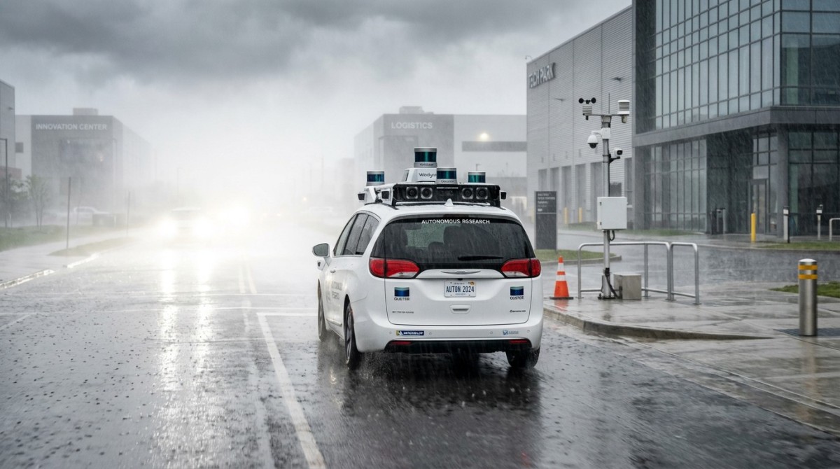
In controlled or fair-weather conditions, sensor fusion LiDAR and camera achieves a useful balance between geometric depth and visual semantics. LiDAR measures distance and point cloud structure, while the camera identifies lane markings, color, text, edges, and object classes. For lidar for autonomous driving vehicles, this pairing improves object detection, path planning, and scene interpretation within a perception cycle that often runs in the tens of milliseconds, depending on compute architecture.
The technical attraction is straightforward. LiDAR supports 3D ranging and shape estimation. Cameras contribute high-resolution contextual data. When aligned correctly through calibration, time synchronization, and extrinsic parameter control, fusion can reduce false positives compared with relying on one sensor alone. In AGV, AMR, roadside, and vehicle platforms, this can support obstacle classification across near-field and mid-range operating zones, often from a few meters out to several dozen meters depending on optics and scanning pattern.
For operators, the benefit appears as smoother navigation and fewer abrupt stops. For procurement teams, the promise is wider scene understanding without committing to a single sensing modality. For enterprise decision-makers, sensor fusion LiDAR and camera can look like a robust middle path between low-cost vision-only stacks and more expensive multi-sensor architectures that add radar, thermal, or redundant LiDAR channels.
However, the strong performance seen in daytime demo routes or dry indoor warehouses can hide a critical engineering truth: fusion does not eliminate sensor weaknesses. In many deployments, it simply averages them until the environment becomes harsher. That distinction matters when writing specifications, estimating operational risk, or comparing lidar for agv obstacle avoidance against sensor packages intended for variable outdoor conditions.
What fusion usually improves before weather degrades performance
When visibility is stable, fusion generally strengthens three practical functions: object detection, free-space estimation, and classification confidence. A camera may identify a pallet, pedestrian, or vehicle type, while LiDAR confirms physical position and contour. In logistics yards, industrial parks, and autonomous driving prototypes, this often improves response quality over a 5 m–80 m working window, though actual range depends on reflectivity, lens selection, and LiDAR resolution.
- Depth plus semantics: LiDAR supplies shape and distance, while the camera distinguishes markings, labels, and visual categories.
- Better scene context: Fusion can help separate static clutter from true hazards in mixed environments such as loading bays or urban roads.
- Improved path decisions: A fused stack can support fewer unnecessary slowdowns when compared with a conservative single-sensor setup.
This is why many developers and sourcing teams start with LiDAR plus camera. The architecture seems rational, scalable, and easier to explain internally. Yet that initial logic should not be confused with all-weather reliability. TSV’s engineering view is simple: a perception stack should be judged by degraded-condition behavior, not just by best-case benchmark clips.
What goes wrong when rain, fog, snow, and glare enter the scene
Bad weather does not affect each sensor equally, and that is exactly where fusion problems begin. Cameras lose contrast in fog, suffer bloom in headlight glare, and can become unreliable when water droplets, dirt, or ice reduce lens clarity. LiDAR faces its own issues: backscatter from rain or fog, reduced effective detection range, noisy point returns, and unstable interpretation when the environment contains spray, dense particulates, or reflective surfaces.
The key issue is correlation of failure. Buyers often assume one sensor will compensate when the other weakens. In light weather, that may be partly true. In heavier weather, both can degrade at the same time, but in different ways. A camera may still “see” lights and outlines yet misclassify. LiDAR may still return points yet produce sparse or contaminated geometry. The fusion engine then receives two imperfect streams and may produce a result that looks mathematically stable but is operationally unsafe.
For lidar for autonomous driving vehicles, this means performance claims based only on sunny-road datasets should be treated cautiously. For lidar for agv obstacle avoidance in outdoor factories, ports, or mining-adjacent logistics corridors, weather sensitivity becomes a procurement variable, not a secondary note. A system that performs well 80% of the time is not automatically suitable if the remaining 20% includes high-risk operating windows such as dawn fog, winter slush, or rain-driven reflective surfaces.
The table below summarizes how weather commonly impacts sensor fusion LiDAR and camera in field-relevant terms. It is not a universal test matrix, but it reflects the engineering logic that spec writers and sourcing teams should apply before approving deployment.
The practical reading is clear. Weather does not merely lower accuracy by a small percentage. It can change failure mode, detection timing, and confidence output. For B2B deployment, those shifts matter more than headline range numbers because they affect braking distance, route planning, site safety policy, and insurance exposure.
Why calibration and cleaning do not fully solve the problem
Teams often respond with tighter calibration, hydrophobic coatings, better housings, and lens cleaning systems. Those steps are useful and should be specified. But they only address part of the issue. Calibration drift can be managed through maintenance intervals such as monthly inspection or after vibration events, yet atmospheric interference remains external to alignment quality. A perfectly calibrated system can still fail in dense fog.
Similarly, cleaning systems help with droplets, mud, or dust accumulation, but they do not restore contrast lost in low-visibility air or recover LiDAR energy scattered by precipitation. This is why weather resilience should be treated as a system architecture question, not just a maintenance question. Procurement that ignores this often buys a cleaner version of the same limitation.
How to evaluate lidar for autonomous driving vehicles and lidar for AGV obstacle avoidance
Evaluation should begin with the operating envelope, not the vendor brochure. Ask first: indoor, outdoor, mixed, or semi-covered? Is the vehicle moving at walking speed, yard speed, or road speed? Is the critical detection zone 0 m–10 m, 10 m–30 m, or beyond? A warehouse AGV and an autonomous road vehicle do not need the same weather tolerance, but both need clearly defined degraded-mode behavior.
For lidar for agv obstacle avoidance, near-field reliability, contamination management, and false-stop control are often more important than long-range performance. For lidar for autonomous driving vehicles, mid-range and long-range consistency become more important, along with sensor redundancy, compute latency, and fail-operational strategy. In both cases, the buyer should request scenario-based test logic rather than generic statements such as “works in rain” or “all-weather capable.”
A useful selection process usually has 4 steps: define scene risk, map sensor blind spots, request environmental evidence, and verify maintenance burden. This reduces the chance of comparing products only by channel count, resolution, or nominal range. Those parameters matter, but they do not answer whether the system will remain usable after 6 months of outdoor exposure or through a winter operating cycle.
The next table provides a practical evaluation framework for sensor fusion LiDAR and camera procurement. It is designed for information researchers, operators, sourcing teams, and senior decision-makers who need defensible screening criteria before pilot deployment.
This framework helps shift procurement from marketing language to engineering accountability. At TSV, that shift is central: parameters, thresholds, and maintenance realities should define the shortlist. If a supplier cannot explain degraded operation, cleaning interval, or calibration retention, the proposal is not yet mature enough for serious comparison.
A practical checklist for buyers and technical teams
- Define 3 operating states: normal weather, reduced-visibility weather, and stop-or-slow fallback mode.
- Request at least 5 key checks: calibration method, lens protection, cleaning mechanism, synchronization method, and diagnostics output.
- Test the true obstacle set: pedestrians, forks, pallets, low-profile debris, reflective film, and dark surfaces.
- Review service burden over 3–12 months, not just at initial installation.
A disciplined checklist is especially useful for cross-functional teams. Operators care about nuisance stops and recovery behavior. Procurement cares about comparable bids. Decision-makers care about scale risk. A shared review method aligns all three.
What sensor strategies reduce weather risk in real deployment
If the environment includes regular rain, fog, or bright-light transitions, the answer is usually not “better fusion tuning” alone. The better answer is layered sensing and explicit fallback logic. In many outdoor systems, radar is added because its behavior in adverse weather can be more stable for detection presence, velocity, and certain range tasks. Thermal imaging may also support human or vehicle recognition in low-visibility conditions, though it brings its own interpretation limits.
That does not mean LiDAR plus camera is a bad architecture. It means it should be deployed where its limitations are acceptable, or where another sensor closes the reliability gap. For lidar for autonomous driving vehicles, weather robustness often depends on multi-modal redundancy, not just one LiDAR and one camera. For lidar for agv obstacle avoidance, the design may combine LiDAR with radar, safety scanners, bumper systems, speed restrictions, and geofenced low-visibility rules.
A strong engineering strategy uses 3 layers: perception diversity, environmental protection, and operational policy. Perception diversity reduces correlated failure. Environmental protection covers enclosures, heating, hydrophobic surfaces, and contamination management. Operational policy defines what happens when confidence falls below threshold, such as reducing speed, shrinking route scope, or pausing the machine until visibility improves.
For B2B buyers, this is where total system design becomes more important than individual component marketing. A lower-cost sensor that fits a disciplined fallback strategy may be safer and more economical than a premium sensor sold with unrealistic “all-condition” language. TSV consistently advises teams to compare architectures by failure management, not only by headline perception quality.
Common architecture choices and when they fit
LiDAR + camera only
Suitable for indoor, semi-controlled, or mostly fair-weather environments where maintenance access is frequent and speed is limited. It can work well for some campuses, warehouses, and development fleets, especially when visibility degradation is occasional rather than routine.
LiDAR + camera + radar
A stronger option for outdoor transport, yard vehicles, and road-adjacent automation. Radar can help when visual contrast drops and LiDAR returns become noisy. Integration complexity rises, but so does resilience across changing weather windows.
Layered perception plus operational constraints
Often the most practical route for industrial users. Instead of chasing a perfect sensor, the site defines lower speed bands, restricted paths, visibility rules, and maintenance checks every shift, daily, or weekly depending on exposure severity.
FAQ: what engineers, buyers, and decision-makers ask before deployment
Is sensor fusion LiDAR and camera enough for all-weather autonomy?
Usually no, if “all-weather” means dependable operation through regular rain, fog, snow, and glare with minimal performance loss. It may be enough for limited-speed or limited-exposure scenarios, but outdoor commercial deployment often benefits from additional sensing or strict degraded-mode rules. The correct answer depends on speed, stopping distance, and the cost of a missed detection.
What should procurement ask for besides range and resolution?
Ask for weather behavior, maintenance interval, cleaning approach, synchronization method, diagnostics, and fallback logic. Also ask how the system handles low-reflectivity targets, lens contamination, and reflective surfaces. These details often reveal more about field readiness than nominal point cloud density or image resolution.
How long does evaluation usually take in an industrial project?
A practical screening cycle often takes 2–4 weeks for requirements definition and supplier review, followed by 4–8 weeks of pilot integration and scenario testing. Outdoor or mixed-weather validation may require a longer observation window because teams need to capture different environmental conditions rather than only lab results.
What is the most common mistake in lidar for AGV obstacle avoidance selection?
The most common mistake is selecting by advertised range alone. For AGV obstacle avoidance, near-field reliability, false-stop rate, contamination tolerance, and serviceability often matter more. A sensor that sees far but triggers unstable stops in wet or dusty conditions can reduce throughput and create operator frustration.
Why decision-makers use TSV before locking a sensor strategy
TechStat Vanguard approaches sensor fusion LiDAR and camera from the standpoint that hard-tech procurement should be benchmarked through engineering evidence, not promotional language. That matters in sensors and edge AI because perception systems are often sold through ideal-condition narratives, while the true cost emerges later through calibration drift, false alarms, visibility failures, and integration delays.
For information researchers, TSV helps separate useful specifications from vague claims. For operators, the focus is on uptime, maintenance intervals, and real failure behavior. For procurement teams, the value is a more disciplined shortlist based on measurable criteria. For enterprise decision-makers, the outcome is lower trial-and-error cost and a clearer link between sensor architecture and operational risk.
If you are comparing sensor fusion lidar and camera options, reviewing lidar for autonomous driving vehicles, or validating lidar for agv obstacle avoidance, the right next step is not a generic demo. It is a parameter review tied to your environment: weather exposure, speed band, obstacle profile, cleaning interval, and fallback policy. Those inputs determine whether a given architecture is merely impressive or actually deployable.
Contact TSV to discuss parameter confirmation, sensor selection logic, delivery-cycle planning, integration risk, compliance considerations, sample evaluation pathways, and quotation communication structure. We help teams build specification sheets that reflect engineering truth: detection zone requirements, degraded-mode rules, maintenance expectations, and the evidence needed before purchase approval.
Search News
Hot Articles
- Carbon Fiber StructuresHow to Specify Aerospace Carbon Fiber Assemblies for Lightweight, Load-Bearing PartsJul 11, 2026
- Machine VisionXiaomi, Alibaba DAMO Academy Drive Open-Source Robotics Model Ecosystem, Lowering Algorithm Development Barriers for Overseas SMEs Adopting Chinese Robotics SolutionsMar 30, 2026
- Cobots & ArmsShanxi 'AI+' Conference Showcases Embodied Intelligence with Multinational Buyer Engagement: Key Industry ImplicationsMar 30, 2026
Popular Tags
Recommended News
 Jul 11, 2026How to Specify Aerospace Carbon Fiber Assemblies for Lightweight, Load-Bearing PartsAerospace carbon fiber assemblies: learn how to specify laminate design, load data, joining methods, and inspection controls for lighter, reliable load-bearing aerospace parts.Elena Rostova (UAV Systems Researcher)
 Mar 30, 2026Xiaomi, Alibaba DAMO Academy Drive Open-Source Robotics Model Ecosystem, Lowering Algorithm Development Barriers for Overseas SMEs Adopting Chinese Robotics SolutionsXiaomi & Alibaba DAMO Academy's open-source robotics models lower algorithm barriers for global SMEs. Boost efficiency in manufacturing, logistics & smart retail with ROS 2 compatible solutions.TSV Data Lab
 Mar 30, 2026Shanxi 'AI+' Conference Showcases Embodied Intelligence with Multinational Buyer Engagement: Key Industry ImplicationsShanxi 'AI+' Conference highlights embodied intelligence with Tesla, Ubtech & Jiantao showcasing multimodal robotics. 40+ global buyers validated tech on-site, creating new B2B channels for industrial automation & AI solutions.Chen Wei (Automation Lead Engineer)
 Mar 30, 2026Zhongguancun Unveils 6G Integrated Sensing-Computing-Intelligence Platform to Empower Embodied Robots for Global Industrial ApplicationsZhongguancun's new 6G platform revolutionizes industrial robotics with <10ms latency, empowering global automotive, logistics & port automation. Discover how this tech boosts China's smart manufacturing exports.TSV Data Lab
 Mar 30, 2026Mech-Mind Tianjin Embodied Intelligence R&D and Production Base Goes Live, Cutting Delivery Time by 20%–30% for Global Customized AMR+Vision SolutionsMech-Mind's Tianjin AMR+Vision production base cuts delivery time by 20%-30% for欧美 & Latin American markets. Discover how this PLd-certified facility accelerates customized robotics solutions for smart manufacturing and logistics.Chen Wei (Automation Lead Engineer)
 Mar 30, 2026Boao Forum Reveals 'Co-evolution of Big and Small Brains' Trend in Humanoid Robots, China's Embodied Intelligence Accelerates Adaptation to Overseas Manufacturing Service ScenariosDiscover how China's humanoid robots, featuring 'Co-evolution of Big and Small Brains,' are revolutionizing global manufacturing. Learn about Embodied Tian Gong 3.0's ISO compliance and overseas deployment at Boao Forum 2026.Chen Wei (Automation Lead Engineer)
 Mar 30, 2026China Railway Industrial Secures Patent for Embodied Robotics in Material Handling, Boosting High-Precision Delivery Capabilities for Overseas Infrastructure and Manufacturing ProjectsChina Railway Industrial's new patent for embodied robotics in material handling boosts high-precision delivery for global infrastructure & manufacturing. Discover how this innovation enhances logistics accuracy in automotive, rail transit & EPC projects.Chen Wei (Automation Lead Engineer)
 Oct 27, 2026GXO and Agility Robotics Expand Partnership to Accelerate US Humanoid Robot DeploymentGXO and Agility Robotics plan to expand US humanoid robot deployment with Digit 4 in early 2027. Explore warehouse automation plans, service terms and future Digit 5 upgrades.Chen Wei (Automation Lead Engineer)
 Oct 27, 2026Robotic Automation Costs: Budgeting for Equipment, Integration, and MaintenancePlan your robotics automation cost with confidence. Explore equipment, integration, and maintenance expenses, compare quotes, and build a realistic budget for better ROI.Chen Wei (Automation Lead Engineer)
 Oct 26, 2026AMAXiMAL Releases Open-Source TopMod 3D v3 With Claude AIExplore AMAXiMAL’s free, open-source TopMod 3D v3 with Claude AI assistance, topology-based modeling and plywood fabrication tools that connect complex designs to physical builds.Dr. Marcus Vance
 Oct 26, 2026Choosing a SCADA System Integrator Company: PLC Compatibility and Long-Term SupportChoose a scada system integrator company with proven PLC compatibility and reliable long-term support. Discover what to test, compare, and require before investing.Victor Lin (Chief Software Architect)
 Oct 25, 2026Hesai Leads Global ADAS Main Lidar Shipments in Yole’s 2026 ReportHesai led global ADAS main lidar shipments with a 43% share in 2025, according to Yole’s 2026 report. Explore what this ranking reveals about its automotive market position.TSV Data Lab
 Oct 25, 2026Choosing an Aerospace Materials Manufacturer: Quality and Traceability ChecksChoosing an aerospace materials manufacturer? Learn how to verify certifications, test reports, and lot traceability to qualify suppliers confidently and reduce costly sourcing risks.Dr. Marcus Vance
 Oct 24, 2026Guotai Haitong: Global Entry-Level 3D Printer Shipments Rose 39% in Q1 2026Entry-level 3D printer shipments rose 39% in Q1 2026, Guotai Haitong reports. Explore how AI, multicolor printing and print farms are shaping market growth.Dr. Marcus Vance
 Oct 24, 2026Choosing an Industrial Vision Inspection Supplier: Acceptance Tests That MatterChoose an industrial vision inspection supplier with confidence. Discover acceptance tests for defect detection, false rejects, production speed, and reliable part rejection before you buy.TSV Data Lab
 Oct 23, 2026US Navy Raises Gecko Robotics Contract Ceiling to $300M for Robotic Fleet MaintenanceUS Navy raises Gecko Robotics’ contract ceiling to $300M for Pacific Fleet robotic inspections. Explore potential opportunities for maintenance suppliers and key procurement considerations.Chen Wei (Automation Lead Engineer)
 Oct 23, 2026Choosing Industrial Sensing Systems for Global Plants: Protocol CompatibilityCompare industrial sensing systems international buyers can trust. Explore protocol compatibility, reduce integration risks, and select proven configurations for reliable global plant deployments.TSV Data Lab
 Oct 22, 2026KUKA Showcases Physical AI and iiQKA.AI Vision at NVIDIA GTC BerlinExplore KUKA’s Physical AI showcase at NVIDIA GTC Berlin and discover how iiQKA.AI Vision aims to simplify robotic vision integration and improve 2D and 3D scene recognition.TSV Data Lab
 Oct 22, 2026Robotic Machining of Advanced Composites: What Tolerances Are Achievable?Explore advanced materials machining robotics: discover what drives achievable composite tolerances and how to validate accuracy before investing in your next machining system.Dr. Marcus Vance
 Oct 21, 2026China’s Industrial Robot Exports Near RMB 10 Billion in First Nine Months of 2026China’s industrial robot exports neared RMB 10 billion in January–September 2026, with value rising faster than volume. Explore the data and what it could mean for suppliers.Chen Wei (Automation Lead Engineer)
 Oct 21, 2026Low-Latency Industrial Data Processing: Pricing and Key Cost DriversExplore industrial data latency price drivers, from edge hardware to integration and support. Learn how to compare quotes, verify performance, and avoid unnecessary costs.TSV Data Lab
 Oct 20, 2026KUKA Launches iiQKA.AI Vision to Simplify Industrial Image ProcessingKUKA iiQKA.AI Vision simplifies industrial image processing with controller-based 2D and 3D vision. Explore drag-and-drop setup for vision-guided automation.TSV Data Lab
 Oct 20, 2026Smart Industrial Edge Devices: Key Criteria for Legacy PLC IntegrationChoose smart industrial edge devices for legacy PLC integration. Discover key criteria for compatibility, data quality, security, and reliable collection without disrupting control.TSV Data Lab
 Oct 19, 2026Choosing a Radar Sensor by Application: Range, Resolution, and Field of ViewSimplify radar sensor application based product selection. Compare range, resolution, and field of view to avoid blind spots and choose with confidence. Explore the guide.TSV Data Lab