Selecting Commercial Drone Payloads for European Inspection Projects
Publication Date
author
Selecting commercial drone payloads for European inspection projects starts with the inspection decision, not the aircraft catalogue. A camera that produces attractive images may still fail the project if it cannot show the defect at the required stand-off distance, retain reliable geolocation, or operate within the endurance and operational limits of the site.
For project leaders, the practical question is straightforward: what evidence must the payload produce for an engineer, asset owner, or regulator to act on it? The answer differs sharply between a roof-condition survey, a wind-turbine blade inspection, a transmission-line patrol, and a confined industrial structure. Payload selection should therefore begin with the failure modes being investigated and the final deliverable expected, then work backward through flight geometry, environmental conditions, data processing, and operational approvals.
In European projects, this discipline matters because sites are often close to infrastructure, people, protected areas, controlled airspace, or cross-border operations. A technically capable sensor package can become an expensive compromise when its mass, operating profile, data requirements, or flight path conflicts with the approved concept of operations.
Start with the defect, not the sensor category
“RGB camera,” “thermal payload,” and “LiDAR” are useful labels, but they are not inspection specifications. A project team should first define the smallest condition it needs to identify, the confidence required to classify it, and whether the output is intended for screening, detailed inspection, measurement, or engineering sign-off.
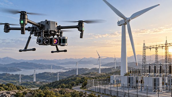
For visible-light inspection, the central calculation is ground sampling distance or, for oblique close-range work, the effective pixel size on the target. A sensor with a high pixel count is helpful only when lens focal length, flight distance, stabilisation, lighting, and target angle preserve usable detail. A long lens can reveal a small crack from a safer distance, but it also narrows the field of view, amplifies aircraft motion, and makes target tracking more demanding. On a wind turbine, for example, the ability to hold image quality at distance may matter more than the maximum resolution stated on a specification sheet.
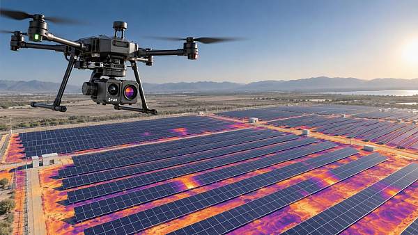
Thermal selection requires the same specificity. Thermal imagery is often valuable for identifying temperature anomalies, moisture patterns, insulation failures, photovoltaic faults, and some electrical issues. It does not automatically diagnose the root cause. The payload must support the temperature measurement method needed by the assignment, with suitable optics, calibration capability, environmental metadata, and enough pixels on the target area. Teams should also establish when the asset can be inspected: surface temperature, solar loading, wind, emissivity, reflected radiation, and viewing angle can materially alter the image interpretation.
LiDAR is appropriate when the deliverable requires geometry rather than surface appearance: clearance measurement, deformation assessment, vegetation encroachment, volume calculation, or a three-dimensional model of complex structures. Yet point density alone does not establish survey fitness. The usable result depends on range, beam divergence, scan pattern, platform movement, GNSS and inertial performance, trajectory correction, control points where required, and the method used to classify and register the point cloud.
Before comparing commercial drone payloads Europe procurement teams should write a short evidence statement for each inspection objective:
- What defect, dimension, anomaly, or condition must be detected?
- What is the smallest reportable feature or measurement tolerance?
- At what distance and viewing angle can the aircraft safely operate?
- Who will interpret the data, and what level of confidence must they have?
- Is the output a prioritisation tool, a maintenance record, or evidence supporting a technical decision?
This turns vague requests for “high-resolution” or “industrial-grade” equipment into testable payload requirements.
Match optics and sensing mode to the site geometry
Asset geometry determines whether a payload can collect useful data within a realistic flight plan. Flat roofs and solar arrays allow repeatable nadir passes. Bridges, facades, chimneys, tanks, lattice towers, and offshore structures require oblique views, changing range, and careful control of perspective. A payload that works well in a demonstration over an open field can be inefficient around structural steel, narrow corridors, or reflective surfaces.
For close visual work, assess the full imaging chain rather than sensor resolution in isolation. Lens distortion, shutter behaviour, autofocus performance, optical zoom range, gimbal pointing accuracy, image stabilization, and low-light performance all affect whether an inspector can review the result. Mechanical shutters or other motion-tolerant capture methods may be important where the deliverable includes photogrammetry or precise image alignment. Rolling-shutter artefacts can degrade data when the aircraft, subject, or camera angle changes rapidly.
Zoom capability deserves particular scrutiny. It can reduce exposure to obstacles or hazardous zones and may support inspections where a close approach is operationally impractical. But digital zoom adds little engineering value when source detail is insufficient, while high optical magnification can make vibration, atmospheric haze, and poor focus more visible. Ask suppliers or integrators to show representative files captured at the intended inspection range, not only cropped promotional images.
For thermal systems, lens choice controls both coverage and interpretability. A wide field of view may support rapid scanning but leave too few pixels on small components. A narrow lens can improve target detail but may make it harder to locate anomalies, maintain framing, and complete the work within available battery time. Projects involving electrical assets should also consider safe separation, target orientation, and whether the thermal pattern can be correlated with a visible-light image or asset identifier.
LiDAR payloads introduce an additional geometric issue: a dense point cloud is useful only if the survey path gives the scanner suitable coverage. Vertical faces, undercuts, cables, dense vegetation, and narrow industrial spaces can create occlusions. A project that requires a complete structural model may need multiple scan angles and flight passes, which changes endurance assumptions, site access planning, and the volume of data to process.
Payload mass changes more than flight time
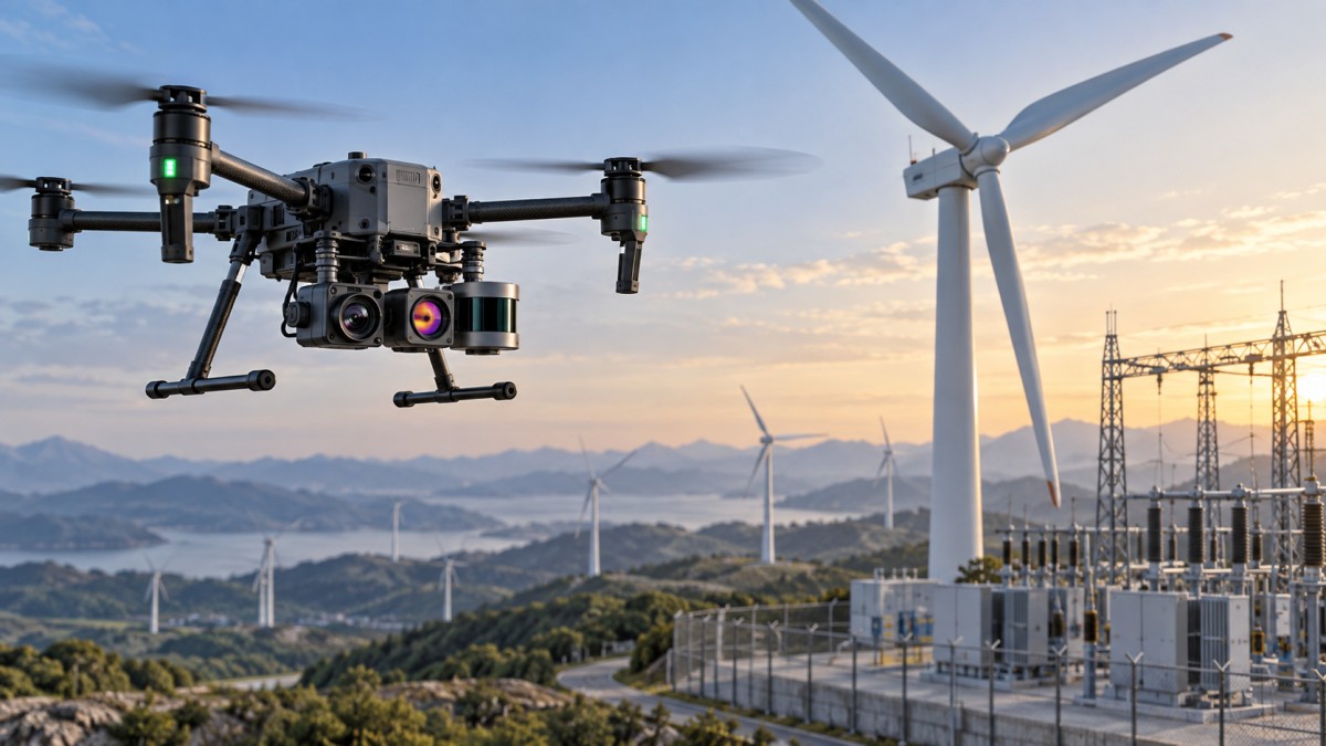
Payload selection is often framed as a trade-off between capability and endurance. That is true, but incomplete. Added mass also changes acceleration, braking distance, gimbal response, wind tolerance, battery reserve, take-off and landing margins, and the practicality of carrying spares into the field. These effects become more pronounced on exposed European sites where wind can be variable around buildings, coastal assets, ridgelines, and turbine structures.
Evaluate the payload as part of a complete mission configuration: aircraft, batteries, mounting hardware, communications equipment, storage media, RTK or PPK accessories, protective equipment, and any redundant sensor. A listed aircraft payload capacity is not a guarantee that every compatible payload produces the same operational performance.
The appropriate metric is not a manufacturer’s maximum flight time in benign conditions. Project teams need usable station time after allowing for launch, transit, hover periods, positioning, contingency margin, and return. For an inspection plan, it is often better to estimate the number of assets, structural bays, or image sets completed per battery rather than relying on minutes airborne.
Weather resilience should be reviewed at the payload level too. Condensation on optics, rain on a thermal lens, salt exposure near coastal infrastructure, dust around industrial facilities, and temperature changes between transport and operation can all affect results. An aircraft may be rated for difficult conditions while the installed sensing package, connectors, lens surfaces, or storage workflow remain the weak point.
Do not separate payload selection from European operational planning
European drone operations are governed through a framework that combines common aviation rules with national implementation, local airspace controls, site restrictions, and operator responsibilities. For inspection projects, the relevant question is rarely whether a payload is legal by itself. The issue is whether the aircraft-payload-mission combination can be operated under the applicable category and authorisation pathway at the planned site.
A long-range or high-zoom payload can reduce the need to fly close to an asset, which may simplify some risks. Conversely, it can encourage operations at distances where visual observation, communications reliability, terrain masking, or airspace constraints become limiting. A heavy LiDAR configuration may require a larger platform and different operating assumptions. Night work, work near people, operations beyond visual line of sight, flights near critical infrastructure, and missions in controlled airspace all require early operational assessment rather than a late-stage paperwork exercise.
Procurement specifications should therefore ask for more than sensor compatibility. They should require the supplier or service team to state the expected take-off mass, normal operational configuration, communications dependencies, positioning method, and any payload-driven restrictions. Where inspection programmes span several countries, establish a country-by-country operating matrix before committing to a common payload fleet. Local permissions, geofencing arrangements, radio use, site access rules, and critical-infrastructure controls can affect the deployment model even when the sensor requirement is identical.
Data handling also has an operational dimension. Asset imagery can reveal security-sensitive layouts, personnel, vehicle movements, neighbouring property, or critical components. A payload selection should account for where images and point clouds are stored, whether processing uses cloud services, how access is controlled, and how long raw data must be retained. These are project requirements, not administrative details to be settled after capture.
Specify the deliverable and processing path before buying hardware
Many payload decisions fail at the handoff between field collection and engineering review. A high-resolution camera can create far more data than the project team can upload, process, inspect, annotate, or archive within its reporting window. LiDAR workflows may require trajectory processing, point-cloud registration, classification, and quality checks that are outside the capability of the intended operator. Thermal data can lose measurement value if files are exported into formats that retain only a visual palette rather than radiometric information.
Ask each internal stakeholder what they will receive and how they will use it. Maintenance planners may need tagged defects linked to asset IDs. Structural engineers may require calibrated imagery and clear scale references. Survey teams may need a coordinate system, metadata, accuracy statement, and raw observations. Operations managers may only need a prioritised exception report with evidence images.
A useful procurement exercise is to request a sample deliverable built from representative conditions. The test should include the intended stand-off distance, target materials, lighting or thermal conditions, flight profile, and output format. Reviewing raw files alongside the final report exposes whether the software workflow introduces gaps, excessive manual effort, or uncertainty that the project cannot accept.
Use a verification matrix instead of a feature checklist
Feature lists encourage teams to compare maximum resolution, zoom range, sensor size, or advertised accuracy as though each number were independent. A verification matrix is more useful because it links each technical claim to a project condition and an acceptance method.
- Detection performance: define target size, range, view angle, and acceptable image quality.
- Measurement performance: define coordinate reference, tolerance, control approach, and validation method.
- Operational performance: define usable mission time, wind and weather assumptions, launch constraints, and reserve policy.
- Data performance: define file formats, metadata, processing time, storage volume, security, and integration with the asset-management process.
- Supportability: define calibration needs, firmware management, repair path, spare availability, operator training, and software licensing exposure.
This approach also reveals when one payload should not be expected to perform every task. A combined visible and thermal unit may be efficient for broad screening, while a separate high-detail visual sensor or survey payload is needed for follow-up work. Carrying multiple payloads can add logistics, but forcing a single sensor into incompatible inspection objectives often costs more in repeat flights and inconclusive reports.
The better choice is the payload that reduces uncertainty
The strongest payload selection is rarely the system with the most impressive headline specification. It is the configuration that produces sufficient evidence within the site’s flight constraints, is repeatable across the inspection programme, and feeds a processing workflow the asset owner can actually use.
For European inspection work, project leaders should make the decision in this order: define the engineering question, establish safe capture geometry, confirm the operating concept, test the data path, then compare payload specifications. That sequence keeps commercial drone payload decisions tied to maintenance and engineering outcomes rather than to sensor marketing claims.
Search News
Hot Articles
- Carbon Fiber StructuresHow to Specify Aerospace Carbon Fiber Assemblies for Lightweight, Load-Bearing PartsJul 11, 2026
- Machine VisionXiaomi, Alibaba DAMO Academy Drive Open-Source Robotics Model Ecosystem, Lowering Algorithm Development Barriers for Overseas SMEs Adopting Chinese Robotics SolutionsMar 30, 2026
- Cobots & ArmsShanxi 'AI+' Conference Showcases Embodied Intelligence with Multinational Buyer Engagement: Key Industry ImplicationsMar 30, 2026
Popular Tags
Recommended News
 Jul 11, 2026How to Specify Aerospace Carbon Fiber Assemblies for Lightweight, Load-Bearing PartsAerospace carbon fiber assemblies: learn how to specify laminate design, load data, joining methods, and inspection controls for lighter, reliable load-bearing aerospace parts.Elena Rostova (UAV Systems Researcher)
 Mar 30, 2026Xiaomi, Alibaba DAMO Academy Drive Open-Source Robotics Model Ecosystem, Lowering Algorithm Development Barriers for Overseas SMEs Adopting Chinese Robotics SolutionsXiaomi & Alibaba DAMO Academy's open-source robotics models lower algorithm barriers for global SMEs. Boost efficiency in manufacturing, logistics & smart retail with ROS 2 compatible solutions.TSV Data Lab
 Mar 30, 2026Shanxi 'AI+' Conference Showcases Embodied Intelligence with Multinational Buyer Engagement: Key Industry ImplicationsShanxi 'AI+' Conference highlights embodied intelligence with Tesla, Ubtech & Jiantao showcasing multimodal robotics. 40+ global buyers validated tech on-site, creating new B2B channels for industrial automation & AI solutions.Chen Wei (Automation Lead Engineer)
 Mar 30, 2026Zhongguancun Unveils 6G Integrated Sensing-Computing-Intelligence Platform to Empower Embodied Robots for Global Industrial ApplicationsZhongguancun's new 6G platform revolutionizes industrial robotics with <10ms latency, empowering global automotive, logistics & port automation. Discover how this tech boosts China's smart manufacturing exports.TSV Data Lab
 Mar 30, 2026Mech-Mind Tianjin Embodied Intelligence R&D and Production Base Goes Live, Cutting Delivery Time by 20%–30% for Global Customized AMR+Vision SolutionsMech-Mind's Tianjin AMR+Vision production base cuts delivery time by 20%-30% for欧美 & Latin American markets. Discover how this PLd-certified facility accelerates customized robotics solutions for smart manufacturing and logistics.Chen Wei (Automation Lead Engineer)
 Mar 30, 2026Boao Forum Reveals 'Co-evolution of Big and Small Brains' Trend in Humanoid Robots, China's Embodied Intelligence Accelerates Adaptation to Overseas Manufacturing Service ScenariosDiscover how China's humanoid robots, featuring 'Co-evolution of Big and Small Brains,' are revolutionizing global manufacturing. Learn about Embodied Tian Gong 3.0's ISO compliance and overseas deployment at Boao Forum 2026.Chen Wei (Automation Lead Engineer)
 Mar 30, 2026China Railway Industrial Secures Patent for Embodied Robotics in Material Handling, Boosting High-Precision Delivery Capabilities for Overseas Infrastructure and Manufacturing ProjectsChina Railway Industrial's new patent for embodied robotics in material handling boosts high-precision delivery for global infrastructure & manufacturing. Discover how this innovation enhances logistics accuracy in automotive, rail transit & EPC projects.Chen Wei (Automation Lead Engineer)
 Sep 17, 2026Selecting Commercial Drone Payloads for European Inspection ProjectsCommercial drone payloads Europe: learn how to select RGB, thermal and LiDAR systems for compliant, reliable inspection data and better project outcomes.Elena Rostova (UAV Systems Researcher)
 Sep 16, 2026Machining Tolerance Validation: How to Verify Critical Dimensions Before Production ReleaseMachining tolerance analysis validation: verify critical dimensions, measurement systems, process capability, and tolerance stacks before production release.Dr. Marcus Vance
 Sep 15, 2026AGV Tape Guidance vs Laser Navigation: Which Fits Your Warehouse Layout?AGV tape guidance comparison: discover how tape and laser navigation fit changing warehouse layouts, docking needs, floor conditions, maintenance, and route flexibility.Chen Wei (Automation Lead Engineer)
 Sep 14, 2026How Point Cloud Analytics Improves Asset Inspection Workflows Across GCC ProjectsPoint cloud analytics GCC helps project leaders improve asset inspections with accurate change detection, safer workflows, and faster maintenance decisions.TSV Data Lab
 Sep 13, 2026How Aerospace Manufacturers Can Build a Digital Thread From Design to Certified ProductionDigital manufacturing for aerospace: learn how to build a traceable digital thread from design through certified production, supplier control, and audit-ready compliance.Victor Lin (Chief Software Architect)
 Sep 12, 2026How to Select a Thermal Sensor for Mapping Drones in Surveying ProjectsMapping drone thermal sensor selection made simple: compare GSD, radiometric data, NETD, calibration, and workflow fit for accurate, survey-ready thermal maps.Elena Rostova (UAV Systems Researcher)
 Sep 11, 2026Integrating Photogrammetry Workflows into Digital Twin Projects Without Data BottlenecksPhotogrammetry workflow integration for digital twins: learn how to streamline capture, validation, versioning, and delivery to prevent data bottlenecks.Victor Lin (Chief Software Architect)
 Sep 10, 2026Hard-Tech Supply Chain Procurement: Qualifying Suppliers to Cut Lead-Time RiskHard-tech supply chain procurement guide: qualify suppliers with proven process, traceability, capacity, and change control to reduce lead-time risk.Chen Wei (Automation Lead Engineer)
 Sep 09, 2026Industrial Application Notes: Cost Factors That Shape Automation Project BudgetsIndustrial application notes cost factors explained: uncover the engineering, safety, integration, and commissioning variables that shape accurate automation budgets.Victor Lin (Chief Software Architect)
 Sep 08, 2026Supplier Discovery for Sourcing: How Buyers Can Verify Capability and Supply RiskSupplier discovery for sourcing: learn how to verify supplier capability, traceability, quote assumptions, and supply risk before placing production orders.TSV Data Lab
 Sep 07, 2026What Determines Process Control Systems Pricing? A Buyer’s Cost GuideProcess control systems pricing explained: compare hardware, engineering, integration, cybersecurity, validation, and lifecycle costs to choose the right-value solution.Victor Lin (Chief Software Architect)
 Sep 07, 2026AMR Robots in ASEAN: Which Industries Are Adopting Them—and Why?AMR robots ASEAN adoption is accelerating in electronics, automotive, warehousing, healthcare, and cold chain. Explore use cases, risks, and deployment insights.Chen Wei (Automation Lead Engineer)
 Sep 05, 2026How to Evaluate Supplier Qualification Support Tools for Industrial Procurement TeamsSupplier qualification support tools help industrial procurement teams verify technical evidence, manage risk, and make defensible supplier approvals. Learn what to evaluate.Victor Lin (Chief Software Architect)
 Sep 04, 2026Grinding Tolerance Analysis: How to Set Realistic Limits for Precision PartsGrinding tolerance analysis explains how to set realistic limits for precision parts, balance fit, geometry, process capability, and inspection for reliable performance.Dr. Marcus Vance
 Sep 03, 2026Warehouse Automation Strategies to Increase Storage Capacity Without ExpansionWarehouse automation space saving strategies help unlock vertical capacity, optimize slotting, and improve storage density without costly building expansion.Victor Lin (Chief Software Architect)
 Sep 02, 2026What Should Buyers Evaluate When Choosing a Hybrid VTOL UAV Factory?Hybrid VTOL UAV factory selection guide: evaluate mission fit, production traceability, payload integration, support, and total ownership costs before procurement.Elena Rostova (UAV Systems Researcher)
 Sep 01, 2026Cobot Collision Detection Settings: How to Tune Sensitivity, Force, and Stop LimitsCobot collision detection settings explained: tune sensitivity, force thresholds, payload data, and stop limits to reduce false trips and improve safer, reliable automation.Chen Wei (Automation Lead Engineer)